Architectural heritage in Coulonges-sur-l’Autize

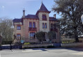
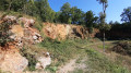
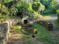
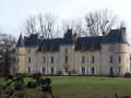
During this walk, you’ll discover the Renaissance castle of Coulonges and its grounds. You’ll pass the old railway station (now privately owned). After a stroll through the countryside, you’ll come across the Logis de Magné and the wash house, as well as the chimney of the old lime kiln. Return to the village of Coulonges via the church, a former washhouse (Rue de l’Épargne), a small square built on the site of a former restaurant, and then the town’s covered market.

Details

4485318
Creation:
Last update:
Last review:
  • Walking
    Activity: Walking
  • ↔
    Distance: 6.76 mi
  • ◔
    Average duration: 3h 15 
  • ▲
    Difficulty: Moderate

  • ⚐
    Back to start: Yes
  • ↗
    Ascent: + 144 ft
  • ↘
    Descent: - 154 ft

  • ▲
    Highest point: 354 ft
  • ▼
    Lowest point: 226 ft

Photos

Description of the walk

Start from the Place du Château.

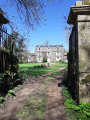
(S/E) Walk past the château towards the village centre, then turn right through a gateway leading to the park entrance. Cross the park and, on exiting, turn left into Rue du Calvaire.

(1) At the end of the street, turn right onto Avenue de la Gare. From this point, the walk is signposted in red and yellow as part ofthe GR® de Pays Sud Gâtine route.
After the station, Avenue de la Gare becomes Route de Niort, and you’ll reach a roundabout. Take the first road on the left, Chemin des Bourlottières. At the end of the road, cross over and take the dirt track directly in front of you. This track becomes grassy.

(2) At the end of the track, ignore the red and yellow markings and carry on straight ahead along the small tarmac road which climbs slightly. After the hamlet of La Grille, you’ll reach a junction.

(3) Carry on straight ahead.

(4) In the wide bend to the right, turn left onto a small path that leads downhill, then take the first path on the left. This path gradually widens. When you reach a junction of paths, carry on straight ahead until you reach a crossroads with a small road.

(5) Turn left and follow the road as it bends to the right (do not take the path opposite) and carry on until you reach a road at right angles.

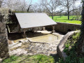
(6) Turn left, pass the house at a place called Touche-Vache, then take the first path on the right. At the end of the path, you’ll reach a junction with the D25. Cross carefully and carry on straight ahead. At the end of the road, turn left. At a place called Magné, pass a farmhouse and a washhouse and continue along the road.

(7) As the road bends to the right, take the grassy path opposite which leads onto Rue de Parthenay. At this point, turn right twice and walk alongside the old railway line. At the chimney of a former lime kiln, take the Chemin de la Grande Cheminée on the right, which runs alongside the buildings.

At the old gatekeeper’s house, turn left, then take the first path on the left (offering another view of the large chimney).

(8) You’ll come out onto Route de Bressuire; follow it to the left towards the village centre. After the cemetery, take thesecond right onto Rue de l’Église.

(9) At the church, turn left into Rue de l’Épargne, which leads back up to the town centre.

(10) At the “Maxime” square, cross Rue de Fontenay and head towards the covered market (Baltard-style).

(11) After the market, turn right onto Rue Saint-Antoine, which leads to the small square of the same name. Then continue to the right along Rue du Minage, then turn left (opposite the Musée du Charronnage) to return to Place du Château (S/E).


Waypoints

  1. S/E : mi 0 - alt. 259 ft - Place du Château
  2. 1 : mi 0.27 - alt. 266 ft - Avenue de la Gare (yellow/red markings)
  3. 2 : mi 1.53 - alt. 295 ft - Small road opposite
  4. 3 : mi 1.88 - alt. 331 ft - Junction – Go straight on
  5. 4 : mi 2.34 - alt. 302 ft - Turn left onto a small path
  6. 5 : mi 3.01 - alt. 325 ft - Turn left at the junction
  7. 6 : mi 3.32 - alt. 348 ft - Route
  8. 7 : mi 4.27 - alt. 282 ft - Grassy path opposite
  9. 8 : mi 6.08 - alt. 272 ft - Turn left onto the Route de Bressuire
  10. 9 : mi 6.41 - alt. 236 ft - Église Saint-Étienne (Coulonges-sur-l'Autize)
  11. 10 : mi 6.57 - alt. 246 ft - Square Maxime
  12. 11 : mi 6.67 - alt. 259 ft - Rue Saint-Antoine
  13. S/E : mi 6.76 - alt. 259 ft - Place du Château

Notes

Alternative route:
(3) At this junction, you can shorten the walk by turning left and then taking the first path on the left before the house at a place called Touche Vache. There are two further opportunities to shorten the route before (4).

The paths may be muddy (very muddy) after a spell of rain.
Please note that the weekly market in Coulonges takes place on Tuesdays. On these days, it is not possible to park at Place du Château, but the car park at Espace Colonica is available and is situated 100 metres from the château.

Worth a visit

Places of interest: the château and its grounds, the old railway station, the chimney of the old lime kiln, a farmhouse, two wash houses, the church and the covered market.

Always be cautious and plan ahead when you're outdoors. Visorando and the author of this route cannot be held responsible for any accidents occurring on this route.

The GR® and PR® markings are the intellectual property of the Fédération Française de Randonnée Pédestre.

Reviews and comments

4.6 / 5
Based on 3 reviews

Reliability of the description
5 / 5
Ease of following the route
5 / 5
Route interest
3.7 / 5
mifo10
mifo10

Overall rating : 4.7 / 5

Date of your route : Nov 09, 2025
Reliability of the description : ★★★★★ Very good
Ease of following the route : ★★★★★ Very good
Route interest : ★★★★☆ Good
Very busy route : No

Easy hike with little elevation gain. Some sections along roads with little traffic (but we were there on a Sunday).
Recommended for discovering interesting aspects of the heritage of Coulonges-sur-l'Autize.

Machine-translated

jlfaure
jlfaure

Overall rating : 4.5 / 5

Date of your route : Apr 04, 2023
Reliability of the description : Not used / Not applicable
Ease of following the route : ★★★★★ Very good
Route interest : ★★★★☆ Good
Very busy route : No

To make the most of spring on this lovely day in early April, this route is ideal and well suited to those who aren’t too keen on steep climbs. Do watch out for the wind on the plain, though. The paths are clear with very little mud, even after the rain over the last few days. There’s a lovely surprise on the second half of the route: the farmhouse and washhouse at Magné, the enormous chimney of the old lime kilns, and finally the walk through the village of Coulonges, with its church, market hall and, of course, its Renaissance-style castle, which houses the town hall.
(We set off from the small car park by the swimming pool on Rue du Calvaire, past the secondary school and just before the castle grounds.)

Machine-translated

philouis
philouis

Overall rating : 4.3 / 5

Date of your route : Nov 28, 2021
Reliability of the description : ★★★★★ Very good
Ease of following the route : ★★★★★ Very good
Route interest : ★★★☆☆ Average
Very busy route : No

A pleasant route. The first part is on flat ground, but you’re sheltered from the wind by the hedges.
The second part is more interesting in terms of heritage (the Magné manor house, the wash house, the chimney, and finally the church, the market halls and the castle).
With very little tarmac, easily walkable paths and pleasant views of the surrounding countryside, this walk is a great way to get some fresh air.

Machine-translated

Other walks in the area

For more walks, use our search engine .

The GPS track and description are the property of this route's author. Please do not copy them without permission.