From the Balingue water tower to the Mervent Dam

A walk connecting the Balingue water tower to the Mervent Dam. Most of this route runs through woodland on well-marked paths, but also includes trails not necessarily shown on maps. The first few kilometres are on very easy terrain, followed by steeper sections through the woodland. Perfect for walkers who enjoy off-the-beaten-track routes.

Details

4125473
Creation:
Last update:
Last review:
  • Walking
    Activity: Walking
  • ↔
    Distance: 8.21 mi
  • ◔
    Average duration: 4h 30 
  • ▲
    Difficulty: Moderate

  • ⚐
    Back to start: Yes
  • ↗
    Ascent: + 807 ft
  • ↘
    Descent: - 830 ft

  • ▲
    Highest point: 325 ft
  • ▼
    Lowest point: 39 ft
  • ⚐ Country: France
  • ⚐ City: L'Orbrie (85200)
  • ⚑
    Start/End: N 46.495759° / W 0.760447°
  • ❏
    IGN map(s): Ref. 1427SB
  • Hour-by-hour weather

Photos

Description of the walk

Park in the car park in front of the water tower.

(S/E) Set off southwards and take the signposted path at the far end of the car park. Carry straight on, ignoring a turn-off to the left (marker 85) and then one to the right (marker 80).

(1) Walk past the access road to Château du Mazeau and, at the Fork in the road, keep to the right. At the junction, follow the D104 to the right. Walk past the wayside cross and join the D65.

(2) Cross with care and continue straight ahead on the D104 towards L’Orbrie.

(3) Turn right onto Rue des Ouchettes. At the end, continue along Chemin des Ouchettes. Further on, ignore Chemin de la Pierrière coming from the left and cross a stream.

(4) At the next junction, take a track on the left. Follow this track to the end. Then turn left.

(5) Follow the Route de Puy Chabot to the right. When the road bends to the right, follow the track opposite which leads into the forest.

(6) Turn onto the first track on the left. At the next junction, keep to the right to stay on this track, which then continues as a path making a sharp bend to the right.

(7) Leave the path by heading down to the left to cross a stream (dry in summer). Continue along the path to the left. Then follow the path as it bends to the right and heads north. Pass a track on your right.

(8) Take a short detour to the left to look out over the Vendée, then retrace your steps a few metres and continue along the path on the left to reach the Allée de Brûleau. Follow this lane to the left, then continue along a path (steep descent) to emerge onto the road leading from the dam.

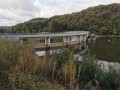
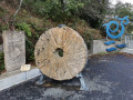
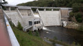
(9) Turn left and cross the crest of the dam. Just as you come out, on the right, you’ll see the millstone of an old submerged mill on display, along with a metal sculpture depicting the fairy Mélusine. At this point, there’s a panoramic view of the dam with information boards. Continue along the road until you reach the bend.

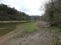
(10) Take the path on the left which climbs into the forest, following the course of the Vendée from above. Head downhill and rejoin the river. Turn right and head away from it to reach the hamlet of Sauvaget.

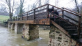
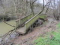
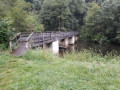
(11) Take the footbridge on the left and then immediately turn right onto the path that runs alongside the river. After 250 metres, this path turns left again, heading uphill to leave the woodland and skirt around the fields.

(12) Follow Rue de la Chaume to the left, then carry on straight ahead along Route de Puy Chabot.

(5) Carry on straight ahead and enter the forest (this section was already covered at the start of the walk).

(6) Carry on straight ahead for a good hundred metres. Take the first path on the right, which then heads north-east and joins the junction of the Route Forestière de la Balingue with the Allée de Bruleau (hut).

(13) Cross the forest road and take the path opposite to return to the D65. Turn right and follow the road up to the car park opposite the water tower (S/E).

Waypoints

  1. S/E : mi 0 - alt. 322 ft - Balingue Water Tower
  2. 1 : mi 0.71 - alt. 220 ft - Mazeau Castle
  3. 2 : mi 1.12 - alt. 194 ft - D65 road
  4. 3 : mi 1.41 - alt. 128 ft - Rue des Ouchettes
  5. 4 : mi 1.83 - alt. 121 ft - Junction
  6. 5 : mi 2.29 - alt. 259 ft - Puy Chabot route
  7. 6 : mi 2.58 - alt. 305 ft - Junction
  8. 7 : mi 3.33 - alt. 112 ft - Fork in the path – Crossing a stream
  9. 8 : mi 3.96 - alt. 56 ft - Detour to the - Vendée (rivière)
  10. 9 : mi 4.38 - alt. 141 ft - Point de vue sur le Barrage de Mervent
  11. 10 : mi 4.66 - alt. 95 ft - Start of the trail
  12. 11 : mi 5.57 - alt. 49 ft - Sauvaget – Footbridge over the - Vendée (rivière)
  13. 12 : mi 6.29 - alt. 243 ft - Rue de la Chaume
  14. 13 : mi 7.63 - alt. 276 ft - Allée de Brûleau hut
  15. S/E : mi 8.21 - alt. 322 ft - Balingue Water Tower

Notes

Warning
Several of the trails described do not appear on the IGN map. However, they are clearly shown on the OSM and OSM Trails maps. In any case, using the mobile app will be a major advantage for these sections of the route.

Equipment:
- Rucksacks containing a first-aid kit, drinks and energy bars.
- Walking poles recommended.
- The Visorando app is strongly recommended, with the route cached.
- Sturdy walking shoes.

Worth a visit

Places to see:
- The Balingue water tower.
- Mazeau Castle.
- Mazeau Calvary.
- Mervent Dam.
- Sauvaget footbridge.
- The Vendée.

Reviews and comments

4.1 / 5
Based on 3 reviews

Reliability of the description
4.3 / 5
Ease of following the route
3.3 / 5
Route interest
4.7 / 5
User 28146189

Overall rating : 4 / 5

Date of your route : Jul 27, 2026
Reliability of the description : ★★★★☆ Good
Ease of following the route : ★★★★☆ Good
Route interest : ★★★★☆ Good
Very busy route : No

A few rather uninteresting stretches of road
On the final circular loop, ongoing farm work obscured the path we needed to take
Significant elevation gain around the dam
Great

Machine-translated

Lucie DEVISE
Lucie DEVISE

Overall rating : 4 / 5

Date of your route : Nov 11, 2023
Reliability of the description : ★★★★☆ Good
Ease of following the route : ★★★☆☆ Average
Route interest : ★★★★★ Very good
Very busy route : No

A really interesting walk, with a bit of a sporty and adventurous feel to it. My mum and I loved it.
Please note: there are no signposts, so a mobile phone is essential for this walk (don’t forget to charge it!), the path is full of scree, and there are lots of fallen trees along the route. That won’t stop us from doing it again, though.

Machine-translated

T.Tessier
T.Tessier
• Edited:

Overall rating : 4.3 / 5

Date of your route : Jan 23, 2022
Reliability of the description : ★★★★★ Very good
Ease of following the route : ★★★☆☆ Average
Route interest : ★★★★★ Very good
Very busy route : No

Hello,

A lovely walk, though a bit tricky to follow and, I think, with a slight mistake in the route description just after the dam ridge: turn left straight away onto the steps before the road’s crash barriers to follow the River Vendée.

Kind regards,

T. Tessier

Machine-translated

Other walks in the area

For more walks, use our search engine .

The GPS track and description are the property of this route's author. Please do not copy them without permission.