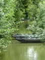
The Marais du Mazeau and the banks of the Sèvre

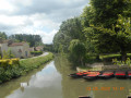
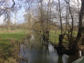
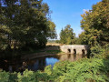
Circular route along footpaths and small tarmac roads through the Marais du Mazeau and along the Sèvre Niortaise.

Details

3002074
Creation:
Last update:
Last review:
  • Walking
    Activity: Walking
  • ↔
    Distance: 5.56 mi
  • ◔
    Average duration: 2h 35 
  • ▲
    Difficulty: Easy

  • ⚐
    Back to start: Yes
  • ↗
    Ascent: + 23 ft
  • ↘
    Descent: - 23 ft

  • ▲
    Highest point: 30 ft
  • ▼
    Lowest point: 7 ft

Photos

Description of the walk

Parking is available in the car park in the village of Le Mazeau, opposite the village hall.

(S/E) Cross the D25 and walk down Rue du Port, almost opposite the car park. At the end, cross the Rigole de la Rive Droite.

(1) Turn left onto Chemin du Pavillon and follow the canal on your left for about 2.2 km. Pass the road leading to the village of Nessier on your left and you will soon reach another junction.

(2) Take the road on the right and continue straight on (south-east) across the marsh.

(3) As you approach the Leat d’Ambreuil, the road turns sharply to the right. There are several stork nests in the meadows on the right! After about 500 m, it turns left (south).

(4) At the end, turn right and continue to the Sèvre Niortaise.

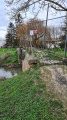
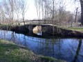
(5) Turn right towards the village of La Sèvre and follow the river on your left. Carry on straight ahead until you reach a footbridge.

(6) Then turn right (do not cross the river). Stay on the road, ignoring the side paths, then head north-west along the Vieux Leat. Ignore a path on the right and walk past a campsite.

(7) Immediately afterwards, turn right and follow the Rigole de la Rive Droite again.

(1) Take thefirst street on the left. Cross the D25 and you’ll find the car park roughly opposite (S/E).

Waypoints

  1. S/E : mi 0 - alt. 30 ft - Le Mazeau car park opposite the village hall
  2. 1 : mi 0.16 - alt. 13 ft - Crossroads marking the end of the circular loop - Marais Poitevin
  3. 2 : mi 1.52 - alt. 13 ft - Junction
  4. 3 : mi 2.21 - alt. 10 ft - Turn right
  5. 4 : mi 2.89 - alt. 10 ft - T-junction
  6. 5 : mi 3.1 - alt. 13 ft - Junction - Sèvre Niortaise (fleuve)
  7. 6 : mi 4.06 - alt. 13 ft - Footbridge over the - Sèvre Niortaise (fleuve)
  8. 7 : mi 5.14 - alt. 13 ft - Junction
  9. S/E : mi 5.56 - alt. 30 ft - Le Mazeau car park opposite the village hall

Notes

Toilets and picnic area near the campsite (7).

Worth a visit

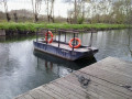
Boat trips from the jetty in the village of Le Mazeau.

Reviews and comments

4.6 / 5
Based on 3 reviews

Reliability of the description
4.7 / 5
Ease of following the route
4.7 / 5
Route interest
4.3 / 5
2MC
2MC

Overall rating : 3.7 / 5

Date of your route : Feb 23, 2025
Reliability of the description : ★★★★☆ Good
Ease of following the route : ★★★★☆ Good
Route interest : ★★★☆☆ Average
Very busy route : No

The scenery is certainly pleasant, but only on tarmac roads.
Only the Chemin du Lancier is unpaved; make sure you wear sturdy shoes as it’s difficult to walk on at this time of year, and this path is ‘endless’. There are pairs of storks at this site.
We’ve been charmed by other walks in the marshes; this one is a bit of a let-down.

Machine-translated

TINO1779
TINO1779

Overall rating : 5 / 5

Date of your route : Feb 17, 2023
Reliability of the description : ★★★★★ Very good
Ease of following the route : ★★★★★ Very good
Route interest : ★★★★★ Very good
Very busy route : No

A short walk through the marshes… always a pleasure.

Machine-translated

Sneg
Sneg

Overall rating : 5 / 5

Date of your route : May 23, 2020
Reliability of the description : ★★★★★ Very good
Ease of following the route : ★★★★★ Very good
Route interest : ★★★★★ Very good
Very busy route : No

A very pleasant setting and route along small tarmac roads, with very, very few vehicles. The only people we came across were a few cyclists and the many anglers.

Machine-translated

Other walks in the area

For more walks, use our search engine .

The GPS track and description are the property of this route's author. Please do not copy them without permission.