


Refine your search for walks in Millières (Haute-Marne)
Millières (Haute-Marne) walks


 Between Millières and Esnouveaux via Le Raillemont
 Visorando Member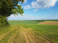
 7.01 mi
 +528 ft
 -518 ft
 3h 40
3h 40
 Moderate
 Departure from Millières (Haute-Marne) (Haute-Marne)
Discover part of the Langres plateau and the Rognon valley. A route through woods and meadows.
La Bove and La Cona
 6.84 mi
+594 ft
-597 ft
3h 40
Moderate
Departure from Bourmont (Haute-Marne)
6.84 mi
+594 ft
-597 ft
3h 40
Moderate
Departure from Bourmont (Haute-Marne)
Starting from Bourmont, a charming little village in the Haut-Marne region, you’ll go on a short walk through the surrounding forest.
The Vivier hillside at Andelot
 2.28 mi
+144 ft
-128 ft
1h 10
2.28 mi
+144 ft
-128 ft
1h 10
 Easy
Departure from Andelot-Blancheville (Haute-Marne)
Easy
Departure from Andelot-Blancheville (Haute-Marne)
A short, easy walk with views of Andelot, Montéclair and the Fouillot hill that hides Rimaucourt. You can also see the Moulin district and its very old Tréfilerie factory.
Le Cul du Cerf, starting from Orquevaux
5.40 mi
+364 ft
-364 ft
2h 50
Moderate
Departure from Orquevaux (Haute-Marne)
A route that takes you to the Cul du Cerf, a limestone cirque 200 metres wide and 65 metres high, at the bottom of which flows the underground spring known as La Manoise. A Natura 2000-listed site notable for its flora, where you can admire the spring gushing from the ground, protected by a metal grille. A fairly technical route with some difficulties due to the nature of the terrain.
The Route des Moines through the Morimond Forest
6.00 mi
+279 ft
-279 ft
3h 00
Easy
Departure from Parnoy-en-Bassigny (Haute-Marne)
A pleasant walk around the site of the former Morimond Abbey and through the woods of the same name. Morimond Abbey, a Cistercian abbey founded in 1115, is the mother house of more than seven hundred monasteries for men and women in France and Europe. The route also takes you past the Morimond Lakes, a series of artificial lakes created by the Cistercian monks to supply water to the abbey’s various outbuildings: gardens, mills, sawmill, nail-making workshop, and so on.
Ferme du Fays and Chaumont Viaduct
 4.56 mi
+299 ft
-312 ft
2h 20
Easy
Departure from Chaumont (Haute-Marne) (Haute-Marne)
4.56 mi
+299 ft
-312 ft
2h 20
Easy
Departure from Chaumont (Haute-Marne) (Haute-Marne)
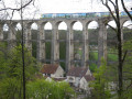
An almost entirely shaded route between the Ferme du Fays and the Chaumont Viaduct.
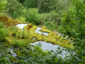
A circular walk around the Tufière de Rolampont and the Gallo-Roman mausoleum at Faverolles
 10.95 mi
+974 ft
-978 ft
5h 55
Moderate
Departure from Rolampont (Haute-Marne)
10.95 mi
+974 ft
-978 ft
5h 55
Moderate
Departure from Rolampont (Haute-Marne)
This walk, three-quarters of which is through woodland, allows you to enjoy two exceptional sites: the active tufa formation at Rolampont, and the Gallo-Roman archaeological site of the Faverolles Mausoleum.
Loop in the Corgebin National Forest
2.58 mi
+56 ft
-56 ft
1h 15
Easy
Departure from Chaumont (Haute-Marne) (Haute-Marne)
Set off on a loop in the heart of the vast Corgebin State Forest, a stone's throw from Chaumont. Covering an area of 1,100 hectares, this forest became state property in 1789. Located in Haute-Marne, it is the closest state forest to the town of Chaumont, the department's prefecture. It is managed by the ONF (French National Forestry Office) for the sustainable production of quality wood, environmental protection and public access, while also allowing hunting in winter. It is very popular with the public, who come here to enjoy the peace and quiet and get in touch with nature on the outskirts of the town. It is a limestone plateau forest, consisting of beech-based deciduous stands. The landscapes are varied, ranging from coppice with standards to high forest. A nature trail starting at the Muguet visitor centre allows visitors to familiarise themselves with the main species present.
Vignory Castle
 6.59 mi
+735 ft
-709 ft
3h 40
Moderate
Departure from Vignory (Haute-Marne)
6.59 mi
+735 ft
-709 ft
3h 40
Moderate
Departure from Vignory (Haute-Marne)
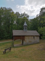
A walk that allows you to explore Vignory, one of the “small towns of character”, with its Romanesque church and the remains of its feudal castle, as well as the forests and woods surrounding the village.
From the Liez Dam to Perrancey-les-Vieux-Moulins, taking a stroll through Langres
7.53 mi
+722 ft
-696 ft
4h 05
Moderate
Departure from Peigney (Haute-Marne)
This stage takes place in the Marne catchment area, whose waters flow into the English Channel. Perched on a high hill detached from the plateau, Langres invites us to stroll along its ramparts. Opt for its restaurants rather than the usual picnic.
Tour of Lake Liez near Langres
 9.47 mi
+49 ft
-49 ft
4h 25
Moderate
Departure from Chatenay-Mâcheron (Haute-Marne)
9.47 mi
+49 ft
-49 ft
4h 25
Moderate
Departure from Chatenay-Mâcheron (Haute-Marne)
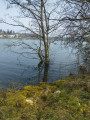
This route takes you around Lac de la Liez along a path in the heart of unspoilt countryside. The lake is very busy in season and is the perfect place to relax, either on the beach or by taking part in the various activities on offer (sailing, water skiing, tubing, etc.). But nature lovers can also enjoy themselves away from the area near the Liez Reservoir dam and Langres Plage.
The meanders of the Mouzon
 10.34 mi
+1,191 ft
-1,181 ft
5h 50
Moderate
Departure from Rebeuville (Vosges)
10.34 mi
+1,191 ft
-1,181 ft
5h 50
Moderate
Departure from Rebeuville (Vosges)
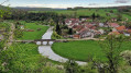
A lovely walk, offering remarkable views over the Mouzon valley.
The route is straightforward for the majority of the walk.
The only slightly technical sections requiring your attention are:
- Near the landmark (3), the stony descent towards the Grotte de l’Enfer,
- After the waypoint (8), the descent down the rudimentary staircase, facing the drop, is a little dizzying.
Route de découverte de Langres
4.96 mi
+118 ft
-105 ft
2h 25
Easy
Departure from Langres (Haute-Marne)
Langres is one of the sub-prefectures of Haute-Marne. The town is unique in being completely surrounded by ramparts, making it the town with the longest fortified wall in Europe. This section takes you on a tour of Langres’ historic centre and along the 3-kilometre-long walkway of the medieval fortifications. The route through the town itself is equally charming, featuring a number of historic monuments, including Saint-Mammès Cathedral, and for those wishing to extend their visit to Langres, there is also the town museum to explore.
Valley, cliffs and Lake La Mouche from Perrancey-les-Vieux-Moulins
 13.88 mi
+784 ft
-778 ft
7h 05
13.88 mi
+784 ft
-778 ft
7h 05
 Difficult
Departure from Saint-Ciergues (Haute-Marne)
Difficult
Departure from Saint-Ciergues (Haute-Marne)
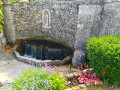
The walk is mainly through woodland, but with a few passages through farmland or pastures to vary the landscape. It visits four pleasant villages with churches and refreshing fountains, as well as several picnic areas. It offers views of Lac de la Mouche and winds its way along the foot of cliffs, some of which are jagged, such as along the "ecological trail" (from (15) to (16)).If you find the walk a little long, you can shorten it to about 15 km by cutting from (8) to (17).
 From the Citadel of Langres to Dijon
56.59 mi
+771 ft
-1,476 ft
8 hrs
Difficult
Departure from Langres (Haute-Marne)
This route, initially designed to connect to the Culmont-Chalindrey railway junction, has been extended to Dijon due to the cancellation of the train service! It crosses the mustard fields of the Côte-d'Or and the former sand pits of La Tille, which have been converted into ponds that are more popular with fishermen than tourists.
Côte des Fourches circular
3.89 mi
+207 ft
-207 ft
2h 00
Easy
Departure from Bourbonne-les-Bains (Haute-Marne)
A walk through meadows, past cows and horses, with beautiful countryside scenery and dirt tracks.
From Neufchâteau station to the Citadel of Langres (Navarre campsite)
53.87 mi
+1,732 ft
-1,145 ft
8 hrs
Difficult
Departure from Neufchâteau (Vosges)
This stage follows the southern part of the Eurovélo 19 "La Meuse à vélo" route (1,050 km from Langres to Rotterdam). From Neufchâteau, we follow the meandering Mouzon, a tributary of the Meuse. We then leave it behind, taking less travelled but more direct roads that avoid the meanders of the Meuse. We rejoin the EV19 just before the "Source de la Meuse" site, on the Langres plateau crossed by three watersheds. With the plateau reaching a height of 450 m, the gradients are not significant, but on arrival, you will need to make a little effort to climb the promontory on which the Citadel of Langres is perched. Your reward: a splendid view at dusk!
South of Coiffy-le-Haut
5.53 mi
+686 ft
-689 ft
3h 10
Easy
Departure from Coiffy-le-Haut (Haute-Marne)
A very lovely little walk, especially in autumn, through the woods and vineyards of Coiffy-le-Haut, with lovely views.
Through the Auberive State Forest from Perrancey-les-Vieux-Moulins
18.45 mi
+1,083 ft
-1,184 ft
9h 25
Difficult
Departure from Perrancey-les-Vieux-Moulins (Haute-Marne)
This stage offers the chance to discover some of the springs of the Langres Plateau, whose waters feed into the English Channel. After skirting the marshes, you enter the Auberive State Forest, in the heart of the Forêts National Park. The abbey founded by Saint Bernard in 1132 reveals its secrets. But why Auberive, exactly?
Route de Saint-Antoine à Rouécourt
 9.45 mi
+965 ft
-945 ft
5h 10
Moderate
Departure from Rouécourt (Haute-Marne)
9.45 mi
+965 ft
-945 ft
5h 10
Moderate
Departure from Rouécourt (Haute-Marne)
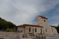
A route exploring the Haut-Marne countryside (route no. 51, marked in yellow and green).
Views of Langres between Arbigny-sous-Varennes and the Liez Dam
19.00 mi
+1,112 ft
-768 ft
9h 40
Difficult
Departure from Arbigny-sous-Varennes (Haute-Marne)
From Arbigny-sous-Varennes, the waters of the Presle stream flow into the Mediterranean, whilst from Orbigny-au-Mont those of the Liez flow into the English Channel. Perched on its hilltop, Langres serves as our landmark.
From the Joan of Arc Basilica to Les Faux
 13.41 mi
+997 ft
-1,014 ft
7h 00
Difficult
Departure from Domrémy-la-Pucelle (Vosges)
13.41 mi
+997 ft
-1,014 ft
7h 00
Difficult
Departure from Domrémy-la-Pucelle (Vosges)
A rich and varied route, starting from the Joan of Arc Basilica, taking you to see the strange, twisted beech trees of Sionne (much less famous, and therefore less popular than the Faux de Verzy), through beautiful, unspoilt forests and a few pastures, to discover a well-hidden dolmen. The tour concludes with a visit to Domrémy-la-Pucelle.