Country:
 City:
City:



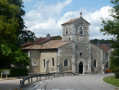
Park in the car park in front of the Basilica of Saint Joan of Arc, on the D53.
(S/E) Following the red and white markings ofthe GR® 714, follow the D53 – which has very little traffic – southwards for about 1 km to the Pré de Villée crossroads.
(1) Turn right onto the small tarmac road, which quickly turns into a good forest track and follows the Cul du Vau valley floor, initially along the edge of the pasture and woodland, then deep into the forest. Always stay as close as possible to the valley floor, following theGR® markings and ignoring any paths branching off to the left or right.
(2) Continue straight on along theGR®714for about fifty metres.
(3) After a slight bend to the left, leave theGR® and take a path that climbs steeply to the right. After 100 metres, the path crosses a track, veering slightly to the left. Continue for a further 500 metres or so until you reach a junction with a very good forest track.
(4) To the left is the Baraque du Comtot, and nearby, a well-hidden dolmen (see below, section ‘During the Walk’). Head left towards the south, passing through areas of excavation or quarrying. Follow this track for about 1.3 km. At the end, turn right and join a good forest track.
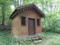
(5) Join theGR® again and follow it to the right. After 100 m, pass several foresters’ shelters, which were open when I passed by. Immediately after the shelters, when the hard-surfaced path turns left, continue almost straight ahead on the grassy path. After 100 m, turn left onto the path you come to.
(6) About a hundred metres further on, take the first path on the right, leaving theGR®. Then follow the Red Triangle-marked route of the Hêtres Tortillards de Sionne. Continue straight on for about 600 m until you reach a wide paved path with a hunter’s hide on the right. Head straight ahead along this path and follow it for about 300 m.
(7) Turn left onto the first track (marked with a Red Triangle). At the T-junction, turn left. After a few dozen metres, you’ll come to another junction.
(8) Turn sharply to the right.
(9) After about 250 m, turn left. Follow the undulating path, heading generally south-east, whilst continuing to follow the Red Triangle markings.
(10) Just over a kilometre after the bend, turn left at a right angle onto a track, and you’ll reach a good, motorable forest track.
(11) Take this track on the right, then follow it round a left-hand bend.
(12) Just after the bend, don’t hesitate to turn onto a path on the left which leads to a small ochre sand quarry with some very beautiful coloured strata.
(12) Return to the track and take the first bend to the right. At the second bend to the right, continue straight ahead along the path that runs straight on (marked with a Red Triangle). After about 500 m, you’ll rejoin theGR® 714.
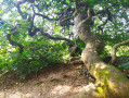
(13) At this junction, leave the Red Triangle markings and head slightly to the left onto the path marked ‘Hêtres Tortillards’: these trees are clearly visible or signposted if they are set back from the path. Take your time on this proper path, which allows you to admire five specimens of these fantastic trees. Further on, the path reaches the edge of the forest before turning north, then north-west, into a new glade.
(14) When this straight path curves slightly to the right, turn right onto another path at a right angle. Cross the forest track and continue along the correct path opposite. Follow it until it bends to the left, then leave it at this point to head straight down the slope. There is no marked path on this short, steep slope, but there are a few tracks through a very open woodland that is easy to navigate. You’ll reach the tarmac road at the bottom of the slope.
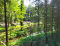
(15) Turn right for 200 m to take a look at the two ponds, which are unfortunately situated within a fenced-off conservation area.
(16) Retrace your steps.
(15) Follow this track straight on as it climbs the valley floor towards the north-west for about 500 m.
(17) At a slight bend to the left, take a forest track that is not suitable for vehicles, branching off to the right (Black Circle marker), almost in line with the path. Ignore the two tracks branching off to the right and continue along the main track, which climbs up to the ridge where you’ll rejoin theGR® 714.
(18) Turn right. Continue for about 700 m.
(3) Ignore the path you took on the way there on your left and walk for about a hundred metres.
(2) Then take a path on the left and head uphill. When you reach a forest track, follow it to the right for about 500 m, before turning right onto a narrow path that leads to a good, carriageable track.
(19) Take this track straight ahead, which leads first through the forest and then across pastures to Domrémy-la-Pucelle. Cross the D53 and take the street leading downhill opposite.
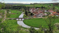
(20) Turn left onto Rue de la Basilique to explore the village of Domrémy. Continue on to Saint-Rémy Church.
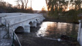
(21) Retrace your steps, continuing along Rue Principale to the bridge over the Meuse. Then turn away from the bridge and head left, before turning left again onto a path called Chemin du Moulin, which joins Rue de la Basilique.
(20) Turn left and follow the road out of the village until you reach the D53. Continue left along the road to return to the car park (S/E).

 Association / Club / Walk leader
 Moderate
 Visorando Member
 Easy
Easy