Country:
 City:
City:



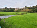
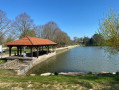
Car park along the Mouzon, Rue du Cougnot.
(S/E) Continue towards the fountain for about 200 metres.
(1) Leave the fountain on your right and head slightly to the left, along the Grande Rue.
(2) At the three-way junction, head up to the left onto the Voie de Tilleux, then carry on straight ahead, keeping to the right at each junction.
(3) At the entrance to the forest, take the path on the right towards Grotte de l’Enfer; there’s a bit of climbing involved as you follow the Red Ring markings to the cave.
Caution: difficult descent with a handrail; stony path.
At the cave, head down the path on the right, following the Red Triangle and Red Saltire markings, and leave the trail 200 metres further down.
(4) At the three-way junction, leave the markings and head left, taking the path that climbs.
At a T-junction, turn left. Continue uphill, following the Red Triangle markings for a short while.
(5) At a junction of two paths, do not take the path on the left; continue climbing, keeping to the right. Leave the Red Triangle markings.
(6) You’ll come out onto a forest track; turn right.
Carry on along this track until you reach a junction and the pretty Saint-Martin Chapel.
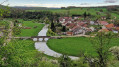
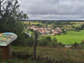
There’s a lovely view over the valley and the village of Certilleux.
Enter the village and head down Rue de l’Abbé Bertrand. A house on the right marks his home. Keep to the left at all times.
Carry on along Rue des Millières.
At the T-junction, take the road that climbs to the left for 50 metres.
(7) Leave the road by turning right onto a lovely flat path, running between meadows and orchards.
At the end of this path, head down to the right alongside the park towards the farm. When you reach the road (D164), follow it to the left for 600 metres until you reach the entrance to the village.
Caution: there may be heavy traffic.
(8) Leave the road by turning right and enter the village of Tilleux. Cross the railway line and the bridge over the Ruisseau du Bani, continue straight ahead along the Grande Rue and head up towards Saint-Epvre Church, which you’ll pass on your right.
Continue towards the forest along the tarmac forest road, which becomes a wide track as you leave the forest. The track goes round the quarry on the left.
(9) At the T-junction, turn right, cross the small road, and continue straight ahead along the quarry, following the white and redGR® markings. Enter the woodland, keeping to the GR® markings.
Head down this path through the forest, always following theGR® markings, until you reach the tarmac road, which you follow downhill for 300 m.
(10) Leave the road by turning right onto the path that climbs through the meadows. Yellow Ring markings
You are now entering a protected area where a few orchids can be found.
(11) Please note: before reaching the top of the hill, turn left; a sign reads ‘limestone meadow’. Follow this direction and keep following the Yellow Ring markings.
Please note: go down three wooden steps; the path becomes somewhat overgrown, so look out for the Yellow Ring markings. It leads to a vertiginous flight of steps until you reach a wire fence; follow it to the right, along the path overlooking Circourt-sur-Mouzon and its valley. A beautiful viewpoint.
(12) Go through a gate on the left and head down, following the wire fence on the right. When you reach the wide path, head down to the left until you reach the road.
The lawn on the left is home to beautiful orchids in season.
Caution: do not go near the edge of the cliff.
Follow the road to the left. Caution: take care when looking at the beautiful cliffs on the left.
Enter Circourt-sur-Mouzon by crossing the bridge on the right.
At the end of the bridge, take the path running alongside the Mouzon on the left for about 100 metres.
(13) When you reach a large stone wall, head up to the right towards Saint-Michel Church.
At the top of the hill, turn left and then, immediately, right into Rue de la Ferme. At the end of this street, turn right
At a wayside cross, follow the road to the left for about 500 m, until you reach a forest track; turn left onto this track, into the Combe aux Lapins.
(14) At the top of this climb, at the T-junction, turn right until you reach the road, then head down to the right for 300 m.
At the right-hand bend, take the road that climbs to the left; tarmac at first, it soon becomes a track.
Follow this wide track through the greenery and farmland. Enjoy the magnificent view of the meandering Mouzon river on your right.
(15) At a crossroads with a cross in the middle of a field, carry on straight ahead.
(16) The track leads onto a stony road; cross it by turning right then left, and then follow a footpath.
(17) The path leaves the edge of the forest twice to the left, runs alongside the field for a few metres, then turns right. You will now have your back to the forest you have left behind.
The Red Triangle markings will take you back to Rebeuville, the starting point.
When you reach a hairpin bend, follow the road down to the right and ignore the path that branches off to the right, overlooking the road.
You will arrive at the entrance to Rebeuville. Carefully cross the road, head down to the left and cross the railway line, then the bridge over the Mouzon. Turn left along the river to reach the car park (S/E).


 Visorando Member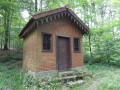


 Difficult
  Association / Club / Walk leader
 Easy
Easy 
 Tourist office