


Refine your search for walks in Mignovillard
Mignovillard walks


 Memorial to the Mirage crash and pond at the start of Froidefontaine
 Visorando Member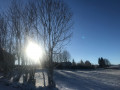
 9.45 mi
 +436 ft
 -440 ft
 4h 45
4h 45
 Moderate
 Departure from Mignovillard (Jura)
A peaceful walk in the Mignovillard area. You will be on the Haute Joux GRP® trail until Essart Bassand. Head towards the Seigne des Barbouillons Regional Nature Reserve, where you will pass the memorial to the crash on 9 January 2019. This memorial was erected here following the crash of a Mirage aircraft from Nancy-Ochey Air Base 133, near the site of the accident in which two soldiers were killed.Take a break at the Fontaine Carrée pond, then return via the hamlet of Petit Villard and the Moulin du Martinet.
Route des Tourbières via the Tourbières car park
 4.07 mi
+36 ft
-36 ft
1h 55
4.07 mi
+36 ft
-36 ft
1h 55
 Easy
Departure from Frasne (Doubs)
Easy
Departure from Frasne (Doubs)
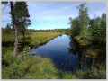
Five good reasons to go:It is the largest high-altitude wetland in France.The Nordic landscape is highly original.You will find a unique biodiversity and surprising natural environments.The route is designed and equipped for educational discovery.The site has been awarded the Tourism and Disability label.
There are two possible routes:
Short Route: 1.44 km, accessible to people with reduced mobility (Tourism and Disability label) and pushchairs
- Long Route: 5.67 km
Bonnevaux Village Trail
 4.46 mi
+663 ft
-656 ft
2h 40
Moderate
Departure from Bonnevaux (Doubs)
4.46 mi
+663 ft
-656 ft
2h 40
Moderate
Departure from Bonnevaux (Doubs)
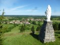
Alternating between pastures and high-altitude forests, this trail allows you to enjoy the varied landscapes of the Haut-Doubs. It leads you to the Vieille Citerne de Bonnevaux, passing through the communal lands of the Côte de Bonnevaux, where you can admire a magnificent panorama of the Frasne plateau and the mosaic of forests, peat bogs and pastures.
Tourbières circuit via the Moulin car park
 5.61 mi
+26 ft
-26 ft
2h 35
Easy
Departure from Frasne (Doubs)
5.61 mi
+26 ft
-26 ft
2h 35
Easy
Departure from Frasne (Doubs)
Five good reasons to go:
It is the largest high-altitude wetland in France.The Nordic landscape is highly original.You will find a unique biodiversity and surprising natural environments.The trail is designed and equipped for educational discovery.The site has been awarded the Tourism and Disability label.
Source of the Ain
 6.19 mi
+820 ft
-840 ft
3h 35
Moderate
Departure from Conte (Jura)
6.19 mi
+820 ft
-840 ft
3h 35
Moderate
Departure from Conte (Jura)
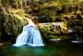
A splendid hike between the plateau and the steep-sided valley of the Ain. This circuit offers an opportunity to discover the upper Ain valley and its unique geology, with its Vaucluse spring, waterfalls (Le Moulinet, Saut des Maillys, Moulin-du-Saut) and ruined mills, evidence of how humans once harnessed the power of water. In fact, an EDF hydroelectric plant has replaced the old Moulin-du-Saut.
The Forest of La Joux, from the Maison du Chevreuil to the Belvédère de la Roche
 8.99 mi
+981 ft
-955 ft
5h 00
Moderate
Departure from Supt (Jura)
8.99 mi
+981 ft
-955 ft
5h 00
Moderate
Departure from Supt (Jura)
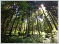
A hike entirely through the forest, alternating between forest roads and footpaths, traversing this vast forest massif. Several designated viewing points offer views of the Jura mountain range or, on the other side of the forest, the Poupet and the entire plateau. A superb site at the start with an arboretum and historical information about the area.
Croix de la Bèche Trail
 10.91 mi
+1,175 ft
-1,165 ft
6h 00
Moderate
Departure from La Rivière-Drugeon (Doubs)
10.91 mi
+1,175 ft
-1,165 ft
6h 00
Moderate
Departure from La Rivière-Drugeon (Doubs)
The Croix de la Bèche trail passes through the villages of La-Rivière-Drugeon and Bouverans, allowing you to explore the Drugeon Valley and the Montagne du Laveron, passing by the shores of Lac de l'Entonnoir.
Circular Nans route via the Angillon springs and the little crosses
6.37 mi
+1,270 ft
-1,276 ft
4h 00
 Difficult
Departure from Les Nans (Jura)
Difficult
Departure from Les Nans (Jura)
A lovely walk around the small village of Les Nans, taking you to the source of the Angillon and its superb waterfalls, the Grotte aux Ours, the Roche des Nans and its viewpoint. You can also enjoy the tranquillity of the Forêt de la Joux as you explore its very well-maintained paths. The route is entirely through woodland on forest paths and tracks.
From the Belvédère des Deux Lacs to the meadows of Remoray
 6.29 mi
+689 ft
-666 ft
3h 30
Moderate
Departure from Brey-et-Maison-du-Bois (Doubs)
6.29 mi
+689 ft
-666 ft
3h 30
Moderate
Departure from Brey-et-Maison-du-Bois (Doubs)
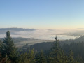
This walk starts at the superb viewpoint overlooking the two lakes of Saint-Point and Remoray. It then alternates between alpine meadows and spruce forests between Le Brey, Bougeons and Remoray. It thus offers an excellent overview of the Jura landscapes.
The source of the Doubs
 3.25 mi
+223 ft
-207 ft
1h 40
Easy
Departure from Mouthe (Doubs)
3.25 mi
+223 ft
-207 ft
1h 40
Easy
Departure from Mouthe (Doubs)
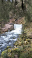
Starting from Mouthe, a small village nestled in the heart of a wide valley bathed by the first meanders of the Doubs, this walk invites passers-by to discover the resurgence of this river, which is listed in the department's inventory of natural sites, and then the Moutat peat bog.
The ancient pass of Chalamont
 3.80 mi
+594 ft
-594 ft
2h 15
Easy
Departure from Villers-sous-Chalamont (Doubs)
3.80 mi
+594 ft
-594 ft
2h 15
Easy
Departure from Villers-sous-Chalamont (Doubs)
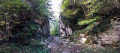
This circular route around Chalamont takes you on a journey of discovery to a remarkable historical site: the ancient Chalamont Passage, where the ruts carved into the rock are a reminder of the carts of yesteryear. The route alternates between forest paths, wilder trails and clearings offering beautiful views of Mont Poupet, the valley and the Boujailles plateau.
Belvédère des Deux Lacs from Le Brey
 3.25 mi
+413 ft
-410 ft
1h 45
Easy
Departure from Brey-et-Maison-du-Bois (Doubs)
3.25 mi
+413 ft
-410 ft
1h 45
Easy
Departure from Brey-et-Maison-du-Bois (Doubs)
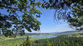
This varied route has a special charm, taking in very different environments: lakes, marshes, peat bogs, rivers, meadows and forests. The highlight is the Belvédère des Deux Lacs, which offers a unique view of the Lac de Remoray National Nature Reserve and its natural environments.
The Deux Lacs viewpoint from Labergement-Sainte-Marie
 6.37 mi
+722 ft
-702 ft
3h 35
Moderate
Departure from Labergement-Sainte-Marie (Doubs)
6.37 mi
+722 ft
-702 ft
3h 35
Moderate
Departure from Labergement-Sainte-Marie (Doubs)
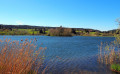
Lac de Remoray, formerly known as Lac Savoureux, is located just upstream from Lac de Saint-Point and used to be part of it. Over thousands of years, the Doubs River, with its alluvial deposits, has separated the original large lake into two. You will discover a patchwork of very different environments: lakes, marshes, peat bogs, rivers, meadows and forests. The viewpoint overlooking the two lakes offers a unique view of the diversity of these landscapes, giving this hike a special charm.
Walk around Lake Remoray
 10.57 mi
+974 ft
-961 ft
5h 40
Moderate
Departure from Labergement-Sainte-Marie (Doubs)
10.57 mi
+974 ft
-961 ft
5h 40
Moderate
Departure from Labergement-Sainte-Marie (Doubs)
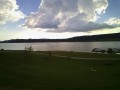
A pleasant walk through forest and pastureland, overlooking the lake. Halfway along the route, there is a superb view of the two lakes from the viewpoint. Return via the same route.
Circuit around Saint-Point-Lac
 Association / Club / Walk leader
 11.53 mi
+607 ft
-604 ft
5h 50
Easy
Departure from Labergement-Sainte-Marie (Doubs)
11.53 mi
+607 ft
-604 ft
5h 50
Easy
Departure from Labergement-Sainte-Marie (Doubs)
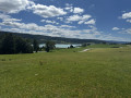
The route around the lake is a long hike but on good roads. Saint-Point-Lac is the third-largest natural lake in France. The path will take you along and close to the lake but also rises up a little and leads away from it at times for better views.
This trail is littered with signs to better understand your environment.
Source of the Doubs and frog pond
 2.88 mi
+23 ft
-23 ft
1h 20
Easy
Departure from Mouthe (Doubs)
2.88 mi
+23 ft
-23 ft
1h 20
Easy
Departure from Mouthe (Doubs)
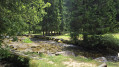
A short, very easy walk with a nice mix of mountain forest, peat bog and the banks of the Doubs.
Flat, easy to access, done with a pregnant woman and a 2.5-year-old child...
Fourperet Gorges and alpine landscapes around Labergement
 5.98 mi
+725 ft
-712 ft
3h 25
Easy
Departure from Labergement-Sainte-Marie (Doubs)
5.98 mi
+725 ft
-712 ft
3h 25
Easy
Departure from Labergement-Sainte-Marie (Doubs)
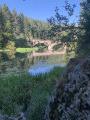
This half-day hike offers beautiful views of the Lac de Remoray Nature Reserve, the Fourperet Gorges on the banks of the Doubs and the alternating spruce forests and pasture meadows. You can also admire the mountains around Métabief.
View of the top of the Chaux-Neuve ski jump and the Bief Bridaux waterfall
 5.67 mi
+873 ft
-869 ft
3h 20
Easy
Departure from Chaux-Neuve (Doubs)
5.67 mi
+873 ft
-869 ft
3h 20
Easy
Departure from Chaux-Neuve (Doubs)
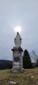
This loop will take you to the Roche Blanche viewpoint with its statue of the Virgin Mary. Enjoy a 360° panorama: to the east, Châtelblanc and the Val de Mouthe; to the west, the Val de Foncine; to the south, the vast Noirmont forest; and to the north, Les Cabouilles, La Combette, La Vernouge and Mont Croz. Then the leat Bridaux waterfall via a very narrow path (caution required), and the top of the Chaux-Neuve ski jump via beautiful paths. Return to the forest.
Levier: Maublin forest - Carved passage
 7.29 mi
+443 ft
-443 ft
3h 45
Moderate
Departure from Boujailles (Doubs)
7.29 mi
+443 ft
-443 ft
3h 45
Moderate
Departure from Boujailles (Doubs)
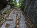
Chemin de Maublin - ancient road and carved passageway of Chalamont.
An easy walk to get your legs back into shape at the start of the season.
Country walk around Chez Mimi
 3.50 mi
+253 ft
-253 ft
1h 50
Easy
Departure from Mouthe (Doubs)
3.50 mi
+253 ft
-253 ft
1h 50
Easy
Departure from Mouthe (Doubs)
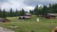
This pleasant, easy hike combines valleys, meadows, woods and forests, taking you on a journey through a rural landscape dotted with chalets. You are in the heart of a site classified as a Sensitive Natural Area by the Doubs department for its remarkable landscape, wildlife, flora and geology.
Chez Liadet - CAF Gros Morond Refuge
 12.78 mi
+1,998 ft
-1,266 ft
7h 35
Difficult
Departure from Mouthe (Doubs)
12.78 mi
+1,998 ft
-1,266 ft
7h 35
Difficult
Departure from Mouthe (Doubs)
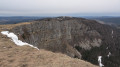
This third stage leads to Mont d'Or, from where the view stretches across the French and Swiss Alps. The route passes by the source of the Doubs, winds through forests and mountain pastures, and climbs to the summit of Mont d'Or before descending to the CAF refuge at Gros Morond.
La Roche Blanche de Châtelblanc
 2.42 mi
+443 ft
-417 ft
1h 25
Easy
Departure from Châtelblanc (Doubs)
2.42 mi
+443 ft
-417 ft
1h 25
Easy
Departure from Châtelblanc (Doubs)
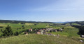
Through woodlands, forests and pastures, discoverthe Belvédère de la Roche Blanche, which rises to 1,013 metres, and admire the magnificent view of the Val de Mouthe (Doubs) on one side and the Val de Foncine (Jura) on the other.
The Pertes de l’Ain gorges
 3.59 mi
+548 ft
-548 ft
2h 10
Easy
Departure from Bourg-de-Sirod (Jura)
3.59 mi
+548 ft
-548 ft
2h 10
Easy
Departure from Bourg-de-Sirod (Jura)
Pleasure in cascades.
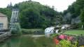
This extraordinary walk around the Pertes de l’Ain gorges sets out from the remarkable site of the old forges and is a delight for all the senses.
Along the way: The Pertes de l’Ain, gorges, cascades, the ruins of Villain castle, and the relics of an old village.
Circular route of Bourg de Sirod via the Rocher des Commères and the Côte Poire
8.70 mi
+1,818 ft
-1,824 ft
5h 35
Moderate
Departure from Bourg-de-Sirod (Jura)
A circular loop around Bourg de Sirod offering a rich variety of landscapes, forests, terrain and paths.
From the ruins of Chateauvillain to the Rochers des Commères, from dry grasslands to mossy thickets and bare scree slopes, from quiet forest tracks to the deafening, bubbling waterfalls of the Ain’s underground watercourses, and from cliff edges to dense forests – there’s something for everyone.
The Val de Sirod and the Perte de l'Ain
10.13 mi
+1,627 ft
-1,617 ft
6h 05
Moderate
Departure from Bourg-de-Sirod (Jura)
Ten minutes from Champagnole, the most powerful of the medieval fortresses still stood not so long ago... A nature and heritage walk awaits you through the Val de Sirod around the site of the Perte de l'Ain, which is at the end of this route. You will pass by the Château Villain fortress, viewpoints, the Rocher des Commères, the castle chapel, the Fontaine des Tufs, the Roche des Sarrasins, the village of Syam, and more.
The Rocher des Commères and the Perte de l'Ain
 4.65 mi
+1,050 ft
-1,079 ft
3h 05
Moderate
Departure from Bourg-de-Sirod (Jura)
4.65 mi
+1,050 ft
-1,079 ft
3h 05
Moderate
Departure from Bourg-de-Sirod (Jura)
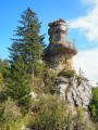
A lord had three daughters of marriageable age. Capricious, they found all suitors unworthy. Annoyed, the fairy Melusine turned them into stone statues. Erosion has destroyed two of these gossips. Time will get the better of the last one, so don't delay in paying her a visit. On the way, you will see the ruins of a castle perched on the cliffs, views of the Val de Sirod, and picturesque stony paths winding through beautiful rocks. Return via the Perte de l'Ain and its superb gorges.
From the Source of the Saine to the Belvédère de la Roche Fendue
 4.80 mi
+810 ft
-801 ft
2h 55
Easy
Departure from Foncine-le-Haut (Jura)
4.80 mi
+810 ft
-801 ft
2h 55
Easy
Departure from Foncine-le-Haut (Jura)
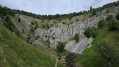
The Saine river has its source in the shelter of this limestone amphitheatre. Admire this magnificent resurgence with its wild but accessible character, climb up high, follow the Bayard botanical trail and contemplate a grandiose and unusual landscape from the Belvédère de la Roche Fendue.
The source of the Saine
 9.22 mi
+1,467 ft
-1,483 ft
5h 30
Moderate
Departure from Foncine-le-Haut (Jura)
9.22 mi
+1,467 ft
-1,483 ft
5h 30
Moderate
Departure from Foncine-le-Haut (Jura)
A trail starting out from Foncine le Haut that will take you to the source of the Saine and various viewpoints. A themed trail and a botanical trail...
From Foncine-le-Haut to Bellefontaine
 12.87 mi
+1,575 ft
-994 ft
7h 15
Difficult
Departure from Foncine-le-Haut (Jura)
12.87 mi
+1,575 ft
-994 ft
7h 15
Difficult
Departure from Foncine-le-Haut (Jura)
Thirteenth stage of the Échappée Jurassienne: discover the Jura Mountains on this stage between Haut-Jura and Haut-Doubs. Explore the cross-country ski trails of the Mont Noir massif, which are transformed into superb hiking trails in summer. Immerse yourself in a peaceful, unspoilt environment, where alpine flowers bloom alongside the woody scents of fir and spruce trees. Between the woods, valleys and ridges, enjoy the fresh air while admiring the picturesque landscapes.
This stage will also take you along the Bellefontaine and Mortes lakes, known for their peat bogs, which are home to remarkable flora and fauna.
The trails around Chaffois
 5.77 mi
+413 ft
-400 ft
3h 00
Easy
Departure from Chaffois (Doubs)
5.77 mi
+413 ft
-400 ft
3h 00
Easy
Departure from Chaffois (Doubs)
Starting from the village of Chaffois, near the church, explore the woodland trails with magnificent wild landscapes. Possible detour to the remarkable tree with views of Mont d’Or and Mont Blanc, as well as Notre-Dame-du-Mont.
Very well-marked trail, suitable for either walking or mountain biking (route number 111). Parking available near the church. The hike can be done on foot, by mountain bike or on snowshoes.
The Great Chimney
 5.39 mi
+1,306 ft
-1,280 ft
3h 35
Moderate
Departure from Syam (Jura)
5.39 mi
+1,306 ft
-1,280 ft
3h 35
Moderate
Departure from Syam (Jura)
Forest walk in the hills above Syam to discover the Grande Cheminée, an open-air cave that was visited in the Bronze Age. An axe made of this metal was found there. According to some, you may be walking on the lost site of Alesia as you make your way to two viewpoints over the wild Saine valley.
Around the Chaux-des-Crotenay plateau
 10.47 mi
+1,713 ft
-1,693 ft
6h 20
Difficult
Departure from Syam (Jura)
10.47 mi
+1,713 ft
-1,693 ft
6h 20
Difficult
Departure from Syam (Jura)
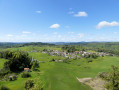
I suggest a lovely walk in the heart of the Jura, between Syam and the Chaux-des-Crotenay plateau, to a site of interest to archaeologists.
There are two difficulties to note: access to the Belvédère du Rachet and the short crossing of the Grotte de la Grande Cheminée. The rest of the route is not difficult.
Waterfalls and Gorges of the Langouette from Les Planches-en-Montagne
 1.00 mi
+108 ft
-112 ft
0h 35
Easy
Departure from Les Planches-en-Montagne (Jura)
1.00 mi
+108 ft
-112 ft
0h 35
Easy
Departure from Les Planches-en-Montagne (Jura)
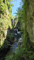
The village of Les Planches-en-Montagne has a picturesque gem at its heart: gorges carved into the limestone and well hidden under the trees. The Saine rushes through them with gusto. Force, turmoil and noise coexist here with calm, serenity and gentleness.
The River Saine along the Langouette and Malvaux gorges
 6.91 mi
+892 ft
-886 ft
3h 55
Moderate
Departure from Les Planches-en-Montagne (Jura)
6.91 mi
+892 ft
-886 ft
3h 55
Moderate
Departure from Les Planches-en-Montagne (Jura)
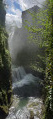
The Malvaux and Langouette Gorges offer cool respite on hot summer days as well as magnificent scenery. This hiking route is suitable for families, with a shorter alternative (9.5 km) that does not go around Lac à la Dame. Part of the route follows the old tramway, so a head torch or torch is required to cross the 180 m tunnel.
Circular walk around Lac à la Dame from Les Planches-en-Montagne
9.59 mi
+1,112 ft
-1,099 ft
5h 25
Moderate
Departure from Les Planches-en-Montagne (Jura)
A lovely walk starting from Les Planches-en-Montagne which, through a variety of landscapes, will take you to the shores of Lac à la Dame, then to the summit of Crêt Pelé, where you’ll be treated to a 360° panorama. You’ll cross some beautiful communal meadows to reach Fort du Plasne and, through a lovely forest, the outskirts of the village of Entre-Deux-Monts. Beautiful high forests, large peat bogs, dry grasslands and superb woodland meadows will delight those who appreciate stunning and diverse vegetation.
The Devil's Bridge, the Lison spring and waterfall and the Sarrazine Cave
 10.18 mi
+2,254 ft
-2,228 ft
6h 40
Difficult
Departure from Crouzet-Migette (Doubs)
10.18 mi
+2,254 ft
-2,228 ft
6h 40
Difficult
Departure from Crouzet-Migette (Doubs)
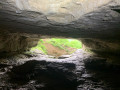
A lovely loop along beautiful paths, discovering the Pont du Diable, the Creux Billard, the Grotte Sarrazine, the Source and the Cascade du Lison. At the start of this beautiful walk, you'll cross the protected natural area of the marl pits and the Bois de Château-Renaud stream. Then head for Crouzet-Migette to reach the Source du Lison site, with a steep descent into the Combe Fagot. Before arriving at the site, you'll passthe Gros Chêne, presumed to be 300 years old, with a circumference of 5.5 m, an imposing sight. On arrival at the site: a return trip to the Creux Billard (unfortunately the Source path is off-limits), then a break at the Cascade du Lison, and a return trip to the Grotte Sarrazine (headlamp required). Then back along the Lison, a nice rest before a steep climb to Crouzet-Migette.
Circular walk around the Langouette Gorges via the Col du Gyps
6.52 mi
+689 ft
-663 ft
3h 35
Moderate
Departure from Les Planches-en-Montagne (Jura)
A lovely walk with no major difficulties, offering a chance to discover the Langouette Gorges and its magnificent waterfalls via a well-maintained and safe path. After passing through the village of Les Planches-en-Montagne, you’ll reach Chaux des Crotenay via forest paths and the route over the Col du Gyps.
From Chaux-des-Crotenay to Foncine-le-Haut
 12.62 mi
+1,998 ft
-1,765 ft
7h 35
Difficult
Departure from Chaux-des-Crotenay (Jura)
12.62 mi
+1,998 ft
-1,765 ft
7h 35
Difficult
Departure from Chaux-des-Crotenay (Jura)
Twelfth stage of the Échappée Jurassienne. For this stage,prepare to be amazed by the wild and authentic beauty of the Jura as you let yourself be carried away by the water for a peaceful break, out of time.
Follow the tumultuous course of the Saine River through theLangouette Gorges, then discover the village of Les Planches-en-Montagne and the spectacular Malvaux Gorges, where the Saine has formed the Cascade du Bief de la Ruine, the largest waterfall in the department with a drop of 110 metres. The river then winds its way under the viaduct of the old tramway towards Foncine-le-Bas, offering breathtaking natural landscapes.
Finally, cross the Mont Bayard at an altitude of over 1,000 metres for a remarkable view of the surrounding mid-mountain landscape. End your day with a descent to the village of Foncine-le-Haut, ideal for a restful and rejuvenating night.
From Les Belettes to the Bois de Ban
5.47 mi
+741 ft
-722 ft
3h 10
Easy
Departure from Chaux-des-Crotenay (Jura)
A walk through the woods, consisting of two circular loops with a return section between them.
View over the Billaude Valley from the Rocher de la Baume viewpoint. Option to extend the walk by visiting the village of Châtelneuf. The walk ends in the Billaude Valley, where you can see sections of the ‘Ligne des Hirondelles’ from above.
A walk with no major difficulties, though some sections may be muddy due to forestry work. It winds through a pleasant deciduous forest; the paths are marked in yellow and red.
More walks in Mignovillard
Select a point of interest below: