Between Mignovillard and Petit-Villard via the Seigne des Barbouillons

This easy circular route links Mignovillard to Petit-Villard, alternating between village streets and farm tracks. It runs alongside the Seigne des Barbouillons Regional Nature Reserve, a remarkable peat bog in the Haut-Jura, before reaching Petit-Villard via a track running parallel to the D107. The return journey to Mignovillard takes you through the countryside, along a gently undulating route combining agricultural landscapes, village heritage and remarkable wetlands.

Details

104742737
Creation:
Last update:
Last review:
  • Walking
    Activity: Walking
  • ↔
    Distance: 3.66 mi
  • ◔
    Average duration: 1h 45 
  • ▲
    Difficulty: Easy

  • ⚐
    Back to start: Yes
  • ↗
    Ascent: + 95 ft
  • ↘
    Descent: - 95 ft

  • ▲
    Highest point: 2,933 ft
  • ▼
    Lowest point: 2,831 ft

Photos

Description of the walk

Park in the car park opposite the town hall.

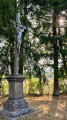
(S/E) Opposite the town hall, turn right onto Rue de Mouthe (D55). Follow it for about 50 metres until you reach the stone cross at the junction with Rue de l’Agriculture.

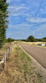
(1) Turn left onto this street, then follow Rue de Frasne, which runs below the D35. On leaving the village, continue straight ahead along the farm track that runs alongside the departmental road.

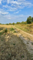
(2) Turn left and carefully cross the D35 to take the dirt track towards the Seigne des Barbouillons. Follow it along the edge of the meadows, without entering the Nature Reserve, until you reach the cemetery and the information board for the Seigne des Barbouillons Regional Nature Reserve.

(3) Turn right and follow the farm track towards the farm, then continue straight on to the D107.

(4) Turn left onto the farm track separate from the main road and follow it towards Petit-Villard. Continue until you reach the first houses. At Rue de la Fontaine Carrée, turn left onto Rue de la Chapelle (D286).

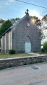
(5) When you reach the Chapelle Saint-Joseph and the war memorial, cross the D286 with care and take Rue du Chalet on the left. Then turn left onto Rue du Puits and follow it to a farm.

(6) After passing the farm buildings, continue to the round concrete tank and then turn immediately left. Take the farm track and follow it straight on in the general direction of Mignovillard until you reach the D286.

(7) Cross it carefully to reach the Red Cross in Petit-Villard. Then continue towards Mignovillard, keeping to the left-hand side of the road, facing the oncoming traffic, until you reach the first houses. Pass the cemetery and you’ll arrive at Saint-Michel Church.

(8) Carry on straight ahead along Rue de Champagnole until you reach the car park opposite the town hall (S/E)
Waypoints

  1. S/E : mi 0 - alt. 2,838 ft - Car park opposite the town hall
  2. 1 : mi 0.12 - alt. 2,838 ft - Junction of Rue de Mouthe and Rue de l’Agriculture
  3. 2 : mi 0.57 - alt. 2,884 ft - Crossing the D35 – Chemin de la Seigne
  4. 3 : mi 1.23 - alt. 2,854 ft - Réserve naturelle régionale de la Seigne des Barbouillons (Mignovillard)
  5. 4 : mi 1.81 - alt. 2,858 ft - Path running alongside the D107
  6. 5 : mi 2.43 - alt. 2,900 ft - Chapel
  7. 6 : mi 2.63 - alt. 2,887 ft - Farm
  8. 7 : mi 3.18 - alt. 2,877 ft - Petit-Villard Red Cross
  9. 8 : mi 3.56 - alt. 2,831 ft - Église Saint-Michel (Mignovillard)
  10. S/E : mi 3.66 - alt. 2,838 ft - Car park opposite the town hall

Notes

The route mainly follows quiet roads and farm tracks. However, two crossings of departmental roads require particular caution: the D35 on leaving Mignovillard and the D286 on the return journey from Petit-Villard. After the Red Cross in Petit-Villard, a short section runs alongside the D286: keep to the left-hand side of the carriageway, facing oncoming traffic, and take particular care.

The path leading to Petit-Villard runs alongside the D107 but remains separate from the road. Some farm tracks may be wet or muddy after heavy rain. On the outskirts of the Seigne des Barbouillons Regional Nature Reserve, stay on the paths and observe the regulations and respect the tranquillity of the site.

Worth a visit

Seigne des Barbouillons Regional Nature Reserve
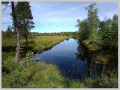
The route runs alongside the Seigne des Barbouillons, a protected peat bog situated in the commune of Mignovillard. Classified as a nature reserve, it is one of the area’s most remarkable wetlands and features a mosaic of peat bogs, wet meadows and woodland characteristic of the Haut-Jura. The walk allows you to get close to the edge of the reserve whilst remaining on the perimeter paths.

Petit-Villard
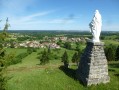
Now a hamlet of Mignovillard, Petit-Villard was for a long time an independent commune. It merged with Mignovillard in 1966 to form the commune of Mignovillard-Petit-Villard, before the latter expanded in 1973 with the incorporation of Froidefontaine and Essavilly and reverted to the name Mignovillard. The route passes through the heart of Petit-Villard, where several reminders of this former municipal life remain, notably the Chapel of Saint Joseph and the war memorial, unveiled on 18 June 1927. On the way back to Mignovillard, it also passes the Petit-Villard Red Cross, situated alongside the D286, near a statue of the Virgin Mary.

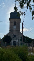
Saint-Michel Church, Mignovillard
Situated in the centre of the village and directly on the route, the Church of Saint-Michel has its origins in a vicarage chapel first recorded in 1304. The present Gothic building was consecrated in 1488 and subsequently enlarged in the 18th century; its bell tower was completed in 1763. Inside, the church notably houses a remarkable pulpit attributed to the sculptor Augustin Fauconnet, as well as an 18th-century painting depicting Saint Michael slaying the dragon, which has been listed as a historic monument since 2019.

Other walks in the area

For more walks, use our search engine .

The GPS track and description are the property of this route's author. Please do not copy them without permission.