La Croix au Maréchal circular from Mignovillard

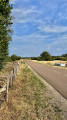
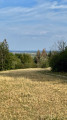
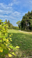
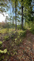
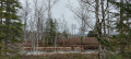
Starting from the centre of Mignovillard, this circular route gradually takes you through farmland and then the wooded areas to the south-east of the village. It first reaches the Croix au Maréchal, an old stone cross standing alone amongst meadows and woods, situated at a former crossroads. The route continues towards the restored oratory of Notre-Dame-du-Moru, then crosses the Moru area, a reminder of a former hamlet of farmhouses that has now disappeared. The return journey takes you via La Pettouse, first overlooking and then skirting the limestone aggregate quarry. Rural landscapes, woodland and traces of local history give this circular walk a very distinctive character.

Details

104605979
Creation:
Last update:
Last review:
  • Walking
    Activity: Walking
  • ↔
    Distance: 6.62 mi
  • ◔
    Average duration: 3h 35 
  • ▲
    Difficulty: Moderate

  • ⚐
    Back to start: Yes
  • ↗
    Ascent: + 614 ft
  • ↘
    Descent: - 610 ft

  • ▲
    Highest point: 3,448 ft
  • ▼
    Lowest point: 2,835 ft

Photos

Description of the walk

The route starts in front of Mignovillard Town Hall, in the centre of the village. Parking is available in the Town Hall car park.

(S/E) From the town hall, head towards Rue de Mouthe and follow it south-east.

(1) At the junction with the D340, turn right and follow this road until you reach a farm track on the left.

(2) Continue south-east across the pastures and then towards the edge of the woodland until you reach the Croix au Maréchal, situated slightly off the track.

(3) Return to the track and continue to the right, heading east. Go round the wooded area on its northern side to reach the Oratory of Notre-Dame-du-Moru.

(4) Turn round and head back along the previous path. Head left towards Le Moru and continue through the forest until you reach the next junction.

(5) At the junction with the Route du Moru, turn right and follow this small tarmac road.

(6) At the junction with mountain bike routes 37–38, leave the Route du Moru and turn right into the forest.

(7) Continue to the right through the woods, following the path which gradually turns south, then west, north and finally north-west.

(8) At the junction between the old and new tracks, turn left onto the new track and head down towards the quarry.

(9) As you approach La Pettouse, go through the gate in the fence provided for mountain bikes and turn left onto the track running alongside the quarry. Stay on the track and do not enter the quarry site.

(10) On leaving the La Pettouse area, carefully join the D340 and ride along the left-hand verge of the carriageway, facing the oncoming traffic, towards Mignovillard.

(2) On entering Mignovillard, continue straight ahead towards the village centre, following the reverse route of the outward journey. Join Rue de Mouthe and then head back to the town hall (S/E).

Waypoints

  1. S/E : mi 0 - alt. 2,835 ft - Mignovillard Town Hall
  2. 1 : mi 0.47 - alt. 2,854 ft - D340 junction
  3. 2 : mi 0.78 - alt. 2,861 ft - Junction of the circular loop
  4. 3 : mi 1.5 - alt. 2,972 ft - Croix au Maréchal
  5. 4 : mi 1.7 - alt. 2,982 ft - Oratoire de Notre-Dame-du-Moru
  6. 5 : mi 3.06 - alt. 3,294 ft - Forest junction / Route du Moru
  7. 6 : mi 3.23 - alt. 3,346 ft - Junction of MTB routes 37 and 38
  8. 7 : mi 3.53 - alt. 3,448 ft - Le Moru
  9. 8 : mi 4.56 - alt. 3,140 ft - Junction: old/new path
  10. 9 : mi 4.87 - alt. 3,005 ft - Edge of the quarry – La Pettouse
  11. 10 : mi 4.99 - alt. 2,946 ft - D340 road
  12. S/E : mi 6.62 - alt. 2,838 ft - Mignovillard Town Hall

Notes

Parking: car park opposite Mignovillard Town Hall.

The route mainly follows farm tracks and forest paths. Some sections may be wet or muddy after heavy rain.

The route has no specific signposting, apart from certain sections shared with mountain bike routes 37 and 38: the route description and GPS track are useful at the main forest junctions.

At La Pettouse, you must stay on the paths open to the public and must not enter the quarry site.

There are no identified water points along the route: make sure you bring something to drink.

This route passes through a protected area, which may be subject to special regulations:

Worth a visit

Croix au Maréchal
An old stone cross, now standing alone amidst meadows and woodland. Its location marks a former crossroads of paths linking, in particular, Mignovillard, Froidefontaine, Mouthe, Cerniébaud, Fraroz and Bonnevaux. It provides an interesting insight into the area’s historical layout.

Oratory of Notre-Dame-du-Moru
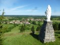
A small religious building situated near the old path from Mignovillard to Mouthe. The oratory has recently been restored.

Le Moru
This locality preserves the memory of a former hamlet of farmhouses that has now disappeared. A walk through this wooded area thus serves as a reminder that a space now largely returned to the forest was once inhabited.

La Pettouse
The return route runs above and then close to the La Pettouse quarry, used for the extraction of limestone aggregates. This rocky landscape contrasts with the agricultural and woodland areas passed through earlier.

Other walks in the area

For more walks, use our search engine .

The GPS track and description are the property of this route's author. Please do not copy them without permission.