


Refine your search for walks in Le Teilleul
Le Teilleul walks


 Le Tertre de Montécot to Le Teilleul
 Visorando Member
 7.05 mi
 +630 ft
 -640 ft
 3h 45
3h 45
 Moderate
 Departure from Le Teilleul (Manche)
A small hill in the Mortainais region can be explored from Le Teilleul via a unique path, an ancient pilgrimage route once used by pilgrims coming from Burgundy. From the top of this hill, the view stretches towards Domfront and Mortain.
The Barenton Heritage Orchard
 0.37 mi
+33 ft
-33 ft
0h 10
0.37 mi
+33 ft
-33 ft
0h 10
 Easy
Departure from Barenton (Manche)
Easy
Departure from Barenton (Manche)
A very, very short walk to discover Normandy’s arboricultural heritage and the various ways in which local fruit is utilised. You’ll stroll through the heritage orchard and then into old buildings once used for processing. Numerous information boards line this informative trail.
Claire-Fontaine and the Chapelle de Courbefosse in Fougerolles-du-Plessis
 9.08 mi
+440 ft
-413 ft
4h 35
Moderate
Departure from Fougerolles-du-Plessis (Mayenne)
9.08 mi
+440 ft
-413 ft
4h 35
Moderate
Departure from Fougerolles-du-Plessis (Mayenne)
A very pleasant walk, starting with two lakes, followed by wide, straight paths through wooded countryside, before continuing along the circular western route with unobstructed views as you walk alongside a small stream. Along the way, you’ll see some beautiful country houses and two small chapels.
The sunken lanes of La Dorée
 7.05 mi
+541 ft
-528 ft
3h 45
Moderate
Departure from La Dorée (Mayenne)
7.05 mi
+541 ft
-528 ft
3h 45
Moderate
Departure from La Dorée (Mayenne)
The Mayenne is a land of pastures where plots of land remain small. There are numerous sunken lanes here, and you are invited to explore several of them.
One slight drawback: due to their nature, there is no continuity. Walkers will therefore have to accept walking some distances on tarmac roads.
The Fosse Arthour tour
 5.26 mi
+433 ft
-410 ft
2h 50
Easy
Departure from Saint-Georges-de-Rouelley (Manche)
5.26 mi
+433 ft
-410 ft
2h 50
Easy
Departure from Saint-Georges-de-Rouelley (Manche)
This easy hike allows you to discover the Fosse Arthour. It is a geological fault called a cluse, which gives the landscape an exceptional appeal.
This cluse forms a narrow, 70-metre-deep gorge carved into a rocky ridge and strewn with large boulders on its sides. The area is ideal for walking and climbing.
Short circular loop around La Fosse Arthour
 1.48 mi
+226 ft
-210 ft
0h 55
Easy
Departure from Saint-Georges-de-Rouelley (Manche)
1.48 mi
+226 ft
-210 ft
0h 55
Easy
Departure from Saint-Georges-de-Rouelley (Manche)
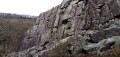
A very short route, ideal for families, which, in a lovely setting, offers a wide variety of landscapes: river, rocky outcrop, viewpoint, pond and woodland.
La Fosse Arthour in all its splendour
9.61 mi
+587 ft
-600 ft
4h 55
Moderate
Departure from Rouellé (Orne)
Passing through a marshland to discover this natural wonder – a gorge over 70 metres high, carved out by a river which, at this point, is more like a torrent – come and explore the Sonce and walk a short section ofthe GR® trail that links France’s two most spectacular sites: Notre-Dame Cathedral in Paris and Mont-Saint-Michel Abbey.
Via La Belle Eau from Mortain-Bocage
 6.97 mi
+810 ft
-807 ft
3h 55
Moderate
Departure from Mortain (Manche)
6.97 mi
+810 ft
-807 ft
3h 55
Moderate
Departure from Mortain (Manche)
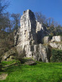
Although "Belle Eau" is the name of a hamlet located at the northernmost point of this route, hikers will be amazed from the outset by the water gushing through the rocks in magnificent waterfalls. The route continues along wide paths, often bathed by runoff water from the various branches of the Cance, and ends on a high note with the panorama offered at altitude 314, famous not only for its small chapel but also for the battles that took place there in August 1944.
Along the Airon from Landivy
 11.43 mi
+466 ft
-489 ft
5h 40
Moderate
Departure from Landivy (Mayenne)
11.43 mi
+466 ft
-489 ft
5h 40
Moderate
Departure from Landivy (Mayenne)
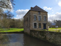
With one foot in Normandy and one in Brittany, this trail offers some truly stunning views. After taking in the panoramic scenery, you’ll wind your way through the shaded paths along the Futaie Valley.
As far as Mausson Castle, staying within the Bazouge region
4.24 mi
+318 ft
-305 ft
2h 15
Easy
Departure from Landivy (Mayenne)
Tree-lined paths running alongside a river lead to the château. The return route mainly follows a winding path through the fields.
In the footsteps of the potters of yore, starting from the Musée Le Placitre
4.02 mi
+1,404 ft
-1,263 ft
3h 05
Moderate
Departure from Manche
A 6 km route starting from the Ceramics Museum – Ger Creative Centre. You can park in the museum car park when the museum is closed. Otherwise, please park in the field opposite to leave the car park for museum visitors (coaches). Woodland, sunken lanes and old pottery hamlets.
A gentle, short walk around Domfront-en-Poiraie
3.90 mi
+322 ft
-295 ft
2h 05
Moderate
Departure from Domfront (Orne) (Orne)
A gentle, short walk around Domfront-en-Poiraie with a slight climb. Passes through the small village of Saint-Front. The route follows small roads and paths, some of which are wooded. Lovely views.
From Pontmain to Pont Dom Guérin
3.14 mi
+141 ft
-151 ft
1h 35
Easy
Departure from Pontmain (Mayenne)
This route takes you into the Parc des Oblats and its arboretum, then along a shaded path by the water’s edge leading to Mausson Castle, which is privately owned but can be admired from the outside. Pontmain is an important place of pilgrimage to Our Lady of Pontmain, who appeared to several children on 17 January 1871.
The Pouillé Copse in Larchamp
6.64 mi
+299 ft
-302 ft
3h 20
Moderate
Departure from Larchamp (Mayenne)
Unnoticeable to the hiker, this route has a unique feature: the waters encountered in the south feed into the Atlantic basin, whilst those in the north flow towards the English Channel.
It does, however, offer the chance to explore a site where woodworking was, for several centuries, the primary industry.
Le Relais des Vallées in La Chapelle-Janson
8.13 mi
+650 ft
-623 ft
4h 20
Moderate
Departure from La Chapelle-Janson (Ille-et-Vilaine)
Beautiful sunken lanes, hedgerow-lined countryside, patches of woodland, open countryside and quiet country lanes with very little traffic, offering views over the lush green valleys. A glimpse of the local heritage: the 16th-century Manoir de la Lande.