Short route around the Larchamp Mill

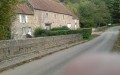
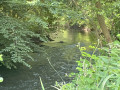
This trail invites you to take a bucolic stroll through the unspoilt Normandy countryside of the commune of Larchamp. Ideal for those who love peace and nature, the route features traditional sunken paths, crosses charming little wooden bridges and runs alongside tranquil ponds near an old mill.

Details

n°111623786
Creation:
Last update:
Last review:
–
  • Walking
    Activity: Walking
  • ↔
    Distance: 4.22 mi
  • ◔
    Average duration: 2h 10 
  • ▲
    Difficulty: Easy

  • ⚐
    Back to start: Yes
  • ↗
    Ascent: + 259 ft
  • ↘
    Descent: - 266 ft

  • ▲
    Highest point: 866 ft
  • ▼
    Lowest point: 712 ft

Description of the walk

Park in the car park on the square in front of the church.

(S/E) Leave the car park on the right and walk gently down Rue des Lavandières towards La Talvandière to leave the village.

(1) At the first junction, turn right at the fenced-off survey point and walk gently down the footpath which winds its way under the canopy of trees and into the heart of the bocage. Follow the traditional hedgerows until you reach the D25.

(2) Cross the departmental road carefully : at this point, a short detour takes you to the Étang de Larchamp leisure centre. Continue for about a hundred metres along the road opposite, then turn right, following the path that winds its way around the edges of the farmland. Carry on straight ahead, leaving the path on your right, until you reach the road from Vassy to Domfront (D54).

(3) Cross it carefully and carry on towards La Ménardrie; head for the Moulin de Larchamp and turn right to walk alongside the pond and cross the bridge over the Halouze.

(4) Once back on the Vassy to Domfront road, head down it on the right-hand side, then cross it carefully and turn left onto the Route de la Mare. Continue to the hamlet of La Bresdrie.

(5) Carry on straight ahead along the Chemin du Gas, which makes a first turn left then right before reaching its end.

(6) Carry on straight ahead along the footpath for about 1 km, then take the path on the right by the houses at La Mare and continue to the junction.

(7) Turn right, cross the Halouze again and carry on straight ahead to reach Les Tombettes, where you’ll rejoin the tarmac road.

(8) Carry on straight ahead along the road until you come out onto the D25.

(9) Cross it at the pedestrian crossing, continue straight ahead along Rue de la Ferronnerie, then turn immediately right to reach Place du Sabotier and the car park (S/E).

Waypoints

  1. S/E : mi 0 - alt. 860 ft - Place de l’Église
  2. 1 : mi 0.07 - alt. 827 ft - Survey point – Path on the right
  3. 2 : mi 0.38 - alt. 791 ft - D25
  4. 3 : mi 1.24 - alt. 735 ft - D54. Larchamp Mill
  5. 4 : mi 1.72 - alt. 755 ft - D54. Route de la Mare
  6. 5 : mi 1.95 - alt. 748 ft - La Bresdrie
  7. 6 : mi 2.31 - alt. 778 ft - End of tarmac – sunken track
  8. 7 : mi 3.04 - alt. 850 ft - La Mare
  9. 8 : mi 3.86 - alt. 794 ft - Les Tombettes
  10. 9 : mi 4.15 - alt. 853 ft - D25
  11. S/E : mi 4.22 - alt. 860 ft - Place de l’Église

Notes

The sunken paths and areas near the stream and ponds are particularly prone to damp. They can become very muddy and slippery during wet weather or from autumn to spring. It is strongly recommended that you wear waterproof walking boots.

Did you know? Larchamp takes its name from a noble family of the same name, the de Larchamp family, whose existence is documented as far back as the 12th century, notably with Robert de Larchamp in 1141.

Worth a visit

1. The Church of Notre-Dame-de-l’Assomption in Larchamp: the starting point of the walk, this 19th-century neo-Gothic building, constructed from granite and sandstone, bears witness to the rich local architectural heritage of the Normandy Bocage.

2. The Étangs du Moulin: this string of unspoilt lakes is the scenic highlight of the route, perfect for observing aquatic wildlife or enjoying a refreshing break.

3. The network of sunken paths: traditional paths flanked by embankments and trees, forming veritable green tunnels.

4. The Étang de Larchamp Complex: situated in the hamlet of La Cour, this leisure and recreation site centres around a 2-hectare lake much loved by anglers (roach, tench, carp, trout). It offers a range of facilities to make the most of a family outing: a shaded picnic area, a mini-golf course, a pétanque court, a large car park and an on-site café.

Other walks in the area

For more walks, use our search engine .

The GPS track and description are the property of this route's author. Please do not copy them without permission.