The Barenton Heritage Orchard

A very, very short walk to discover Normandy’s arboricultural heritage and the various ways in which local fruit is utilised. You’ll stroll through the heritage orchard and then into old buildings once used for processing. Numerous information boards line this informative trail.

Details

105948191
Creation:
Last update:
Last review:
  • Walking
    Activity: Walking
  • ↔
    Distance: 0.37 mi
  • ◔
    Average duration: 0h 10 
  • ▲
    Difficulty: Easy

  • ⚐
    Back to start: Yes
  • ↗
    Ascent: + 33 ft
  • ↘
    Descent: - 33 ft

  • ▲
    Highest point: 479 ft
  • ▼
    Lowest point: 446 ft
  • ⚐ Country: France
  • ⚐ City: Barenton (50720)
  • ⚑
    Start/End: N 48.587866° / W 0.807°
  • ❏
    IGN map(s): Ref. 1416E
  • Hour-by-hour weather

Photos

Description of the walk

Park in the car park of the Musée du Poiré (signposted from the D907 between Barenton and Saint-Georges-de-Rouelley).

Signposts are in place along the route.

(S/E) Leave the car park via the entrance on the museum side and turn right to reach the top of a flight of steps.

(1) Go down the steps on the left, leaving the museum entrance on your left, and take note of the first information board. Follow the winding, compacted track.

(2) At the signposted junction, there are two options:
- Continue straight ahead along the compacted track (wheelchair-accessible route) and rejoin the main route at (3).
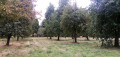
- Alternatively, as shown on the map, turn left onto the pedestrian route. Follow a grassy path (not shown on the map) which winds through the orchard, where many varieties of apples and pears are grown.

(3) Return to the compacted track and follow it to the left. Pass the beehives on your left and turn right with the track.

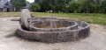
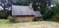
(4) Walk between an old farmhouse on the left – well worth a visit – and a large wine press on the right. You’ll reach the top of the steps you took at the start of the walk.

(1) Leave the site and turn left to return to the car park where you started (S/E).

Waypoints

  1. S/E : mi 0 - alt. 479 ft - Car park at the - Maison de la Pomme et de la Poire (Barenton)
  2. 1 : mi 0.03 - alt. 469 ft - Crossing point on the circular loop – Staircase
  3. 2 : mi 0.11 - alt. 459 ft - Junction
  4. 3 : mi 0.23 - alt. 459 ft - Grassy path x Gravel track
  5. 4 : mi 0.28 - alt. 466 ft - Area dedicated to processing
  6. S/E : mi 0.37 - alt. 479 ft - Car park at the - Maison de la Pomme et de la Poire (Barenton)

Notes

A simple pair of trainers is sufficient for this very short route along good paths and tracks.

Public toilets are located near the museum, between (1) and (2).

The site is open all year round.

The museum is only open from 2 April to 31 October, from 10.00 am to 1.00 pm and from 2.00 pm to 6.00 pm. Local products are on sale on site: perry, cider, Domfront calvados (i.e. made from a blend of apples and pears), etc. – to be consumed in moderation.

The author has completed this route twice: the first time on 19 August 2021, and the second on 27 August 2026.

Worth a visit

- Numerous information boards along the entire route.
- Beautiful historic buildings.
- A wide variety of apple and pear trees in the orchard.

Other walks in the area

For more walks, use our search engine .

The GPS track and description are the property of this route's author. Please do not copy them without permission.