


Refine your search for walks in La Terrasse
La Terrasse walks


 Belvédère du Puy
 Visorando Member
 2.79 mi
 +1,913 ft
 -1,883 ft
 2h 55
2h 55
 Moderate
 Departure from La Terrasse (Isère)
A pleasant walk with a beautiful view on arrival at the Belvédère du Puy.
From the fortified house of La Frette to the Château du Touvet, a circular route
 4.66 mi
+938 ft
-928 ft
2h 55
Moderate
Departure from Le Touvet (Isère)
4.66 mi
+938 ft
-928 ft
2h 55
Moderate
Departure from Le Touvet (Isère)
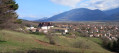
An easy route in the hills above Le Touvet, from one castle to another, with the first part in the forest and the return via the hamlets on the road, including 250 m on the D29, but without any danger.
The Pas de l’Écharasson round trip
 6.17 mi
+2,569 ft
-2,572 ft
5h 05
6.17 mi
+2,569 ft
-2,572 ft
5h 05
 Extremely difficult
Departure from Saint-Bernard (Isère) (Isère)
Extremely difficult
Departure from Saint-Bernard (Isère) (Isère)
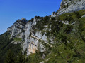
Starting from the Col de Marcieu, this hike to the Pas de l’Écharasson begins with a walk through the forest before continuing along a path that leads to the foot of the Crête de l’Alpette at a scree slope. After negotiating its narrow gap and climbing two rocky outcrops, you’ll discover a magnificent cirque in a breathtaking setting. The route continues along a ledge sheltered by rock; climbing through a gap, then over a small, cable-secured rock barrier and finally along a ridge takes you to the crest and its magnificent viewpoint.
Not Charassons and Arche Miracle
 8.16 mi
+4,783 ft
-4,780 ft
6 hrs
Extremely difficult
Departure from Saint-Bernard (Isère) (Isère)
8.16 mi
+4,783 ft
-4,780 ft
6 hrs
Extremely difficult
Departure from Saint-Bernard (Isère) (Isère)
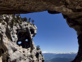
A breathtaking circular route linking together numerous wonders: the rugged Pas des Charassons, the scenic Crête de l’Alpette, the magnificent Écaille du Pas de Ragris, the famous Tour Percée, the precarious Arche Miracle and the beautiful Aup du Seuil pass.
This hike, covering less than 13km with 1,500m of elevation gain, requires a good sense of direction and sure-footedness (short sections of grade 3c climbing). Please note: the IGN topographic map is completely unreliable here!
An agreement has been signed between the department and the owner of the 800 hectares in the Hauts de Chartreuse nature reserve to allow free access to the two paths that run across the Marcieu plateau. The exit at Pas des Charassons, which leads back onto the plateau, joins one of these paths within a few metres. You may request permission to pass from the landowner, although there are no visible prohibition signs on the ground.
Hanging gardens of Les Charassons
 6.09 mi
+3,389 ft
-3,383 ft
5h 45
Extremely difficult
Departure from Saint-Bernard (Isère) (Isère)
6.09 mi
+3,389 ft
-3,383 ft
5h 45
Extremely difficult
Departure from Saint-Bernard (Isère) (Isère)
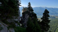
Spectacular hike to the hanging gardens of Charassons with two magnificent arches to discover.As the Marcieu valley is entirely private, the hike never passes through it and always remains on authorised terrain.
This hike is extremely difficult, beyond what is usual on Visorando, and requires climbing a short 3c section (a single move). An ice axe is recommended even (especially) in summer to tackle the steep slopes of the hanging gardens without stress. Most of the hike takes place on unmarked and (very) poorly marked paths. See Practical Information.
This hike takes place largely at the foot of cliffs. Geolocation (GPS, etc.) is therefore approximate, with errors exceeding 40 m. You must therefore use your brain and critical thinking skills and act according to the terrain.
As is often the case, this hike is a variation on a theme by Pascal Sombardier.
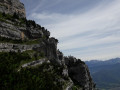
L’Aulp du Seuil
 4.99 mi
+2,648 ft
-2,644 ft
4h 35
Moderate
Departure from Saint-Bernard (Isère) (Isère)
4.99 mi
+2,648 ft
-2,644 ft
4h 35
Moderate
Departure from Saint-Bernard (Isère) (Isère)
Please note: the route is closed from 15 August until the end of September 2026.
The Aulp du Seuil crossing: this hike ranks among the most beautiful in the Chartreuse.
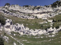
A circular route via the Pas de Montbrun and Pas de Rocheplane, starting from Les Massards
 5.57 mi
+3,383 ft
-3,383 ft
5h 30
5.57 mi
+3,383 ft
-3,383 ft
5h 30
 Difficult
Departure from Saint-Hilaire (Isère) (Isère)
Difficult
Departure from Saint-Hilaire (Isère) (Isère)
A hike to explore the secluded Pas de Montbrun, which leads to the ridge of the Rochers de Bellefont via a route of moderate exposure and without any major difficulty, apart from finding your way in the upper section. From Les Massards, the path heads towards the Source du Sanglier and then the Col de Marcieu, leaving it opposite the Pas de Montbrun. A narrow track climbs up a scree slope and, via a few short scrambling sections, reaches the ridge leading to the Pas de Rocheplane. A well-marked path crosses a few rocky outcrops and, after a section through the forest, returns to the car park.
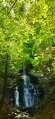
Les Dioux Waterfall and the Porte Traine Mill
 3.17 mi
+528 ft
-528 ft
1h 55
3.17 mi
+528 ft
-528 ft
1h 55
 Easy
Departure from Saint-Hilaire (Isère) (Isère)
Easy
Departure from Saint-Hilaire (Isère) (Isère)
On the Saint-Hilaire du Touvet plateau, this is a circular loop of 2 to 3 hours that is suitable for young children.
Very shady and close to the Saint-Hilaire paragliding training slopes (FFVL South take-off point), it also gives children a fun opportunity to watch the sails inflate.
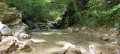
From Montfort Castle to the Crolles Waterfall
 3.88 mi
+974 ft
-965 ft
2h 40
Moderate
Departure from Crolles (Isère)
3.88 mi
+974 ft
-965 ft
2h 40
Moderate
Departure from Crolles (Isère)
A 25-minute drive from Grenoble, this is a family-friendly walk starting from the Saint-Hilaire-du-Touvet funicular station, beneath the paragliders, to the path leading to the Crolles waterfall. There is little elevation gain and it can be done in all weathers.
Le Pal de Fer
1.43 mi
+2,001 ft
-0 ft
2h 25
Moderate
Departure from Crolles (Isère)
An original outing that allows you to discover the superb work carried out here for the construction of the Touvet funicular railway. The ascent is on foot and the descent, to relieve the knees, is by funicular.
(Please note): This route is currently closed. See explanations here
(Comment from a hiker) dated 18 June 2023: small difficult section: crossing the scree slope where you need to use two ropes to reach the path in the forest.
Climb up to Les Petites Roches and take flight
 3.58 mi
+617 ft
-587 ft
2h 10
Easy
Departure from Saint-Hilaire (Isère) (Isère)
3.58 mi
+617 ft
-587 ft
2h 10
Easy
Departure from Saint-Hilaire (Isère) (Isère)
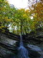
Whether you're a paraglider or hang glider, Saint-Hilaire-du-Touvet is paradise. From the valley, the funicular takes paragliders and walkers alike to the Petites Roches plateau, where everyone can take off into the air or walk on the edge of the void.
For hikers, this route at the foot of the Dent de Crolles offers a viewpoint over the valley before entering the forest in search of the remains of the Moulin de Porte-Traîne mill.
Circular route from Château du Touvet to Château du Montalieu
 4.11 mi
+807 ft
-797 ft
2h 35
Easy
Departure from Le Touvet (Isère)
4.11 mi
+807 ft
-797 ft
2h 35
Easy
Departure from Le Touvet (Isère)
An easy circular route, half through woodland and half along small tarmac roads, from one castle to another. This circular route can be combined with another circular route, from the fortified house of La Frette to Château du Touvet.
 Aulp du Seuil Hut – Pravouta Hut
6.81 mi
+2,815 ft
-3,009 ft
8 hrs
 Very difficult
Departure from Saint-Bernard (Isère) (Isère)
Very difficult
Departure from Saint-Bernard (Isère) (Isère)
Day2 of this trip via the Col de Bellefont to reach the Dent de Crolles plateau.Descent via the pass above the Trou du Glaz, then down to the Col des Ayes and up the Roc d’Arguille to the Col de Pravouta and the hut of the same name.
⚠️ 27/11/2025: Route modified following a rockfall. It is no longer possible to take the path via the Trou du Glaz (5). The area remains particularly dangerous due to the high risk of further rockfall and falling boulders. Following this incident, the municipality of Saint-Pierre de Chartreuse has issued a by-law to close several hiking trails (for walking, snowshoeing and ski touring). For an ascent of the Dent de Crolles, it is possible to take the route via the Pas de l’Oeille.
You can also go via the Guiers waterfalls to reach (E).
Dent de Crolles via the Terreaux and Rocheplane steps
 8.23 mi
+3,937 ft
-3,940 ft
6 hrs
Very difficult
Departure from Saint-Hilaire (Isère) (Isère)
8.23 mi
+3,937 ft
-3,940 ft
6 hrs
Very difficult
Departure from Saint-Hilaire (Isère) (Isère)
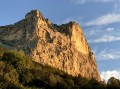
A splendid but little-used circular, starting from Saint-Hilaire du Touvet and passing through the Pas des Terreaux, the Dent de Crolles, the Cheminée du Paradis and the Pas de Rocheplane.
Much of the hike is on poorly marked paths on steep slopes. The Cheminée du Paradis is a small climbing step, which explains the level of difficulty.
It is possible to extend this hike in a pleasant way, either during the hike itself or nearby.
The Crêt de la Scia circuit
4.43 mi
+833 ft
-814 ft
2h 45
Moderate
Departure from Hurtières (Isère)
A local family walk for residents of Grenoble and Chambéry, ideal in spring and autumn, offering beautiful views of Belledonne, the Chartreuse and the Grésivaudan valley. It follows a small tarmac road for a few hundred metres.
Circular of the Alloix waterfalls and return via Bellechambre
 5.82 mi
+1,818 ft
-1,811 ft
4h 15
Moderate
Departure from Saint-Vincent-de-Mercuze (Isère)
5.82 mi
+1,818 ft
-1,811 ft
4h 15
Moderate
Departure from Saint-Vincent-de-Mercuze (Isère)
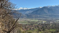
From Saint-Vincent-de-Mercuze, this is a varied, beautiful and enjoyable hike, accessible to children in dry weather. Please note that the climb up the Ruisseau l'Alloix can be very slippery in wet weather. Most of the route is under trees. It is pleasant to do in hot weather, with a short stop halfway to eat at Moulin Tardy (picnic table) and the possibility of swimming in the Alloix. It is best to do this in spring when there is plenty of water and the waterfalls are magnificent.