


Refine your search for walks in Kreuzlingen
Kreuzlingen walks
 Tour of Lake Constance
 Visorando Member
 118.30 mi
 +1,516 ft
 -1,519 ft
 10 hrs
 Difficult
 Departure from Konstanz (Regierungsbezirk Freiburg)
This cycle route takes you round the main part of Lake Constance. I recommend doing it on a gravel bike, as the route alternates between roads, cycle paths and dirt tracks.
For the fittest cyclists, the tour can be completed in a single day. Otherwise, it’s perfectly possible to do it over several days. The lakeside areas are popular with tourists, so you’ll easily find accommodation and places to eat all along the route.
To follow the official cycle route around Lake Constance, look out for the signpost showing a cyclist with a blue rear wheel.
 From Amlikon-Bissegg to Konstanz
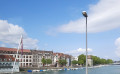 13.91 mi
+682 ft
-745 ft
7h 00
Difficult
Departure from Amlikon-Bissegg (Thurgau)
13.91 mi
+682 ft
-745 ft
7h 00
Difficult
Departure from Amlikon-Bissegg (Thurgau)
Nineteenth stage: From Les Rousses to Lake Constance via the Jura mountain range.
For this final stage, you will take the ViaJacobi, the ancient pilgrimage route that leads German pilgrims to Santiago de Compostela via Geneva. Following in their footsteps, you will reach the city of Constance (Konstanz), nestled in southern Germany.
Constance charms visitors with its medieval charm, particularly in the picturesque Niederburg district, where narrow streets and half-timbered houses tell centuries of history. Its majestic Romanesque cathedral, the Münster Unserer Lieben Frau, has watched over the city since the Middle Ages. Finally, Lake Constance (Bodensee), a true natural gem, stretches out at the foot of the Alps and unites three nations — Germany, Switzerland and Austria — in a landscape of serene beauty.
Lake Constance tour: From Friedrichshafen to Eriskirch lido
4.38 mi
+69 ft
-105 ft
2h 05
 Easy
Departure from Friedrichshafen (Regierungsbezirk Tübingen)
Easy
Departure from Friedrichshafen (Regierungsbezirk Tübingen)
This varied hike leads from Friedrichshafen through the idyllic Eriskircher Ried – one of the most important nature reserves on Lake Constance. Two viewing platforms with magnificent views over the unique reed landscape await you. Impressive views of Lake Constance open up again and again before the tour ends in a relaxed manner at the lido in Eriskirch. Ideal for nature lovers, families and anyone looking for a peaceful hike in beautiful surroundings.
From Uesslingen-Buch to Amlikon-Bissegg
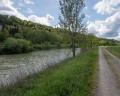 13.83 mi
+259 ft
-128 ft
6h 35
Difficult
Departure from Uesslingen-Buch (Thurgau)
13.83 mi
+259 ft
-128 ft
6h 35
Difficult
Departure from Uesslingen-Buch (Thurgau)
Stage 18 From Les Rousses to Lake Constance via the Jura ridges. This stage, starting from Uesslingen, first takes you through peaceful agricultural pastures before skirting the vineyards of an old monastery. You then reach Warth, home to the Ittingen Charterhouse, which bears witness to more than 850 years of history and spirituality. Passing through Frauenfeld, the capital of the canton of Thurgau, you leave the hustle and bustle of the city behind and return to the tranquillity of the banks of the Thur. The route takes you to Pfyn, then offers a beautiful immersion along the river, punctuated by the passage of the superb Eschikofen customs bridge. A stage combining heritage, nature and the gentle flow of the river.
From Rorschach (Lake Constance) to Lucerne via the Alpenpanorama Weg
 112.35 mi
+21,299 ft
-21,188 ft
10 days
Difficult
Departure from Rorschach (Canton of St. Gallen)
112.35 mi
+21,299 ft
-21,188 ft
10 days
Difficult
Departure from Rorschach (Canton of St. Gallen)
This 10-stage Alpine panorama trail takes you from Rorschach on the shores of Lake Constance to Lucerne. The trail crosses numerous mountain pastures and offers a few small peaks with beautiful views of the Alps and lakes. You will visit Appenzell, world-famous for its cheese. You will enjoy the Säntis, the highest point of the Alpstein massif. You will meet many pilgrims in Einsiedeln. You will enjoy walks along the lakes of Zug and Lucerne.
Rorschach - Speicher via the Alpenpanorama Weg
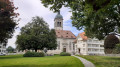 10.70 mi
+3,360 ft
-1,640 ft
7h 50
Difficult
Departure from Rorschach (Canton of St. Gallen)
10.70 mi
+3,360 ft
-1,640 ft
7h 50
Difficult
Departure from Rorschach (Canton of St. Gallen)
This stage will take you from Rorschach to Speicher. After a beautiful walk along the shores of Lake Constance, you will climb up to the village of Heiden. At Kaienspitz, the highest point of the stage, you will be rewarded with a beautiful view of Lake Constance and the Alps.
“Moor in a Nutshell” on the Wilhelmsdorf Ried Nature Trail
 Tourism professional2.38 mi
+43 ft
-43 ft
1h 10
Easy
Departure from Wilhelmsdorf (Regierungsbezirk Tübingen)
Tourism professional2.38 mi
+43 ft
-43 ft
1h 10
Easy
Departure from Wilhelmsdorf (Regierungsbezirk Tübingen)
An exciting circular walk for the whole family
The circular walk along the Wilhelmsdorf Ried Nature Trail begins right next to the Wilhelmsdorf Nature Conservation Centre, home to the interactive exhibition ‘Experience the Moor’.
Here, over a relatively short distance and along soft, well-maintained paths, you can walk through the various moorland habitats and make many exciting discoveries. A visit to the Ried Nature Trail is particularly worthwhile for families with children.
To the heights of Ringgenburg
4.63 mi
+495 ft
-512 ft
2h 35
Easy
Departure from Wilhelmsdorf (Regierungsbezirk Tübingen)
A historic hiking trail surrounded by rich flora
Rising a good hundred metres above the surrounding landscape on the edge of the Pfrunger Ried, the isolated Ringgenburg-Höhe proves to be a wonderful area for walking. Vertical Nagelfluh cliffs and caves still bear witness to the erosive power of the meltwater that carved out the Ostrach and Rotach valleys on either side. The porous Nagelfluh layers support a rich variety of flora.
Despite the woodland, the 725-metre-high mountain spur offers magnificent views down into the Ried. The fact that the Rinkenburg or Ringgenburg, a prehistoric refuge fortress whose moats are still visible, once stood here adds to its appeal for many.
To the heights of Judentenberg and Ochsenbach
5.87 mi
+607 ft
-617 ft
3h 15
Easy
Departure from Ostrach (Regierungsbezirk Tübingen)
Thanks to its high altitude, this circular walk promises stunning views of nature and the countryside.
From a distance, you can see the wind turbines atop the hill, which stretches southwards from Pfullendorf to the west of the Pfrunger-Burgweiler Ried. Almost a hundred metres above the Ried lie several small villages set in a varied landscape. The high altitude offers walkers magnificent views into the distance; in good weather, you can see as far as the Upper Swabian national mountain, the Bussen.
Speicher - Appenzell via the Alpenpanorama Weg
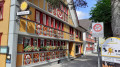 9.47 mi
+1,745 ft
-2,241 ft
5h 50
9.47 mi
+1,745 ft
-2,241 ft
5h 50
 Moderate
Departure from Appenzell Ausserrhoden
Moderate
Departure from Appenzell Ausserrhoden
This stage will take you from Speicher to Appenzell via Trogen. At Hohe Buche, you will enjoy a superb view of Lake Constance and the city of St Gallen. Another hill will take you to the summit of the Säntis. A descent through the mountain pastures will lead you to Appenzell, famous for its cheese. A visit to the town is a must.
Along panoramic paths to Bethlehem
6.17 mi
+367 ft
-348 ft
3h 10
Easy
Departure from Pfullendorf (Regierungsbezirk Tübingen)
Circular walk along sections of the Way of St James and through peaceful woodland.
This walk to Bethlehem leads directly from Pfullendorf into a beautiful woodland area with good farm tracks and moderate gradients. Along the way, we frequently follow sections of the Way of St James, which leads from Wald via Pfullendorf on to Überlingen.
Gyrenbad - Hulftegg via the Züri Oberland-Höhenweg
 13.05 mi
+2,674 ft
-1,936 ft
8h 20
Difficult
Departure from Turbenthal (Canton of Zürich)
13.05 mi
+2,674 ft
-1,936 ft
8h 20
Difficult
Departure from Turbenthal (Canton of Zürich)
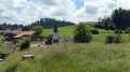
This second stage will take you from Gyrenbad to the Hulftegg Pass. The Schauenberg offers a magnificent view of the Alps. The route to Sitzberg offers more interesting views, particularly of the Bichelsee. From Sitzberg (on the border between the cantons of Zurich and St. Gallen) to Allenwinden, the route follows a small road, which fortunately is not very busy. When you arrive at the Hulftegg Pass, you will enjoy a superb view of the Toggenburg and the Appenzell region.
Circular walk to St Anthony’s Chapel, Nonnenhorn
5.92 mi
+423 ft
-420 ft
3h 05
Easy
Departure from Nonnenhorn (Swabia)
Easy walk with beautiful viewpoints
You can explore this beautiful and varied landscape along narrow lanes and footpaths. The circular route leads from the lake, through fertile orchards and vineyards, to stunning vantage points and historic sights against the magnificent backdrop of the Alpine panorama.
Two-Lakes Tour, Nonnenhorn
11.95 mi
+955 ft
-945 ft
6h 20
Moderate
Departure from Nonnenhorn (Swabia)
A varied circular walk with lovely views across the surrounding countryside to Lake Deger and Lake Schlein.
A very varied circular route awaits you through the ‘hinterland’ of Nonnenhorn to the beautiful Degersee and Schleinsee lakes, offering stunning panoramic views. You’ll pass through the villages of Selmnau, Poppis, Riedensweiler, Wettis, Busenhaus, Nitzenweiler, Gattnau and Retterschen. Parts of the route follow small roads, and often take you along field tracks, woodland paths and meadow paths.
Hulftegg - Chrüzegg via the Züri Oberland-Höhenweg
 7.04 mi
+2,395 ft
-1,394 ft
5h 20
Difficult
Departure from Mosnang (Canton of St. Gallen)
7.04 mi
+2,395 ft
-1,394 ft
5h 20
Difficult
Departure from Mosnang (Canton of St. Gallen)
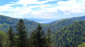
This third stage will take you from the Hulftegg Pass to the isolated inn at Chrüzegg. The start of the route alternates between forest and pastures before taking a ridge trail at Roten. You will follow this ridge between the cantons of St. Gallen and Zurich to the Schnebelhorn, the highest point in the canton of Zurich and also the highest point of the hike. This summit offers a splendid panorama stretching from Lake Constance to Lake Zurich. The scenic route then passes through the Schindelberg, Rossegg, Habrütispitz and Chrüzegg peaks, offering more superb views.
From Winterthur to Rapperswil via the Züri Oberland-Höhenweg
 46.71 mi
+8,235 ft
-8,287 ft
4 days
Difficult
Departure from Winterthur (Canton of Zürich)
46.71 mi
+8,235 ft
-8,287 ft
4 days
Difficult
Departure from Winterthur (Canton of Zürich)
Four-day tour through the cantons of Zurich and St. Gallen.
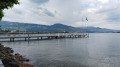
This route offers views of Lake Zurich and the peaks of the Bernese Alps, the Glärnisch massif and the Alpstein, including the Säntis
Winterthur, the starting point, and Rapperswil, the finish, both have remarkable historic centres.
Winterthur - Gyrenbad via the Züri Oberland-Höhenweg
 11.51 mi
+1,955 ft
-1,033 ft
7h 00
Difficult
Departure from Winterthur (Canton of Zürich)
11.51 mi
+1,955 ft
-1,033 ft
7h 00
Difficult
Departure from Winterthur (Canton of Zürich)
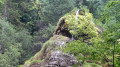
For this first stage, starting from Winterthur station, after exploring the old town, you will very quickly find yourself in the countryside. You will cross an animal park. The route is quite varied, following the Töss river and passing through the peaceful village of Kollbrunn. Then, a ridge path will lead you to Gyrenbad, a place of tranquillity and rest.
Appenzell - the Schwägalp via the Alpenpanorama Weg
 9.40 mi
+3,323 ft
-1,440 ft
7h 15
Difficult
Departure from Appenzell (Appenzell Innerrhoden)
9.40 mi
+3,323 ft
-1,440 ft
7h 15
Difficult
Departure from Appenzell (Appenzell Innerrhoden)
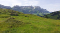
This stage will take you from Appenzell to Schwägalp at the foot of the Säntis. This day is devoted to climbing the Kronberg, a ridge parallel to the Alpstein massif. The Kronberg offers superb views of the Säntis to the south and the plain stretching to Lake Constance in the north. In the evening, you will appreciate the tranquillity of Schwägalp.
Chrüzegg - Rapperswil via the Züri Oberland-Höhenweg
15.06 mi
+1,201 ft
-3,921 ft
8h 00
Difficult
Departure from Goldingen (Canton of St. Gallen)
This fourth stage will take you from Chrüzegg to Rapperswil on the shores of Lake Zurich. The trail quickly leads to a ridge line, passing through Tweralspitz. In the distance, you will recognise Chrüzegg. You will then descend gradually towards Rotstein, Schwammegg and Köbelberg, with panoramic views on both sides.
From Rüeterswil, the Züri Oberland-Höhenweg and the Via Jacobi merge. The arrival in Rapperswil is achieved by avoiding roads as much as possible.
Tour of the Seealpsee starting from Wasserauen
4.72 mi
+1,496 ft
-1,467 ft
3h 30
Moderate
Departure from Schwende (Appenzell Innerrhoden)
Almost all of the elevation gain is in the first two kilometres. Your efforts will be rewarded once you reach the lake. A peaceful and relaxing spot, with views of Santis and Ebenalp among others, which will make you forget the tingling in your thighs.
Wasserauen, Sämtisersee, Fählensee, Saxer Lücke and Seealpe
14.22 mi
+6,975 ft
-6,936 ft
12 hrs
 Extremely difficult
Departure from Schwende (Appenzell Innerrhoden)
Extremely difficult
Departure from Schwende (Appenzell Innerrhoden)
Circular hike starting from Wasserauen: an ascent to the tranquil Sämtisersee, passing by the magnificent Fählensee, then climbing to the spectacular Saxer Lücke, which offers exceptional views of the Alpstein. The route then descends towards the Seealpsee before returning to Wasserauen. This is a challenging hike through some of Switzerland’s most beautiful landscapes.
The Schwägalp - Stein (SG) via the Alpenpanorama Weg
 7.48 mi
+1,404 ft
-3,087 ft
4h 40
Moderate
Departure from Hundwil (Appenzell Ausserrhoden)
7.48 mi
+1,404 ft
-3,087 ft
4h 40
Moderate
Departure from Hundwil (Appenzell Ausserrhoden)
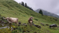
This short stage will take you from Schwägalp to Stein. You will cross numerous mountain pastures until you reach Lutertannen. From Risipass, you will continue through meadows and mountain pastures until you reach Stein (Canton of St. Gallen).