


For ease of description, the following symbols are used:
R sign: Yellow sign with hiker pictogram.
Sign No. 69 or P69: Red/white multi-directional sign with green sticker No. 69.
The start of this hike is at Berggasthaus Chrüzegg.
(S) From the Chrüzegg inn, heading south-east, take the path on the right. Continue until you reach a junction marked by a P69 sign. Start with a slight descent until you reach a junction. Follow the direction indicated by a new P69 sign and climb towards a clearly visible building at an altitude of 1249 metres.
(1) At the P69 sign, turn right and start climbing towards the ridge and the small peak of Weralpspitz (1332 m). Follow this path, passing by Rotstein. Follow the various P69 signs and descend to the lower station of the Atzmännig cable car.
(2) Continue the descent, passing the Atzmännig Harz mountain restaurant, then join a fork (P69).
(3) Turn south-east onto the "Halden" trail. Follow the various P69 signs to Köbelberg, where a hiker's sign indicates a change of direction.
(4) Turn left and descend into the forest until you reach a crossroads at an altitude of 1004 metres (hiking sign)
(5) Head right towards the west, then start turning south. Descend about 150 metres down a very steep path alongside a stream. Join a small road at the hamlet of Hugenmatt.
(6) Take the path on the left that leads to Allenwindenstrasse. (P69)
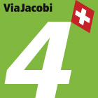
From here, the route merges with the Via Jacobi (No. 4), see § Practical information.
(7) Turn right, cross the small village of Rüeterswil until you reach the intersection with Kirchbodenstrasse. (P69)
(8) Continue west on Kirchbodenstrasse until you reach another P69.
(9) Turn left onto Breitenhlzstrasse and continue until you reach the next P69.
(10) Turn left, pass through the villages of Betzikon and Bifang, before reaching another P69.
(11) Take Bifangwaldweg back to St. Gallenkappel. Cross Rickenstrasse with caution and look for a P69 just in front of the church.
(12) Pass in front of the church square and turn left onto Kirchweg. Follow the various P69 signs to leave St. Gallenkappel at Gerendingen (hiking sign).
(13) Head west-southwest and take the path overlooking the Aabach stream. Join Rickenstrasse.
(14) At the sign, turn right and stay on the pavement of the flyover bridge over the Aabach.
(15) At the end of the flyover, look out for a P69 sign to find a path that branches off to the right.
(16) At the sign, take the path that goes down under the road. This underpass allows you to cross the busy road safely. Go back up towards Aatalstrasse, at a covered bridge over the Aabach.
(17) Take the bridge and descend into the Aa valley (P69).
(18) Turn right to climb back up to Jackobstrasse, after passing under the main road (P69). Follow it to the left for 60 m. Turn right and join Rickenstrasse.
(19) Cross it carefully. Turn right onto Lettenstrasse, cross the Neuhaus district, and you will come to a P69 at the intersection of Lettenstrasse and Töbeliweg. Continue for another 30 metres or so, and you will see a hiker's sign indicating a change of direction.
(20) Turn left and gradually enter the town of Eschenbach. Join Rickenstrasse and look for another P69 sign shortly after a Migros store. (P69)
(21) Continue along Rickenstrasse for another hundred metres, then, at the bend, take Rütistrasse heading west. Follow this road for about 1 km, then look out for a signpost indicating a path on the right.
(22) Turn right onto this path overlooking Rütistrasse. Walk for a good kilometre, then return to Rütistrasse and follow it to the right for about 100 metres.
(23) Cross Rütistrasse and turn left onto the trail that crosses Eggwald (hiking sign).
(24) Turn right towards the hamlet of Egg and head west, following the various P69 signs. Cross Jona until you reach the railway bridge (P69).
(25) Go under the bridge and follow Werkstrasse until you reach a fork. (P69)
(26) Continue west on Hanfländerstrasse until you cross Attenhoferstrasse (hiking sign).
(27) Turn right towards Lake Zurich and join Burgeraustrasse via the Gemüsebrücke.
(28) Follow the pedestrian paths opposite to arrive near a shopping centre and the entrance to the old town of Rapperswil (P69).
(29) Return to the old town via Stadthofplatz and continue to the church.
(30) Go down the steps leading to the main square and the Hotel Jackob, where you will be staying for the night. (E)


 - Amden via the Alpenpanorama Weg")


 via the Alpenpanorama Weg")

