


Wasserauen, Sämtisersee, Fählensee, Saxer Lücke and Seealpe


Circular hike starting from Wasserauen: an ascent to the tranquil Sämtisersee, passing by the magnificent Fählensee, then climbing to the spectacular Saxer Lücke, which offers exceptional views of the Alpstein. The route then descends towards the Seealpsee before returning to Wasserauen. This is a challenging hike through some of Switzerland’s most beautiful landscapes.
Details
Creation:
Last update:
Last review:
–
–
-
 Activity: Walking
 -
 Distance: 14.22 mi
 -
 Duration according to the author: 12 hrs
 -
 Difficulty: Extremely difficult
 -
-
 Back to start: Yes
 -
 Ascent: + 6,975 ft
 -
 Descent: - 6,936 ft
 -
-
 Highest point: 6,234 ft
 -
 Lowest point: 2,841 ft
-
 Country:
Switzerland
Country:
Switzerland
-
 Area: Alps
 -
 City:
Schwende
City:
Schwende -
 Start/End: N 47.284574° / E 9.427364°
 -


 Hour-by-hour weather


Waypoints
- S/E : mi 0 - alt. 2,851 ft - Wasserauen
- 1 : mi 1.41 - alt. 4,101 ft - Crossroads
- 2 : mi 2.17 - alt. 5,427 ft - Zamme Gocht
- 3 : mi 3.56 - alt. 4,012 ft - Sämtisersee
- 4 : mi 4.56 - alt. 4,711 ft - Fork in the road
- 5 : mi 5.8 - alt. 4,833 ft - Junction
- 6 : mi 6.13 - alt. 4,869 ft - Mountain inn
- 7 : mi 6.68 - alt. 5,423 ft - Suxerlücke
- 8 : mi 7.85 - alt. 4,724 ft - Fork in the road
- 9 : mi 8.37 - alt. 5,397 ft - Widderalp Alpine Hut
- 10 : mi 8.97 - alt. 6,109 ft - Widderalpsattel
- 11 : mi 10.42 - alt. 4,997 ft - Berggasthaus Meglisalp
- 12 : mi 12.28 - alt. 3,802 ft - Seealpsee
- S/E : mi 14.22 - alt. 2,864 ft - Wasserauen
Other walks in the area
Tour of the Seealpsee starting from Wasserauen
 Visorando Member4.72 mi
+1,496 ft
-1,467 ft
3h 30
Visorando Member4.72 mi
+1,496 ft
-1,467 ft
3h 30
 Average
 Departure from Schwende (Appenzell Innerrhoden)
Almost all of the elevation gain is in the first two kilometres. Your efforts will be rewarded once you reach the lake. A peaceful and relaxing spot, with views of Santis and Ebenalp among others, which will make you forget the tingling in your thighs.
Appenzell - the Schwägalp via the Alpenpanorama Weg
 9.40 mi
+3,323 ft
-1,440 ft
7h 15
9.40 mi
+3,323 ft
-1,440 ft
7h 15
 Difficult
Departure from Appenzell (Appenzell Innerrhoden)
Difficult
Departure from Appenzell (Appenzell Innerrhoden)
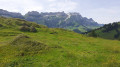
This stage will take you from Appenzell to Schwägalp at the foot of the Säntis. This day is devoted to climbing the Kronberg, a ridge parallel to the Alpstein massif. The Kronberg offers superb views of the Säntis to the south and the plain stretching to Lake Constance in the north. In the evening, you will appreciate the tranquillity of Schwägalp.
The Schwägalp - Stein (SG) via the Alpenpanorama Weg
 7.48 mi
+1,404 ft
-3,087 ft
4h 40
Average
Departure from Hundwil (Appenzell Ausserrhoden)
7.48 mi
+1,404 ft
-3,087 ft
4h 40
Average
Departure from Hundwil (Appenzell Ausserrhoden)
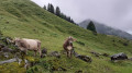
This short stage will take you from Schwägalp to Stein. You will cross numerous mountain pastures until you reach Lutertannen. From Risipass, you will continue through meadows and mountain pastures until you reach Stein (Canton of St. Gallen).
Grappelensee from Unterwasser
6.03 mi
+1,680 ft
-1,683 ft
4h 15
Average
Departure from Alt St. Johann (Canton of St. Gallen)
A lovely circular route starting from the Unterwasser car park, passing by Grappelensee and descending towards Alt St Johann.
The route follows small tarmac roads before reaching the higher ground. The same applies on the descent. These roads are quiet.
Speicher - Appenzell via the Alpenpanorama Weg
 9.47 mi
+1,745 ft
-2,241 ft
5h 50
Average
Departure from Appenzell Ausserrhoden
9.47 mi
+1,745 ft
-2,241 ft
5h 50
Average
Departure from Appenzell Ausserrhoden
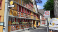
This stage will take you from Speicher to Appenzell via Trogen. At Hohe Buche, you will enjoy a superb view of Lake Constance and the city of St Gallen. Another hill will take you to the summit of the Säntis. A descent through the mountain pastures will lead you to Appenzell, famous for its cheese. A visit to the town is a must.
Stein (SG) - Amden via the Alpenpanorama Weg
 8.45 mi
+2,687 ft
-2,438 ft
6h 15
Average
Departure from Stein (Canton de Saint-Gall) (Canton of St. Gallen)
8.45 mi
+2,687 ft
-2,438 ft
6h 15
Average
Departure from Stein (Canton de Saint-Gall) (Canton of St. Gallen)
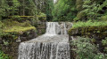
This stage will take you from Stein to Amden. You will walk alongside the Dürrenbach, a torrent with numerous waterfalls, for a long time. At Vordere Höhi, you will enjoy a superb view of the Glarus Alps. You will pass at the foot of the Mattstock as you descend to Amden. As you approach this village, you can also admire the Walensee.
The Alpspitz circular route on the western slope
 4.00 mi
+2,510 ft
-2,484 ft
4h 00
4.00 mi
+2,510 ft
-2,484 ft
4h 00
 Very difficult
The Alpspitz is a small peak situated above Vaduz, which can be reached fairly easily from the car park next to the Clinicum Alpinum above Gaflei. The view from the summit is superb, taking in the surrounding mountains and the Rhine Valley. Do take care, however, as the circular descent via the suggested route is particularly exposed and vertiginous.
Rorschach - Speicher via the Alpenpanorama Weg
 10.70 mi
+3,360 ft
-1,640 ft
7h 50
Difficult
Departure from Rorschach (Canton of St. Gallen)
10.70 mi
+3,360 ft
-1,640 ft
7h 50
Difficult
Departure from Rorschach (Canton of St. Gallen)
This stage will take you from Rorschach to Speicher. After a beautiful walk along the shores of Lake Constance, you will climb up to the village of Heiden. At Kaienspitz, the highest point of the stage, you will be rewarded with a beautiful view of Lake Constance and the Alps.
For more walks, use our search engine .
The GPS track and description are the property of this route's author. Please do not copy them without permission.

