


Refine your search for walks in Hernani
Hernani walks


 Circular route to Urdaburu
 Visorando Member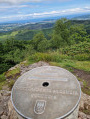
 7.91 mi
 +2,418 ft
 -2,425 ft
 5h 45
5h 45
 Moderate
 Departure from Hernani (Gipuzkoa)
Urdaburu, visible from miles away, is a landmark for the fishermen of Gipuzkoa who popularised its name (pronounced ‘urde-buru’, meaning ‘pig’s head’). With its characteristic steep cliff face, it has always served as a landmark for them. This route presents no difficulty apart from the final ascent, which requires a little care. For the descent, you need to retrace your steps slightly to avoid the steep and potentially vertiginous path on the eastern slope.
Adarra from Besabi
 4.31 mi
+1,657 ft
-1,657 ft
3h 25
Moderate
Departure from Urnieta (Gipuzkoa)
4.31 mi
+1,657 ft
-1,657 ft
3h 25
Moderate
Departure from Urnieta (Gipuzkoa)
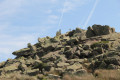
Adarra (816 m) is an iconic mountain in the Donostia–San Sebastián region, home to numerous prehistoric sites. It is traditional to climb to this summit on1 January to celebrate the New Year.
Sagarraren Bidea - The Apple Route
 Association / Club / Walk leader
 2.60 mi
+666 ft
-656 ft
1h 45
2.60 mi
+666 ft
-656 ft
1h 45
 Easy
Departure from Hernani (Gipuzkoa)
Easy
Departure from Hernani (Gipuzkoa)
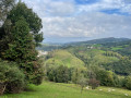
This easy circular is known as SL-GI-1002 Sagarraren Bidea (the Apple Route in Basque).
Sagarno, literally "apple wine", is an iconic product of the Basque Country that can be enjoyed in cider houses (Sagardotegia).
Les Dolmens d'Igorin
 5.37 mi
+1,257 ft
-1,247 ft
3h 35
Moderate
Departure from Hernani (Gipuzkoa)
5.37 mi
+1,257 ft
-1,247 ft
3h 35
Moderate
Departure from Hernani (Gipuzkoa)
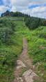
Cette boucle est connue sous l'appellation PR®-GI-1002 Igoringo trikuharriak, soit les dolmens d'Igorin en basque.
La présence de nombreuses palombières recommande d'éviter ce trajet à l'automne en période de chasse.
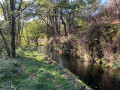
Canals of a thousand and five hundred steps
 6.20 mi
+1,010 ft
-1,007 ft
3h 45
Easy
Departure from Andoain (Gipuzkoa)
6.20 mi
+1,010 ft
-1,007 ft
3h 45
Easy
Departure from Andoain (Gipuzkoa)
An atypical course, with a gradient reminiscent of Antoine de Saint-Exupéry's "snake that swallowed an elephant".
The climb up the stairs may be a little rough, but the journey along the canal is very pleasant.
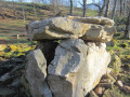
San Marco and the summit of Txoritokieta near Errenteria.
 3.55 mi
+761 ft
-761 ft
2h 20
Moderate
Departure from Errenteria (Gipuzkoa)
3.55 mi
+761 ft
-761 ft
2h 20
Moderate
Departure from Errenteria (Gipuzkoa)
The Fort of San Marco is a military construction located at the top of Mount Bizarain at an altitude of 260 metres. It was built in 1880, near the village of Errenteria, to defend San Sebastián and the region from French attacks by land and sea. It is an excellent vantage point offering beautiful views of San Sebastián, Pasaia and Txingudi Bay.
The hike described here also offers the chance to discover some dolmens and take trails that are somewhat hidden in the forest. It may be useful to bring pruning shears to cut back any brambles or ferns that may have invaded the path.
At the foot of the Fort of San Marko in Errenteria
2.63 mi
+459 ft
-433 ft
1h 35
Easy
Departure from San Sebastián (Gipuzkoa)
A very pleasant circular route through the forest if you want to avoid the heatwave. The paths are well marked. You may spot a few cows and bulls (safely penned away). At one point, you can even admire the very typical port of Pasïa down below, to the north.
San Markos
 4.37 mi
+778 ft
-781 ft
2h 40
Easy
Departure from Errenteria (Gipuzkoa)
4.37 mi
+778 ft
-781 ft
2h 40
Easy
Departure from Errenteria (Gipuzkoa)
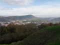
This route is known as the SL-GI-3 San Markos. It passes by the Fort of San Marko, built on Mount Bizarain, which was used for military purposes until 1992.
From here, there are views of the Concha (the shell-shaped bay of San Sebastián), Passaia, and Txingudi Bay.
Munagirre loop
 5.99 mi
+1,473 ft
-1,493 ft
4h 00
Moderate
Departure from Oiartzun (Gipuzkoa)
5.99 mi
+1,473 ft
-1,493 ft
4h 00
Moderate
Departure from Oiartzun (Gipuzkoa)
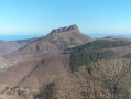
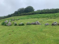
We start by climbing to the summit of Munagirre (781 m), then follow a path through streams, small waterfalls and a beech forest, discovering the fairly recent ruins of the old Artikutza train, or very old ruins with cromlechs and superb views, either of the coast or of the peaks of the Three Crowns.
Munagirre summit and Oianleku Cromlech
 3.46 mi
+771 ft
-774 ft
2h 15
Easy
Departure from Oiartzun (Gipuzkoa)
3.46 mi
+771 ft
-774 ft
2h 15
Easy
Departure from Oiartzun (Gipuzkoa)
Lovely walk with views of San Sebastian, the Basque coast, the Trois Couronnes, La Rhune and a visit to a remarkable cromlech site.
Pasaia-San Sebastian - Amara along the coastal path
 8.67 mi
+1,795 ft
-1,808 ft
5h 35
Moderate
Departure from San Sebastián (Gipuzkoa)
8.67 mi
+1,795 ft
-1,808 ft
5h 35
Moderate
Departure from San Sebastián (Gipuzkoa)
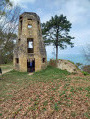
Leave your car in Hendaye and take this superb walk along the coastal path using the TOPO.Get off at Herrera station and head for the harbour of Pasaia-San Pedro, the starting point of the coastal path.Pass by Mont Ulia and its leisure park. In San-Sebastian, make a detour to Monte Urgull, with its fortress, monumental Christ (it's Rio) and view of Santa-Klara Island and the bay.
Return to Amara station and take the TOPO to Hendaye.
Pasaia - San Sebastian (Spain) coastal path.
 7.43 mi
+1,043 ft
-997 ft
4h 20
Moderate
Departure from Pasaia (Gipuzkoa)
7.43 mi
+1,043 ft
-997 ft
4h 20
Moderate
Departure from Pasaia (Gipuzkoa)
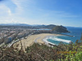
Superb hike for passing a lovely afternoon and enjoying an evening in old San Sebastien, eating tapas and pintxos.
Pasaia Donibane
 3.87 mi
+909 ft
-912 ft
2h 35
Moderate
Departure from Pasaia (Gipuzkoa)
3.87 mi
+909 ft
-912 ft
2h 35
Moderate
Departure from Pasaia (Gipuzkoa)
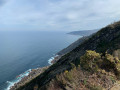
A beautiful loop on the southern tip of the Jaizkibel above Pasaia. The first part of the route passes through the town of Pasaia via charming narrow streets. The route then passes along a steep path and returns to the village along a narrow road.
Eskas - Artikutza
6.76 mi
+1,447 ft
-1,473 ft
4h 20
Moderate
Departure from Goizueta (Navarre)
Circular path in a natural park to Lake Artikutza (dry) via thePR®®-NA-124 Eskas - Artikutza trail.
The Exkax and Putrarrita peaks from Eskas
 2.25 mi
+397 ft
-400 ft
1h 25
Easy
Departure from Goizueta (Navarre)
2.25 mi
+397 ft
-400 ft
1h 25
Easy
Departure from Goizueta (Navarre)
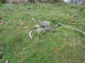
A short and pleasant hike in the Aiako Harria Natural Park, right in the heart of the forest. However, you’ll need to be prepared to go off-track (easy) as the paths become a bit overgrown. Using the GPS track is therefore recommended. You’ll climb two peaks of just over 700 m. This is a family-friendly hike offering beautiful scenery.
Bianditz loop from Artikutxa park
 6.61 mi
+1,621 ft
-1,621 ft
4h 25
Moderate
Departure from Goizueta (Navarre)
6.61 mi
+1,621 ft
-1,621 ft
4h 25
Moderate
Departure from Goizueta (Navarre)
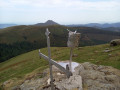
A magnificent loop through the Artikutxa park, taking in the splendour of the beech forest and the panoramic view of the Navarre mountains via Bianditz.
Arditurri Mines
 5.88 mi
+1,437 ft
-1,453 ft
3h 55
Moderate
Departure from Oiartzun (Gipuzkoa)
5.88 mi
+1,437 ft
-1,453 ft
3h 55
Moderate
Departure from Oiartzun (Gipuzkoa)
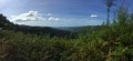
Short walk around the Arditurri mines.Lovely undergrowth with numerous small streams and paths.When the weather's fine, you'll have a view of San Sebastien Bay and its rocky outcrop.
The Egieder and Beltzaiz peaks from Gurutze
 6.88 mi
+1,663 ft
-1,654 ft
4h 35
Moderate
Departure from Oiartzun (Gipuzkoa)
6.88 mi
+1,663 ft
-1,654 ft
4h 35
Moderate
Departure from Oiartzun (Gipuzkoa)
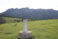
A hike around Gurutze with two peaks to climb via forest paths. But it is also a historical hike with traces of very ancient monuments or more recent ones dating from the war.
El Mendibeltz (Belitz), Arburu, Sardinola, Gogortegiko near Ellurretxe
 6.90 mi
+1,637 ft
-1,617 ft
4h 35
Moderate
Departure from Irun (Gipuzkoa)
6.90 mi
+1,637 ft
-1,617 ft
4h 35
Moderate
Departure from Irun (Gipuzkoa)
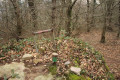
A hike after passing the Elurretxe Pass through the forest with numerous streams and therefore sometimes muddy paths. During the hike, you will climb several peaks: Belitz, Arburu, Sardinola and Gogortegiko.
Aiako Harria - The Three Crowns
 3.85 mi
+1,827 ft
-1,811 ft
3h 20
3.85 mi
+1,827 ft
-1,811 ft
3h 20
 Very difficult
Departure from Irun (Gipuzkoa)
Very difficult
Departure from Irun (Gipuzkoa)
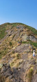
What more could you ask for in the coastal area of the Southern Basque Country: mountainous landscape, granite terrain and a ridge path! The Three Crowns massif offers three peaks to explore. We will start this route with Erroilbide, then Txurrumurru and finally Irumugarrieta. The view is magnificent, with a 360° panorama of the Southern Basque Country and the Labour coastline stretching as far as the Landes. The route along the ridge includes passages, in couloirs and on slabs, which must be negotiated with caution.Some passages require the use of your hands. There is a fixed ring on the ascent to Txurrumurru. Not suitable for those who suffer from vertigo.
Three Crowns: Muganix - Irumugarrieta- Txurrumurru
 2.13 mi
+1,066 ft
-1,066 ft
1h 55
Moderate
Departure from Irun (Gipuzkoa)
2.13 mi
+1,066 ft
-1,066 ft
1h 55
Moderate
Departure from Irun (Gipuzkoa)
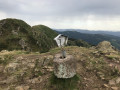
A round trip to the first two summits of the Three Crowns, plus a third as a preamble.
For the less adventurous, the climb to Txurrumurru requires crossing a rocky bar that can be tricky.
Nevertheless, it's worth the effort to reach the narrow passage between two boulders that gives a view of Lake Endara.
Going to the last summit, Erroilbide, is much trickier and requires experience, which is why it is not mentioned in this itinerary.
The summit of Zubeltzu near Irun
 3.13 mi
+604 ft
-591 ft
2h 00
Easy
Departure from Irun (Gipuzkoa)
3.13 mi
+604 ft
-591 ft
2h 00
Easy
Departure from Irun (Gipuzkoa)
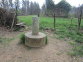
A lovely little hike very close to the town of Irun, but taking place entirely in the woods. In addition to breathing in the fresh air, you will visit a historical site where you can see one of the two towers that remain today, which were used to defend the town of Irun.
Elatzeta circular starting from Irun
 4.15 mi
+1,040 ft
-1,024 ft
2h 50
Moderate
Departure from Irun (Gipuzkoa)
4.15 mi
+1,040 ft
-1,024 ft
2h 50
Moderate
Departure from Irun (Gipuzkoa)
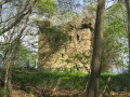
Very close to the town of Irun, this route takes you into the heart of nature, where you can breathe in the fresh air far from the traffic. You will climb a small hill, but you will also learn a little history as you discover an ancient tower that was once used to defend the town of Irun.
Orio - Itxaspe
4.79 mi
+751 ft
-745 ft
2h 50
Easy
Departure from Orio (Gipuzkoa)
A circular route starting from the village of Orio at the mouth of the river of the same name. It will allow you to admire the coastline before returning to the town via narrow streets that are well worth exploring.
The Labetxu valley in Jaizkibel
 5.88 mi
+1,499 ft
-1,526 ft
4h 00
Moderate
Departure from Hondarribia/Fontarrabie (Gipuzkoa)
5.88 mi
+1,499 ft
-1,526 ft
4h 00
Moderate
Departure from Hondarribia/Fontarrabie (Gipuzkoa)
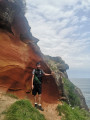
A beautiful walk to a "secret" valley in the Jaizkibel, with difficult access, but you're rewarded at every turn by the shapes of the rocks and their different colours, so much so that the Spaniards call it the valley of "los colores".But this is quite a demanding walk, and you need to be careful not to slip, as there are some tricky passages.
The Artola in the Jaizkibel from Santa Barbara
 3.53 mi
+906 ft
-1,099 ft
2h 25
Easy
Departure from Hondarribia/Fontarrabie (Gipuzkoa)
3.53 mi
+906 ft
-1,099 ft
2h 25
Easy
Departure from Hondarribia/Fontarrabie (Gipuzkoa)
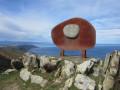
A round trip hike in the Jaizkibel massif, allowing you to reach the summit of Artola, where there is a sculpture dedicated to the friendship of peoples, the work of sculptor Remigio Mendiburu. It is an easy hike, accessible to all.
Jaïzkibel loop, Grande faille, Vallée des couleurs and Paramoudras
 9.86 mi
+2,562 ft
-2,572 ft
6h 45
9.86 mi
+2,562 ft
-2,572 ft
6h 45
 Difficult
Departure from Hondarribia/Fontarrabie (Gipuzkoa)
Difficult
Departure from Hondarribia/Fontarrabie (Gipuzkoa)
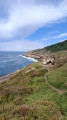
A very beautiful loop with a stunning view of Mount Jaïzkibel and the magnificent Spanish Basque coastline with its faults, valley of colours, Paramoundras and swimming pool. Difficult passages (equipped with ropes). For experienced hikers only.
San Martial in a circular route near Irun
 3.93 mi
+702 ft
-719 ft
2h 25
Easy
Departure from Irun (Gipuzkoa)
3.93 mi
+702 ft
-719 ft
2h 25
Easy
Departure from Irun (Gipuzkoa)
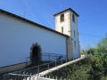
A pretty loop near the town of Irun to climb to the summit of San Martial, then on to the Ermita de San Martial with its exceptional view over the bay of Txingudi.Please note: due to the presence of numerous hunting posts, this hike should not be attempted during the pigeon hunting season.
Aitzondo waterfall from Meaka
 3.09 mi
+833 ft
-833 ft
2h 10
Moderate
Departure from Irun (Gipuzkoa)
3.09 mi
+833 ft
-833 ft
2h 10
Moderate
Departure from Irun (Gipuzkoa)
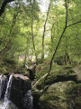
Signposted loop on the SL-GI-1006 trail which passes at the foot of the Aitzondo waterfall and along the Irugurutzeta kilns.
Apart from the incline at the start and the staircase to follow, the rest of the hike is a pleasant, mostly shaded walk with no major difficulties.
The spectacle of the great waterfall is magnificent for those who manage to get close enough.
Paramoudras short version
 4.26 mi
+1,168 ft
-1,171 ft
3h 00
Easy
Departure from Hondarribia/Fontarrabie (Gipuzkoa)
4.26 mi
+1,168 ft
-1,171 ft
3h 00
Easy
Departure from Hondarribia/Fontarrabie (Gipuzkoa)
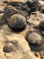
A short walk to discover the paramoudra site in half a day.
Biosnar Point from Zioso
 4.71 mi
+1,030 ft
-1,047 ft
3h 05
Moderate
Departure from Hondarribia/Fontarrabie (Gipuzkoa)
4.71 mi
+1,030 ft
-1,047 ft
3h 05
Moderate
Departure from Hondarribia/Fontarrabie (Gipuzkoa)
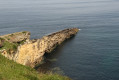
Discover the largest rocky headland in Jaizkibel, which juts out into the ocean, see incredible rock shapes and admire superb coves - these are just some of the activities on offer on this walk, which constantly offers superb views of the sea.
Plaiaundi Ecological Park in Irun from Ficoba
 3.39 mi
+20 ft
-20 ft
1h 35
Easy
Departure from Irun (Gipuzkoa)
3.39 mi
+20 ft
-20 ft
1h 35
Easy
Departure from Irun (Gipuzkoa)
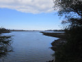
Plaiaundi Ecological Park is located in Irun, between the Bidassoa River, the Jaizubia Stream and Txingudi Bay. Inside the park, there is an interpretation centre providing information.
There are numerous observation points along the route where you can watch the birds without disturbing them. There are also many information panels and benches.
The park serves as a refuge for migratory birds due to its location at the foot of the Pyrenees. It has two saltwater lagoons and one freshwater lagoon.
With virtually no elevation gain, it is a great place for a family outing.
Jaizkibel - Coastal path - Cape Higuer - Our Lady of Guadalupe
 8.54 mi
+1,155 ft
-1,145 ft
4h 55
Moderate
Departure from Hondarribia/Fontarrabie (Gipuzkoa)
8.54 mi
+1,155 ft
-1,145 ft
4h 55
Moderate
Departure from Hondarribia/Fontarrabie (Gipuzkoa)
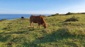
The walk is located in the northern part of Mount Jaizkibel, along the ocean to the Fig Tree lighthouse, returning through the forest, Fort and Guadalupe Chapel.
Jaizkibel circular loop
4.76 mi
+896 ft
-892 ft
3h 00
Moderate
Departure from Hondarribia/Fontarrabie (Gipuzkoa)
Jaizkibel starting from Guadalupé in Hondaribia. Circular route. It follows the Way of St James (northern route). It climbs gently along a forest path, then returns along the ridge with views of the ocean...
The Jaizkibel aerials from Our Lady of Guadalupe
 5.37 mi
+1,168 ft
-1,148 ft
3h 30
Moderate
Departure from Hondarribia/Fontarrabie (Gipuzkoa)
5.37 mi
+1,168 ft
-1,148 ft
3h 30
Moderate
Departure from Hondarribia/Fontarrabie (Gipuzkoa)
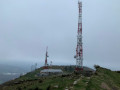
The entire route follows the ridge of the Jaizkibel, with beautiful views on both sides.Not recommended during dove hunting season.
Paramoudras circular from the Fortress of Guadalupe
10.24 mi
+1,929 ft
-1,929 ft
6h 25
Moderate
Departure from Hondarribia/Fontarrabie (Gipuzkoa)
This is a variation of the "Paramoudras from Our Lady of Guadalupe" walk, which extends farther from the starting point. It adds some more kilometres, but awards with beautiful sandstone sculptures made by wind and water. It also adds two descents that not everybody would be comfortable with, but nothing too bad. We were happy that we missed the turn from the original route and felt that this added a lot of value to the walk.
Paramoudras from Our Lady of Guadalupe
 7.54 mi
+1,663 ft
-1,677 ft
4h 55
Moderate
Departure from Hondarribia/Fontarrabie (Gipuzkoa)
7.54 mi
+1,663 ft
-1,677 ft
4h 55
Moderate
Departure from Hondarribia/Fontarrabie (Gipuzkoa)
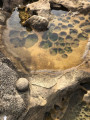
A visit to this very special place where paramoudras can be observed.
Plan to be at your destination at low tide for best viewing.
Guadalupe Chapel and the coastal path at the foot of Jaizkibel
 5.13 mi
+748 ft
-745 ft
3h 00
Moderate
Departure from Hondarribia/Fontarrabie (Gipuzkoa)
5.13 mi
+748 ft
-745 ft
3h 00
Moderate
Departure from Hondarribia/Fontarrabie (Gipuzkoa)
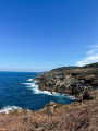
Take advantage of a sunny day to picnic and enjoy this short family walk of about 8km. A bit of road with very little traffic, then a forest path, and then the descent to the ocean. You'll find coves, steep hills, sailing boats, cows, sheep and pottoks.Before or after your walk, don't forget to visit the chapel of Guadalupe and its view over the bay of Hendaye/Hondarribia and the mouth of the Bidassoa.
Jaizkibel via the Paramoudras
 7.32 mi
+1,234 ft
-1,289 ft
4h 25
Moderate
Departure from Hondarribia/Fontarrabie (Gipuzkoa)
7.32 mi
+1,234 ft
-1,289 ft
4h 25
Moderate
Departure from Hondarribia/Fontarrabie (Gipuzkoa)
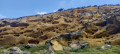
Starting from Guadalupe Chapel, enjoy a magnificent hike along the coast with its strange rocks carved out by the sea over millions of years! Then climb back up towards Jaïkibel to discover the coast from above.
Artzu Portua from Our Lady of Guadalupe
 4.56 mi
+692 ft
-692 ft
2h 40
Easy
Departure from Hondarribia/Fontarrabie (Gipuzkoa)
4.56 mi
+692 ft
-692 ft
2h 40
Easy
Departure from Hondarribia/Fontarrabie (Gipuzkoa)
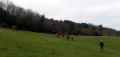
Lovely loop overlooking the sea, near Hondarribia. The views are magnificent, both East and West.
The historic center of Fontarrabie
 1.29 mi
+98 ft
-102 ft
0h 40
Easy
Departure from Hondarribia/Fontarrabie (Gipuzkoa)
1.29 mi
+98 ft
-102 ft
0h 40
Easy
Departure from Hondarribia/Fontarrabie (Gipuzkoa)
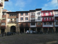
The typical, picturesque village of Fontarrabie is one of the region's finest examples of Basque-Spanish culture and architecture. With its facades of brightly-colored wood contrasting with the surrounding white, its pedestrian streets, ancient fortifications and cathedral, it's a Basque journey summed up in one town. Numerous cafés and "pintxos" bars line the route for a gastronomic break.