Monte Oindi

A circular route that climbs to the summit of Oindi (Monte Onyi in Spanish) and returns via the Mulisko Gaina megaliths site (Muniskue in Spanish).

Details

3127896
Creation:
Last update:
Last review:
  • Walking
    Activity: Walking
  • ↔
    Distance: 4.32 mi
  • ◔
    Average duration: 3h 00 
  • ▲
    Difficulty: Moderate

  • ⚐
    Back to start: Yes
  • ↗
    Ascent: + 1,125 ft
  • ↘
    Descent: - 1,112 ft

  • ▲
    Highest point: 1,768 ft
  • ▼
    Lowest point: 955 ft

Photos

Description of the walk

Head towards Andoain via the GI-3722 road. After passing Urnieta, turn left onto the GI-3721 towards the Besabi restaurant. Park opposite the restaurant, at the side of the road.

(S/E) Take the path on the left heading south-east, the SL-GI-43 (Besadegi – Muniskue – Oindi), ignoring the road that runs alongside the restaurant beyond the car park. Further on, ignore a path on the left.

(1) Turn left onto the track that winds along the hillside.

(2) Turn right and stay on this path until you reach the pass.

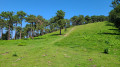
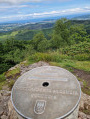
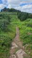
(3) Continue straight ahead towards the north-east to go round Zorrotzarri on the right along the hillside, then follow the ridge towards the summit along a wide grassy strip flanked on either side by a pine forest.

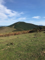
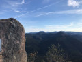
(4) Enjoy the view before heading back down towards the south-east.
Pass through the gate via a wooden chicane and take a short detour to the remarkable monument to Juanito Oyarbide, known as Txili (a former member of ETA).
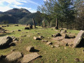
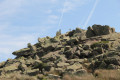
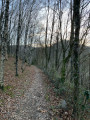
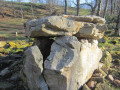
The path then descends steeply through the forest, with tree roots serving as steps, until it joins the HIU-3 path, near which stand the Mulisko Gaina megaliths.

(5) Turn right at the junction to head back towards the pass along a wide, level path through the woods.

(3) At the junction, leave the path you took on the way there and turn left, heading due south. Join a cross-country path at the top of the hill.

(6) Turn right onto thePR®-GI-203.

(7) Amidst the farm buildings, turn right to return to the starting point opposite the restaurant (S/E).

Waypoints

  1. S/E : mi 0 - alt. 968 ft - Car park opposite the restaurant
  2. 1 : mi 0.4 - alt. 1,063 ft - Path to the left
  3. 2 : mi 0.83 - alt. 1,043 ft - Left again
  4. 3 : mi 1.06 - alt. 1,148 ft - Pass, junction of the Oindi circular loop
  5. 4 : mi 1.73 - alt. 1,759 ft - Summit - Monte Oindi
  6. 5 : mi 2.21 - alt. 1,358 ft - Megaliths of Mulisko Gaina
  7. 6 : mi 3.51 - alt. 1,417 ft - T-junction
  8. 7 : mi 4.08 - alt. 1,158 ft - On the right, between the buildings
  9. S/E : mi 4.32 - alt. 968 ft - Car park opposite the restaurant

Notes

No water sources along the route.

Worth a visit

Always be cautious and plan ahead when you're outdoors. Visorando and the author of this route cannot be held responsible for any accidents occurring on this route.

The GR® and PR® markings are the intellectual property of the Fédération Française de Randonnée Pédestre.

Reviews and comments

4.7 / 5
Based on 2 reviews

Reliability of the description
4.5 / 5
Ease of following the route
4.5 / 5
Route interest
5 / 5
Pou95
Pou95

Overall rating : 4.3 / 5

Date of your route : Aug 26, 2024
Reliability of the description : ★★★★☆ Good
Ease of following the route : ★★★★☆ Good
Route interest : ★★★★★ Very good
Very busy route : No

A very pleasant walk with a variety of paths. The climb between points 3 and 4 was a bit steep, but we managed it without any trouble as there were no stones (it was a grassy path going uphill). There were lovely views of the mountains in the second half.

Machine-translated

aqualux13
aqualux13

Overall rating : 5 / 5

Date of your route : Sep 15, 2020
Reliability of the description : ★★★★★ Very good
Ease of following the route : ★★★★★ Very good
Route interest : ★★★★★ Very good
Very busy route : No

A short but lovely walk offering views of the MULISKO GAINA site, perhaps the most beautiful in the region.

Machine-translated

Other walks in the area

For more walks, use our search engine .

The GPS track and description are the property of this route's author. Please do not copy them without permission.