


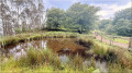
The walk begins from the car park opposite the Susperregi restaurant (327m,S/E). We ignore the main track and its signpost to take a small forest path on the left which climbs towards the Olsarte hill. Further on, we descend to the Malbazar Pass (401m) and take the path on the right to climb the small hill of the same name (or Malbazarko gaina, 443m, point 1), an area renowned as a stopover for migratory birds. There is a lovely view of Urdaburu, which we are about to climb. We pass a small pond on the left, go through a metal gate and then walk through the woods just below Zuarkazu (465m). The path leads us to Pagosarde (413m, mountain hut and signpost). Nearby, we note the presence of a small (artificial) pond with a remarkable ecosystem (point 2). We then veer left off the dirt track, winding our way through the forest on a gentle descent as we skirt the summit of Urdaburu until we reach the low point (372m, point 3). We thus arrive at the Lizarregi Pass (375m, point 4), which offers beautiful panoramic views to both the north and the south. Its location is marked by the numerous signposted paths that intersect here. Directly in front of us, Urdaburu reveals itself in full, with its small western rocky outcrop which we will need to go round. We leave the track at a signpost to take a path that climbs to the left, which we follow to the summit. It leads to the foot of the rock face, which it skirts to the right as it climbs between the boulders. Once on the upper plateau, the path winds its way through pine trees and boulders to the summit ridge, where the triangulation point and the rounded letterbox (buzon) are located. Here we are at the top of Udaburu (599m, point 5), which rises majestically to an altitude of 600 metres between the right bank of the River Urumea and the Añarbe reservoir. There’s a beautiful panorama: La Concha Bay and the entire Guipúzcoa coastline are clearly visible, despite the twelve kilometres separating us from them. For the return journey, we retrace our steps to avoid tackling the descent down the eastern slope, which is very steep and potentially vertiginous. We go round Urdaburu Txiki to the north and follow the path which takes us back through Pagosarde. We stop for a picnic here. For the return journey, we follow tracks running parallel to the outward route (passing through the Malbazar Pass again), which are more direct and lie slightly lower down. Arrival at the car park (start/finish).
Urdaburu as seen from Susperregi


Urdaburu, visible from kilometres out to sea, is a landmark for fishermen in Gipuzkoa, who have popularised its name (pronounced ‘urde-buru’, meaning ‘pig’s head’). With its characteristic steep cliff face, it has always served as a landmark for them. This route presents no particular difficulties apart from the final ascent, which requires a little care. This relatively short circular route starts from the car park of the Susperregi restaurant, on the hills above Errenteria.
Details
Creation:
Last update:
Last review:
–
–
-
 Activity: Walking
 -
 Distance: 5.33 mi
 -
 Average duration: 3h 40
 -
 Difficulty: Moderate
 -
-
 Back to start: Yes
 -
 Ascent: + 1,371 ft
 -
 Descent: - 1,358 ft
 -
-
 Highest point: 1,886 ft
 -
 Lowest point: 1,063 ft
-
 Country:
Spain
Country:
Spain
-
 Area: Basque Country
 -
 City:
Errenteria
City:
Errenteria -
 Start/End: N 43.258561° / W 1.888659°
 -


 Hour-by-hour weather
Photos
Description of the walk
Waypoints
- S/E : mi 0 - alt. 1,076 ft - Susperregi car park (327m)
- 1 : mi 0.82 - alt. 1,404 ft - Malbazarko Gaina - Malmazarko Gaina (436 m)
- 2 : mi 1.56 - alt. 1,348 ft - Pagoxarde
- 3 : mi 2 - alt. 1,220 ft - Lowest point (372m)
- 4 : mi 2.99 - alt. 1,230 ft - Lizarregi Gaina (375m)
- 5 : mi 3.46 - alt. 1,886 ft - Urdaburru (599m)
- S/E : mi 5.33 - alt. 1,073 ft - Susperregi car park (327m)
Other walks in the area
Circular route to Urdaburu
 Visorando Member
 7.91 mi
+2,418 ft
-2,425 ft
5h 45
Moderate
7.91 mi
+2,418 ft
-2,425 ft
5h 45
Moderate
 Departure from Hernani (Gipuzkoa)
Urdaburu, visible from miles away, is a landmark for the fishermen of Gipuzkoa who popularised its name (pronounced ‘urde-buru’, meaning ‘pig’s head’). With its characteristic steep cliff face, it has always served as a landmark for them. This route presents no difficulty apart from the final ascent, which requires a little care. For the descent, you need to retrace your steps slightly to avoid the steep and potentially vertiginous path on the eastern slope.
San Marco and the summit of Txoritokieta near Errenteria.
 3.55 mi
+761 ft
-761 ft
2h 20
Moderate
Departure from Errenteria (Gipuzkoa)
3.55 mi
+761 ft
-761 ft
2h 20
Moderate
Departure from Errenteria (Gipuzkoa)
The Fort of San Marco is a military construction located at the top of Mount Bizarain at an altitude of 260 metres. It was built in 1880, near the village of Errenteria, to defend San Sebastián and the region from French attacks by land and sea. It is an excellent vantage point offering beautiful views of San Sebastián, Pasaia and Txingudi Bay.
The hike described here also offers the chance to discover some dolmens and take trails that are somewhat hidden in the forest. It may be useful to bring pruning shears to cut back any brambles or ferns that may have invaded the path.
Les Dolmens d'Igorin
 Association / Club / Walk leader
 5.37 mi
+1,257 ft
-1,247 ft
3h 35
Moderate
Departure from Hernani (Gipuzkoa)
5.37 mi
+1,257 ft
-1,247 ft
3h 35
Moderate
Departure from Hernani (Gipuzkoa)
Cette boucle est connue sous l'appellation PR®-GI-1002 Igoringo trikuharriak, soit les dolmens d'Igorin en basque.
La présence de nombreuses palombières recommande d'éviter ce trajet à l'automne en période de chasse.
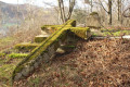
The Arraskuelarre peak and the Gainzabal dolmen in Elizalde
 4.44 mi
+604 ft
-604 ft
2h 35
4.44 mi
+604 ft
-604 ft
2h 35
 Easy
Departure from Oiartzun (Gipuzkoa)
Easy
Departure from Oiartzun (Gipuzkoa)
This route around Elizalde, which takes you up to a small peak, follows part of a ‘Voie verte’ – a former railway line that ran from Artikutza to Renteria or Arditurri and was mainly used to transport ore. You’ll also be walking a lot on tarmac tracks, but there’s very little traffic.
Munagirre loop
 5.99 mi
+1,473 ft
-1,493 ft
4h 00
Moderate
Departure from Oiartzun (Gipuzkoa)
5.99 mi
+1,473 ft
-1,493 ft
4h 00
Moderate
Departure from Oiartzun (Gipuzkoa)
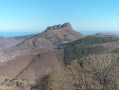
We start by climbing to the summit of Munagirre (781 m), then follow a path through streams, small waterfalls and a beech forest, discovering the fairly recent ruins of the old Artikutza train, or very old ruins with cromlechs and superb views, either of the coast or of the peaks of the Three Crowns.
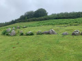
Munagirre summit and Oianleku Cromlech
 3.46 mi
+771 ft
-774 ft
2h 15
Easy
Departure from Oiartzun (Gipuzkoa)
3.46 mi
+771 ft
-774 ft
2h 15
Easy
Departure from Oiartzun (Gipuzkoa)
Lovely walk with views of San Sebastian, the Basque coast, the Trois Couronnes, La Rhune and a visit to a remarkable cromlech site.
Sagarraren Bidea - The Apple Route
 2.60 mi
+666 ft
-656 ft
1h 45
Easy
Departure from Hernani (Gipuzkoa)
2.60 mi
+666 ft
-656 ft
1h 45
Easy
Departure from Hernani (Gipuzkoa)
This easy circular is known as SL-GI-1002 Sagarraren Bidea (the Apple Route in Basque).
Sagarno, literally "apple wine", is an iconic product of the Basque Country that can be enjoyed in cider houses (Sagardotegia).
At the foot of the Fort of San Marko in Errenteria
2.63 mi
+459 ft
-433 ft
1h 35
Easy
Departure from San Sebastián (Gipuzkoa)
A very pleasant circular route through the forest if you want to avoid the heatwave. The paths are well marked. You may spot a few cows and bulls (safely penned away). At one point, you can even admire the very typical port of Pasïa down below, to the north.
For more walks, use our search engine .
The GPS track and description are the property of this route's author. Please do not copy them without permission.

