Adarra from Besabi

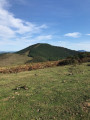
Adarra (816 m) is an iconic mountain in the Donostia–San Sebastián region, home to numerous prehistoric sites. It is traditional to climb to this summit on1 January to celebrate the New Year.

Details

22059576
Creation:
Last update:
Last review:
  • Walking
    Activity: Walking
  • ↔
    Distance: 4.31 mi
  • ◔
    Average duration: 3h 25 
  • ▲
    Difficulty: Moderate

  • ⚐
    Back to start: Yes
  • ↗
    Ascent: + 1,657 ft
  • ↘
    Descent: - 1,657 ft

  • ▲
    Highest point: 2,628 ft
  • ▼
    Lowest point: 971 ft

Photos

Description of the walk

The start of the hike is at the Besabi restaurant (a remote location) near the town of Urniéta. (For directions, see the ‘Practical Information’ section below).

(S/E) Walk past the Besabi restaurant along the road, so that you are below the three signs. Continue for about 30 m and take the small road on the left that goes uphill (towards Montefrio).

(1) When you reach the farm, go through the small wooden gate (towards Adarramendi) and follow the white and yellow markings until the next junction.

(2) Head towards the posts and follow the sign for Eteneta on the right. In wet weather, the path may be muddy.

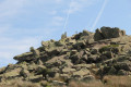
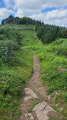
(3) Head straight up towards the group of trees visible on the left, then continue towards the pass between the peaks. There is no clearly marked path. For the last few metres over the rocks, don’t hesitate to use your hands.

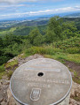
(4) “At the summit, there’s a superb view of San Sebastián and peaks such as the Tres Coronas and Jaizquibel.” Descend on the opposite side to the ascent, following the ridge more or less. The descent is a bit steep at first. The idea is to reach the path that appears wider further down and to pass to the left of the rocky ridges.

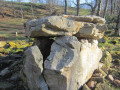
(5) Take a short detour to see a cromlech, then continue the descent.

(6) At the pass, head towards the sign and follow the route marked SLGI43 towards Besadegi. Then follow a path marked in white and red. (You’ll notice a small house on the left with tables and benches in front of it, in the shade of the trees: an ideal spot for a bite to eat). A little further on, as you continue along the path, you’ll come to a sign pointing towards “Sansonarri” (which tells you you’re heading in the right direction).

(7) Take a short detour to see another cromlech. Then continue downhill towards the wide path visible below.
When you reach a sign, turn left towards PRGI203 Besadegi. Further on, you’ll come across the white and yellow markings from the start of the route again.

(1) Return to the car park via the same route you took on the way there (S/E).

Waypoints

  1. S/E : mi 0 - alt. 971 ft - Besadi Restaurant
  2. 1 : mi 0.2 - alt. 1,165 ft - Start of the circular loop
  3. 2 : mi 1.03 - alt. 1,837 ft - Follow signs for Eteneta
  4. 3 : mi 1.76 - alt. 2,192 ft - Climb towards the trees
  5. 4 : mi 2.16 - alt. 2,625 ft - Adarra Summit
  6. 5 : mi 2.55 - alt. 2,014 ft - Cromlech
  7. 6 : mi 2.72 - alt. 1,893 ft - Sign
  8. 7 : mi 3.27 - alt. 1,745 ft - Cromlech
  9. S/E : mi 4.31 - alt. 971 ft - Besadi Restaurant

Notes

Best undertaken in dry weather as some sections of the path may be muddy.
This walk has an IBP rating of 61, making it a walk of medium difficulty.

To get to the start by car, avoiding tolls:
From Saint-Jean-de-Luz, take the D810 to cross the border at Béhobie. Cross the bridge and, at the roundabout, follow signs for the GI636 to San Sebastian; continue along this road towards San Sebastian, which will become the GI20.
Take exit 5, signposted Donostia/Passai, and keep as far to the right as possible (as if heading for the Garbera shopping centre), but at the roundabout do not go towards Garbera; instead, follow signs for GI40/Martutene 2.
At the roundabout, take thefirst exit, ‘Todas Direccciones’.
At the roundabout, take thethird exit, ‘Todas Direccciones’. GI41/E5/E70.....Bainona/Bilbao and A15/Hernani 5
Continue towards A15/Hernani/Iruna/Pamplona. Take exit 162 Urnieta (do not take exit 164 Urnieta) and drive under the motorway. At the roundabout, take thesecond exit towards GI3722 Andoin (you are now on Bo Ergoyer).
At the roundabout, take the3rd exit towards GI 3721 Besabi 4/Xoxoka. Pass through Goiburu then stop at the car park of the Bedsabi restaurant (closed on Mondays). On the left you will see three signposts and the restaurant is opposite on the right.
As a guide, the journey is about 50 km and takes around 1 hour.

Note: there is another, quicker option via toll motorways.

Reviews and comments

4.6 / 5
Based on 3 reviews

Reliability of the description
4.7 / 5
Ease of following the route
4.3 / 5
Route interest
4.7 / 5
User 4357442

Overall rating : 4.3 / 5

Date of your route : Jul 19, 2025
Reliability of the description : ★★★★★ Very good
Ease of following the route : ★★★★☆ Good
Route interest : ★★★★☆ Good
Very busy route : No

Good footwear is highly recommended for this route, which passes over large rocks and mud. The difficulty level is moderate. The view from the summit and during the descent is magnificent, overlooking Donostia and Hendaia.

Machine-translated

eric bourdon
eric bourdon

Overall rating : 5 / 5

Date of your route : Jun 24, 2024
Reliability of the description : ★★★★★ Very good
Ease of following the route : ★★★★★ Very good
Route interest : ★★★★★ Very good
Very busy route : No

Stunning scenery and a magnificent panoramic view over San Sebastián Bay from the summit of Adarra. A few things to bear in mind. The path is very wet and muddy after rain, so avoid the climb in wet weather. The final 100 metres of ascent are steep for weekend hikers like us. The GR descends from the summit via a steep path which one of us, who suffers from vertigo, was unable to take. However, it’s perfectly possible to go round the other way to get down safely.
A lovely walk and a friendly restaurant at the end.

Machine-translated

corinne Berger
corinne Berger

Overall rating : 4.3 / 5

Date of your route : May 06, 2023
Reliability of the description : ★★★★☆ Good
Ease of following the route : ★★★★☆ Good
Route interest : ★★★★★ Very good
Very busy route : Yes

: A very pleasant walk with a magnificent view
Very busy, a family-friendly walk – we got swept along by the stream of walkers and went straight up without doing the circular route! So it was a bit of a steep climb to do it again following your route

Machine-translated

Other walks in the area

For more walks, use our search engine .

The GPS track and description are the property of this route's author. Please do not copy them without permission.