Urkabe – Beloaga Gaztelua

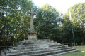
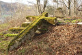
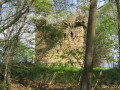
A circular walk that passes Mount Urkabe and visits the ruins of Beloaga Castle: Castillo de Beloaga in Spanish or Beloaga Gaztelua in Basque.

Details

n°3157490
Creation:
Last update:
Last review:
  • Walking
    Activity: Walking
  • ↔
    Distance: 3.93 mi
  • ◔
    Average duration: 2h 35 
  • ▲
    Difficulty: Easy

  • ⚐
    Back to start: Yes
  • ↗
    Ascent: + 919 ft
  • ↘
    Descent: - 892 ft

  • ▲
    Highest point: 784 ft
  • ▼
    Lowest point: 318 ft

Description of the walk

To reach the start, cross the border at Biriatou and head towards Fontarrabie via the GI-636.
At the exit towards the airport, instead of turning right towards Fontarrabie at the roundabout, head straight on towards Donostia.
At the fifth roundabout, head towards Oiartzun on the GI-2134, go under the railway line and continue on the GI-2134. Go over the motorway. On arrival in Gurutze, go past the roundabout; the car park is on the right and the start point is at the corner of the car park, near a building.

(S/E) Turn left towards the west onto thePR® GI-1011 path.

(1) Continue along the path, which veers left towards the south. You’ll come out onto a small road; follow it to the left for a few tens of metres.

(2) Turn right towards the summit of Urkabe Mendia (Mount Urkabe).

(3) Carry on to the left heading west until you reach a crossroads.

(4) Turn right (north), pass under the power line and head eastwards. The path winds its way along the contour lines until it joins a concrete track.

(5) Turn left towards the west at the hairpin bend. After a sharp right-hand bend, the road veers northwards and joins a tarmac road; turn left then right onto a track suitable for vehicles. Keep right at the first three-way junction and follow the track which runs alongside the motorway. Pass under a power line; just after this, ignore the track on the right and take the next one, which gradually turns south-east. Pass close to a building.

(6) Turn right to go round this building and head back up towards the castle.

(7) Turn back.

(6) Turn right onto the path that leads back down to Gurutze and joins the road near a roundabout. Turn right, then immediately left to go round the building and reach the car park (S/E).

Waypoints

  1. S/E : mi 0 - alt. 505 ft - Gurutze car park
  2. 1 : mi 0.44 - alt. 397 ft - Left-hand bend
  3. 2 : mi 0.78 - alt. 554 ft - Path on the right towards the summit
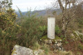
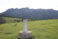
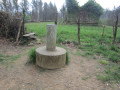
  4. 3 : mi 1.09 - alt. 758 ft - Summit - Urkabe Mendia
  5. 4 : mi 1.47 - alt. 522 ft - Crossroads
  6. 5 : mi 1.82 - alt. 449 ft - Concrete track
  7. 6 : mi 3.38 - alt. 696 ft - Going round the building
  8. 7 : mi 3.51 - alt. 784 ft - Ruins - Beloaga Gaztelua
  9. S/E : mi 3.93 - alt. 505 ft - Gurutze car park

Notes

No water along the route.

Worth a visit

Always be cautious and plan ahead when you're outdoors. Visorando and the author of this route cannot be held responsible for any accidents occurring on this route.

The GR® and PR® markings are the intellectual property of the Fédération Française de Randonnée Pédestre.

Reviews and comments

4.2 / 5
Based on 2 reviews

Reliability of the description
4.5 / 5
Ease of following the route
4.5 / 5
Route interest
3.5 / 5
jeanmichelroy
jeanmichelroy

Overall rating : 4 / 5

Date of your route : Sep 01, 2023
Reliability of the description : ★★★★★ Very good
Ease of following the route : ★★★★★ Very good
Route interest : ★★☆☆☆ Disappointing
Very busy route : No

An easy walk with clear instructions. However, there is one downside: the noise along the section running alongside the motorway (55 decibels measured on 1 September 2023), which really spoils the enjoyment. I wouldn’t recommend this route for that reason.

Machine-translated

laetitia.chauvet
laetitia.chauvet

Overall rating : 4.3 / 5

Date of your route : Aug 04, 2022
Reliability of the description : ★★★★☆ Good
Ease of following the route : ★★★★☆ Good
Route interest : ★★★★★ Very good
Very busy route : No

A pleasant, shaded walk through the woods.
The description is difficult to follow without the app’s GPS tracking.

For the climb to the ruins of Beloaga Castle, the path has been altered compared to the description and the Visorando GPS route. It’s a few metres further on (but there’s a signpost indicating the way).

Machine-translated

Other walks in the area

For more walks, use our search engine .

The GPS track and description are the property of this route's author. Please do not copy them without permission.