Around Gurutze via the summit of Urkabe

A pleasant walk through fields, woods and along streams, accompanied by birdsong.

Details

63254739
Creation:
Last update:
Last review:
  • Walking
    Activity: Walking
  • ↔
    Distance: 4.62 mi
  • ◔
    Average duration: 2h 45 
  • ▲
    Difficulty: Easy

  • ⚐
    Back to start: Yes
  • ↗
    Ascent: + 725 ft
  • ↘
    Descent: - 715 ft

  • ▲
    Highest point: 758 ft
  • ▼
    Lowest point: 390 ft

Photos

Description of the walk

The starting point for this walk is at the Gurutze car park.
To get to this starting point by car, see the ‘Practical Information’ section below.

(D:A) Head left towards the wall to take the tarmac path leading downhill, which is marked in white and yellow. A little further on, this path turns into a dirt track and you’ll walk surrounded by fields or through the forest, accompanied by the sound of a stream. When you reach a fork, continue for a few dozen metres, keeping in the same direction.

(1) Take the path on the right.

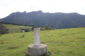
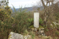
(2) At a white boundary marker on the left, leave the track and take the path leading uphill.
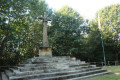
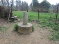
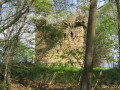
A little further on, turn right, following smaller boundary stones, pass a fairly large cross right in the middle of the forest and reach the summit of Urkabe (234 m), marked by a large cross set on a stepped structure with the Basque flag beside it.

(3) With your back to the cross, cross the meadow and take the exit which is almost directly opposite, following the path ahead. This path bends to the left and then heads west.

(4) At the junction, take the path on the left; at the next junction, do the same and continue at a leisurely pace, heading south-east. Join a small tarmac road and follow it to the left.

(5) Turn right and continue to the GI-2134 road. Take the path on the left which runs parallel to the road and follows it as closely as possible.

(6) At the unguarded crossing (no barrier), cross the road carefully to take the road opposite. At the first junction, turn left onto the tarmac road and continue to the bend.

(7) Carry on straight ahead along a grassy track until you reach a junction.

(8) Turn right and walk past the house on your left, continuing for a few dozen metres.

(9) Turn onto the track on the left. Go round a house on the left.

(10) Cross the river and then follow the narrow path that runs between two fences marking the boundaries of two fields, one on the left and the other on the right. The path looks disused and may be somewhat overgrown with ferns and brambles (bring secateurs). You’ll come out onto a road; head left to quickly reach a road junction.

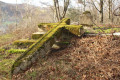
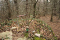
(11) Turn left. A few metres before a private property gate – normally closed – on the left-hand side of the road, marked with a sign warning of bees, head into the woods for a few metres to see the Algorrieta cromlech, which is somewhat hidden amongst the vegetation. It has a diameter of about 5 m and features a burial mound.

(11) Return to the road and continue the route by turning left. Go round the roundabout on the right, cross at the pedestrian crossing to return to the starting car park (S/E).


Waypoints

  1. S/E : mi 0 - alt. 522 ft - Gurutze car park
  2. 1 : mi 0.8 - alt. 561 ft - Path on the right
  3. 2 : mi 0.92 - alt. 650 ft - White signpost
  4. 3 : mi 1.11 - alt. 758 ft - Urkabe
  5. 4 : mi 1.62 - alt. 525 ft - Junction, turn left
  6. 5 : mi 2.35 - alt. 548 ft - Junction, turn right
  7. 6 : mi 2.71 - alt. 515 ft - Crossing the road
  8. 7 : mi 2.91 - alt. 591 ft - Turn, path opposite
  9. 8 : mi 3.14 - alt. 597 ft - Junction
  10. 9 : mi 3.27 - alt. 594 ft - Turn left
  11. 10 : mi 3.54 - alt. 515 ft - Crossing the river
  12. 11 : mi 3.99 - alt. 623 ft - Cromlech
  13. S/E : mi 4.62 - alt. 509 ft - Gurrutze car park

Worth a visit

Driving route to the start of the walk.

From Saint-Jean-de-Luz, head to Béhobie to cross the border.
After crossing the bridge, at the roundabout take thefirst exit towards the GI-636 San Sebastián.
Drive past the Easy Gas petrol station and, at the roundabout, take thesecond exit towards the GI-636 Errenteria and the motorways. A little further on, after a fairly large sign indicating the motorways, look out for a very small sign on the right marked ‘Urdanibia’: then, about a hundred metres further on, turn off onto the small road on the right.
At the roundabout, follow signs for Hondarribia and go through the tunnel. At the tunnel exit, take the road that bends to the left.
At the stop sign, turn right.
At the roundabout, take the2nd exit towards GI-2134 / Oiartzun.
At the next roundabout, take thefirst exit towards GI-2134 / Oiartzun.
Finally, at the next roundabout (before the large signpost indicating Oiartzun straight ahead and Arkale on the left), continue towards Oiartzun and park immediately in the car park on the right.
(Note: at this last roundabout, there is also a car park at thethird exit).

For your information, by car from Saint-Jean-de-Luz, the journey is approximately 22 km and takes around 25 minutes.

Reviews and comments

4.1 / 5
Based on 3 reviews

Reliability of the description
4.3 / 5
Ease of following the route
4.3 / 5
Route interest
3.7 / 5
Tximeleta
Tximeleta

Overall rating : 4 / 5

Date of your route : Sep 06, 2025
Reliability of the description : ★★★★☆ Good
Ease of following the route : ★★★★☆ Good
Route interest : ★★★★☆ Good
Very busy route : No

A leisurely 3 hour 15 minute hike. There is a tricky section after point 9 and especially point 10, as the path is narrow and poorly maintained (brambles and stones). After point 9, you pass by a house (before turning onto a small path) with two very aggressive, unleashed dogs. The owners do not come out!

Machine-translated

dominique texier
dominique texier

Overall rating : 3.7 / 5

Date of your route : Mar 27, 2025
Reliability of the description : ★★★★☆ Good
Ease of following the route : ★★★★☆ Good
Route interest : ★★★☆☆ Average
Very busy route : No

a route that is less interesting than the previous one

Machine-translated

titouberg
titouberg

Overall rating : 4.7 / 5

Date of your route : Jan 20, 2025
Reliability of the description : ★★★★★ Very good
Ease of following the route : ★★★★★ Very good
Route interest : ★★★★☆ Good
Very busy route : No

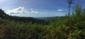
A lovely walk with views of the hills above San Sebastián and the Three Crowns. The route is shaded. Much of the path is paved; the first section is uphill but not particularly difficult.

Machine-translated

Other walks in the area

For more walks, use our search engine .

The GPS track and description are the property of this route's author. Please do not copy them without permission.