Refine your search for walks in Fréjeville
Fréjeville walks


 The Agout circular route in Fréjeville
 Visorando Member
 9.07 mi
 +413 ft
 -420 ft
 4h 30
4h 30
 Easy
Easy
 Departure from Fréjeville (Tarn)
Explore the countryside around Fréjeville.
The little Semalens circular
 3.94 mi
+315 ft
-315 ft
2h 05
Easy
Departure from Sémalens (Tarn)
3.94 mi
+315 ft
-315 ft
2h 05
Easy
Departure from Sémalens (Tarn)
This is a pleasant walk in all seasons, with pretty panoramic views and fairly good signposting.
First follow the signs for "Petite boucle" (small circular) then "Plôts des Drulhes".
Some parts of the route cross private property, so please respect it.
In the Agout region, starting from Guitalens-L’Albarède
 9.76 mi
+883 ft
-876 ft
5h 15
9.76 mi
+883 ft
-876 ft
5h 15
 Moderate
Departure from Guitalens-L'Albarède (Tarn)
Moderate
Departure from Guitalens-L'Albarède (Tarn)
A pleasant countryside walk along narrow paths and quiet tarmac roads (50/50%)
 Along the Agout, starting from Castres
13.63 mi
+673 ft
-682 ft
4 hrs
Moderate
Departure from Castres (Tarn) (Tarn)
A safe walk along the outskirts of Castres towards Burlats and Roquecoube, returning via Les Salvages.
The ridges and burial mounds around Lautrec
 10.56 mi
+912 ft
-892 ft
5h 40
Moderate
Departure from Lautrec (Tarn)
10.56 mi
+912 ft
-892 ft
5h 40
Moderate
Departure from Lautrec (Tarn)
This beautiful hike around Lautrec follows two yellow-marked routes: first the Route des Crêtes, then the Route des Tumulus a little further on. It offers beautiful views of the medieval village, the garlic fields, the Montagne Noire further south and the Pyrenees in the background when the weather is clear.
The Chemin des Crêtes in Lautrec
 3.49 mi
+495 ft
-512 ft
2h 00
Easy
Departure from Lautrec (Tarn)
3.49 mi
+495 ft
-512 ft
2h 00
Easy
Departure from Lautrec (Tarn)
This circular loop will take you through the hills surrounding the village of Lautrec. Along the way, you will enjoy magnificent views of the medieval town and its surroundings or the Montagne Noire.
Garlic trail east of Lautrec
 4.65 mi
+643 ft
-646 ft
2h 40
Easy
Departure from Lautrec (Tarn)
4.65 mi
+643 ft
-646 ft
2h 40
Easy
Departure from Lautrec (Tarn)
This is a modest route to whet your appetite. Do it one morning for a breath of fresh air in the Lautrec countryside. Lautrec is the capital of pink garlic, which is mainly found in the south-west.You can plan this walk for a Friday morning before heading to the "canteen" at the Café Plum.
Circular Two Valleys Route starting from Lautrec
5.06 mi
+709 ft
-709 ft
2h 55
Moderate
Departure from Lautrec (Tarn)
It’s a short walk to whet your appetite. Best done one morning for a breath of fresh air in the Lautrec countryside. Lautrec is the capital of pink garlic, which is mainly found in the South-West.
Short circular loop from Labarthe, starting from Puylaurens
 Association / Club / Walk leader
 3.47 mi
+367 ft
-367 ft
1h 55
Easy
Departure from Puylaurens (Tarn)
3.47 mi
+367 ft
-367 ft
1h 55
Easy
Departure from Puylaurens (Tarn)
A short, easy walk south of Puylaurens, ideal for families. Beautiful views over the Revel plain and the Montagne Noire.
Yellow markings.
Through various localities north of Puylaurens
 9.67 mi
+1,033 ft
-1,040 ft
5h 20
Moderate
Departure from Puylaurens (Tarn)
9.67 mi
+1,033 ft
-1,040 ft
5h 20
Moderate
Departure from Puylaurens (Tarn)
This hike starting from Puylaurens is a combination of severalPR® trails. It is therefore marked, but you should refer to the map and not blindly follow the markings to avoid getting lost in the wrong direction.
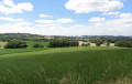
The Montaut Circular Route
 5.81 mi
+758 ft
-764 ft
3h 20
Moderate
Departure from Puylaurens (Tarn)
5.81 mi
+758 ft
-764 ft
3h 20
Moderate
Departure from Puylaurens (Tarn)
An easy hike east of Puylaurens. Beautiful landscapes over the Revel plain and the Montagne Noire.
Yellow markings.
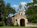
The Saint-Étienne de Florac circular route
 4.36 mi
+568 ft
-564 ft
2h 30
Easy
Departure from Puylaurens (Tarn)
4.36 mi
+568 ft
-564 ft
2h 30
Easy
Departure from Puylaurens (Tarn)
A short, easy walk through the hills of the Pays de Cocagne, north of Puylaurens, suitable for families on foot or by mountain bike.
Yellow markings.
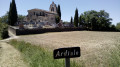
The Ardiale loop
 8.15 mi
+912 ft
-912 ft
4h 35
Moderate
Departure from Puylaurens (Tarn)
8.15 mi
+912 ft
-912 ft
4h 35
Moderate
Departure from Puylaurens (Tarn)
Starting from the village centre, this beautiful loop takes you north of the village through a varied landscape of hills to the hamlet of Ardialle and through Saint-Jean before climbing back up to Puylaurens. Can be done on foot or by mountain bike. Yellow markings.
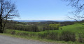
Circular d'Appelle revisited
 8.04 mi
+853 ft
-837 ft
4h 25
Moderate
Departure from Puylaurens (Tarn)
8.04 mi
+853 ft
-837 ft
4h 25
Moderate
Departure from Puylaurens (Tarn)
This hike has a few hills and is pleasant in all seasons, but should be avoided after heavy rain as the paths may be muddy. You will discover the charming hills surrounding the hamlet of Appelle, overlooked by Puylaurens. Several sections are on roads, but these are very small roads with very little traffic and beautiful views.
The Puechs Walk in Montfa
4.88 mi
+420 ft
-430 ft
2h 35
Easy
Departure from Montfa (Tarn) (Tarn)
This walk is a shorter version of the “Randonnée des puechs – in the footsteps of Toulouse-Lautrec”, which has already been published on the website. There is very little road walking, unlike the 12 km version. You can walk around the ruins of Montfa Castle and even visit it if it is open.
The Sentier des Puechs, long route
 11.01 mi
+1,066 ft
-1,089 ft
6h 00
Moderate
Departure from Montfa (Tarn) (Tarn)
11.01 mi
+1,066 ft
-1,089 ft
6h 00
Moderate
Departure from Montfa (Tarn) (Tarn)
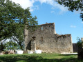
This walk crosses agricultural plateaus, offering the chance to discover beautiful views over the Castraises plains to the south and the Lautrecaises plains to the west. You’ll pass through meadows, woodland and small hamlets along local footpaths or minor country roads.
At the end of the walk, the path passes by the foot of Montfa Castle, which was once the home of the ancestors of the painter Henri de Toulouse-Lautrec. His father lived there until the early 20th century. Today, a local association is working to restore this remarkable site steeped in history.
The Puechs circular route: following in the footsteps of Toulouse-Lautrec towards Montfa
 Tourist office
 7.59 mi
+591 ft
-607 ft
4h 00
Moderate
Departure from Montfa (Tarn) (Tarn)
7.59 mi
+591 ft
-607 ft
4h 00
Moderate
Departure from Montfa (Tarn) (Tarn)
Hiking trail in the commune of Montfa, in Sidobre & Vallées, in the Tarn – Occitanie. This village is one of the former strongholds of the ancestors of the famous painter Henri de Toulouse-Lautrec – Montfa. His father even stayed there as recently as the early20th century. This walk offers the chance to explore the agricultural plateaus and enjoy beautiful views over the Castraises and Lautrécoises plains. As you stroll along, you’ll pass through meadows, village paths, small hamlets and woodland. In particular, you’ll be able to catch a glimpse of the ruins of Montfa Castle, which is gradually being restored thanks to the Friends of the Castle association.
The Sentier des Puechs, short version
7.80 mi
+705 ft
-715 ft
4h 10
Moderate
Departure from Montfa (Tarn) (Tarn)
This hike crosses agricultural plateaus offering beautiful views of the Castraises plains to the south and the Lautrecaises plains to the west. You will cross meadows, undergrowth and small hamlets via communal paths or small local roads.
At the end of the hike, the trail passes by the Château de Montfa, which was the home of the ancestors of the painter Henri de Toulouse-Lautrec. His father lived there until the early 20th century. Today, an association is working to rebuild this remarkable place steeped in history. The trail is markedPR® Yellow throughout.
From Labruguière to the Montagne Noire via the Carbonéral
 11.34 mi
+1,703 ft
-1,686 ft
6h 40
Moderate
Departure from Labruguière (Tarn)
11.34 mi
+1,703 ft
-1,686 ft
6h 40
Moderate
Departure from Labruguière (Tarn)
This walk allows you to explore the hills of Labruguière, comprising small limestone plateaus to the north and wooded countryside to the south. You climb towards the Montagne Noire, which often dominates the southern backdrop of the landscapes in this department. This is the realm of the forest, composed of both deciduous and coniferous trees. Its peaks are gentle and varied: moors, forests and meadows share the view of the sky.
The edge of the Causse de Labruguière
3.97 mi
+522 ft
-502 ft
2h 15
Easy
Departure from Labruguière (Tarn)
A short, unpretentious walk, accessible to all but with some interesting views.
Around the village of Brousse
 4.59 mi
+361 ft
-381 ft
2h 25
Easy
Departure from Brousse (Tarn) (Tarn)
4.59 mi
+361 ft
-381 ft
2h 25
Easy
Departure from Brousse (Tarn) (Tarn)
Explore the countryside around Brousse with beautiful views as you arrive in the village.
From Sainte-Scholastique to the Quatre Saints
 9.88 mi
+1,755 ft
-1,732 ft
6h 05
Moderate
Departure from Dourgne (Tarn)
9.88 mi
+1,755 ft
-1,732 ft
6h 05
Moderate
Departure from Dourgne (Tarn)
A beautiful, undulating route that passes through four places dedicated to the four saints of Dourgne:
Saint-Macaire and his healing spring, Saint-Stapin the giant, Saint-Chipoli or Saint-Hippolyte, Saint-Ferréol and his Capelette.
From Escoussens to the Mouscaillou Waterfall
9.13 mi
+1,965 ft
-1,965 ft
5h 55
Moderate
Departure from Escoussens (Tarn)
There is a pretty waterfall to see, unless there is a drought like the one in 2022.
Les Tuileries - Le Mas d'Enfau circular
4.30 mi
+525 ft
-502 ft
2h 25
Moderate
Departure from Roquecourbe (Tarn)
A circular that will take you around the Tuileries and Mas d'Enfau for some views of the village of Roquecourbe.
The Sainte-Julianne excavations
 2.18 mi
+325 ft
-325 ft
1h 15
Easy
Departure from Roquecourbe (Tarn)
2.18 mi
+325 ft
-325 ft
1h 15
Easy
Departure from Roquecourbe (Tarn)
This route allows you to climb up to the Sainte-Julianne excavation site.
La Capelette via the Taurou Gorges
 5.84 mi
+1,145 ft
-1,145 ft
3h 40
Moderate
Departure from Dourgne (Tarn)
5.84 mi
+1,145 ft
-1,145 ft
3h 40
Moderate
Departure from Dourgne (Tarn)
A lovely climb up a steep gorge leads to the dry grasslands of the Désert de Saint-Ferréol, where La Capelette stands proudly overlooking a vast landscape.
La Capelette from Dourgne
 7.33 mi
+1,594 ft
-1,591 ft
4h 45
Moderate
Departure from Dourgne (Tarn)
7.33 mi
+1,594 ft
-1,591 ft
4h 45
Moderate
Departure from Dourgne (Tarn)
Route through the Montagne Noire, with superb panoramic views of the Lauragais, the village of Dourgne and Sainte-Scholastique, places of worship (Quatre Saints) and magnificent pine forests.
La Capelette Saint Ferréol de Dourgne
 8.47 mi
+1,539 ft
-1,558 ft
5h 15
Moderate
Departure from Dourgne (Tarn)
8.47 mi
+1,539 ft
-1,558 ft
5h 15
Moderate
Departure from Dourgne (Tarn)
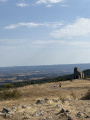
Breathtaking panoramic views, steeped in history and legend.
02/08/2023 Message from the moderator: Route change at point 11 to continue on thePR®® and avoid En Crouzilles, which is private property.
The heights of Burlats and the banks of the Agout
 11.72 mi
+1,496 ft
-1,480 ft
6h 40
Moderate
Departure from Burlats (Tarn)
11.72 mi
+1,496 ft
-1,480 ft
6h 40
Moderate
Departure from Burlats (Tarn)
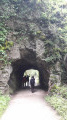
A very pleasant route with beautiful views of Roquecourbe on one side and the Montagne Noire on the other. A beautiful path along the Agout between Carla and Les Salvages, built on an old aqueduct from the town of Castres. Magnificent shaded paths lined with chestnut trees cross pastoral areas.
Gourteau circular loop
 12.14 mi
+1,424 ft
-1,417 ft
6h 50
12.14 mi
+1,424 ft
-1,417 ft
6h 50
 Difficult
Departure from Burlats (Tarn)
Difficult
Departure from Burlats (Tarn)
Hiking trail in the commune of Burlats, in the Sidobre & Vallées region of the Tarn – Occitanie.
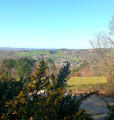
Starting from the medieval village of Burlats, via the ‘Chemin des Fontaines’, this walk allows you to appreciate the scale of the wide meander formed by the River Agout, and offers numerous views over the Sidobre and the Castraise plain.
In Burlats, the Counts of Trencavel built, away from the main roads, a sumptuous residence, hidden in a bend of the Agout valley. A true gem and a rare, perfectly preserved example of Romanesque civil architecture, this pavilion is named after Adélaïde, a countess with violet-coloured eyes who was celebrated in song and courted by the famous troubadours Arnaud de Mareuil and Alfonso II of Aragon.Also worth seeing: the ruins of the12th-century Benedictine abbey and the Bistoure Tower.
The Saut de la Truite waterfall from Burlats
3.31 mi
+909 ft
-892 ft
2h 20
Easy
Departure from Burlats (Tarn)
A walk through the woods to the Saut de la Truite waterfall from Burlats. The path starts with an uphill climb, offering spectacular views of the town of Burlats and its surroundings. After the climb, you will walk through nature before gradually returning to civilisation. To reach the Saut de la Truite waterfall, you will need to take a short stretch of road (with little traffic).