Country:
 City:
City:


Park at Place René Cassin next to Saint-Hilaire Church in Fréjeville.
(S/E) At the old wine press, take the street heading north to join Rue du Lavoir. At the bottom of the slope, turn left at the cross to take Route de la Mouline. Head towards the Lavoir de la Mouline bridge, which spans the Aybes.
(1) Continue along this wide track until you reach the bend where the Chemin du Quintal joins.
(2) Turn right, overlooking the cliffs of the Agout. Carry on until you reach the junction with the tarmac road to En Brugues.
(3) Turn right onto this road and follow it until you are near the junction with the D112. Turn right again and continue to the Tourette junction.
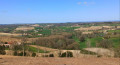
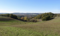
(4) Turn right to reach the Pioch orientation point.
(5) Return along the same route to the previous junction.
(4) Turn right and cross the Napoleon Bridge over the Aygues. Continue for about a hundred metres until you reach a crossroads with a footpath.
(6) Turn sharply right onto this path to reach La Négrarié; turn left, then right to reach the D50 road.
(7) Turn left onto it for about ten metres, then turn right onto the local track towards La Bouriette. Follow it to the crossroads at the hamlet of Le Rouch.
(8) Take the dirt track on the left. Stay on this track, turning right at the next crossroads to pass through the hamlet of En Sabarthés, then on to the hamlet of Pujol.
(9) Pass to the left of the statue of Saint Bartholomew and continue straight ahead. At the end of the street, turn left to head down the path leading towards the banks of the Agout. When you are almost at the bottom, join the tree-lined path on the right which climbs back up to Pujol. At the top, turn right once and then left twice to descend to the hamlet of La Grèze.
(10) Continue to the hamlet of Sarmes. Turn right onto the road running along the right bank of the Agout as far as the hamlet of Aupillac.
(11) Leave the banks of the Agout and turn right onto the track; continue on to reach a bridge just before the hamlet of La Gayé.
(12) Take the path on the left until you reach the junction with the road running alongside the Ginestière pond. Turn right here; you’ll soon come to a small bridge over the Nauze stream.
(13) Cross the bridge, then turn right onto the road. When you reach the pine tree overlooking a triangular clearing, turn left to return to the car park at Place René Cassin (S/E).


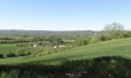
 . I really enjoyed it because a Sunday in the countryside is always lovely!!! However, be careful at the start… as the direction of the walk isn’t marked!!! Facing the old wine press, take your time, get your compass out and head north towards the village square – look for the yellow markings on a tree… the signposting is very subtle along the route…So watch out!!! Keep an eye on the road too! The orientation table isn’t essential, as you can only see as far as the north – 180° – but there’s a lovely view along the path leading there!!! A glimpse of the Pyrenees and the Montagne Noire, of course! I really enjoyed this walk, which took about 4 to 4½ hours! Well worth a go if you’re near Castres!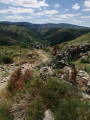
 Visorando Member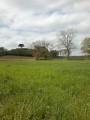

 Moderate
 Association / Club / Walk leader