


Refine your search for walks in Fleurey-sur-Ouche
Fleurey-sur-Ouche walks


 La Combe aux Mammouths
 Visorando Member
 10.77 mi
 +1,545 ft
 -1,522 ft
 6h 20
6h 20
 Difficult
 Departure from Fleurey-sur-Ouche (Côte-d'Or)
Combe d'Arvaux, known as Combe aux Mammouths, with its Cave aux Loups.
Lantenay via the Cave aux Loups from Fleurey-sur-Ouche
11.51 mi
+978 ft
-974 ft
6h 10
Difficult
Departure from Fleurey-sur-Ouche (Côte-d'Or)
A circular route starting from Fleurey-sur-Ouche that leads to two plateaus via the Cave aux Loups, a ruined feudal castle belonging to the Dukes of Burgundy, the Chapelle Saint-Louis, the Château de Lantenay and the Viaduc de Fain, before returning via the suburbs of Velars-sur-Ouche and the banks of the Ouche.
The Mediolanum archaeological site as seen from Fleurey-sur-Ouche
 10.75 mi
+515 ft
-489 ft
5h 25
10.75 mi
+515 ft
-489 ft
5h 25
 Moderate
Departure from Fleurey-sur-Ouche (Côte-d'Or)
Moderate
Departure from Fleurey-sur-Ouche (Côte-d'Or)
A circular route starting from Fleurey-sur-Ouche which, running alongside the Burgundy Canal, takes us to Pont de Pany before heading up towards La Chassagne (golf course, castle, farm and private aerodrome) to reach the archaeological site of Mediolanum. Return via the outskirts of Mâlain and Ancey, before heading back down to Fleurey through the Combe Jardin and the Bois de Morcueil.
The Cocheron Tower and the Orgère Rocks
6.09 mi
+614 ft
-604 ft
3h 20
 Easy
Departure from Fleurey-sur-Ouche (Côte-d'Or)
Easy
Departure from Fleurey-sur-Ouche (Côte-d'Or)
This lovely walk, starting from the cemetery in Fleurey-sur-Ouche, will take you along the Roches d’Orgère path, through the grassy areas bordering the Combe de Beuchail and the Ouche Valley. Along the way, you can admire the mushroom-shaped Pierre qui Vire. You’ll also climb to the summit of Cocheron Hill and walk through the Combe du Sène, amongst woods and fields. Along the way, there are some lovely views over the Ouche Valley and the villages of Malain, Ancey, Lantenay and, of course, Fleurey-sur-Ouche. Halfway through the walk, along Rue de la Croix Saint-Pierre and Rue du Colombier, you’ll spot an old winegrower’s house, as well as a few other very distinctive houses that blend perfectly into their natural surroundings.
A short walk around the Cocheron from Fleury-sur-Ouche
3.26 mi
+1,283 ft
-1,273 ft
2h 35
Easy
Departure from Fleurey-sur-Ouche (Côte-d'Or)
This lovely walk, starting from the Fleurey-sur-Ouche cemetery, will take you to the summit of the Colline du Cocheron and into the Combe du Sène, through woods and fields, with some lovely views of the Ouche valley, the hamlets of Malain, Ancey, Lantenay, and of course Fleurey-sur-Ouche, seen from above.
At the start of the walk, along Rue de la Croix Saint-Pierre and Rue du Colombier, you’ll spot an old winegrower’s house, as well as a few very distinctive houses that blend perfectly into their natural surroundings.
Around Ancey: Combe Piron and Belvédère de la Roche Aigüe
 4.54 mi
+778 ft
-778 ft
2h 45
Moderate
Departure from Ancey (Côte-d'Or)
4.54 mi
+778 ft
-778 ft
2h 45
Moderate
Departure from Ancey (Côte-d'Or)
This route, starting from Ancey, will allow you to discover this picturesque village and will take you from the mysterious, wooded Combe Piron to two viewpoints:- the Combe Piron viewpoint, overlooking the forest of the combe, Notre-Dame d'Étang and Mont Afrique,- the Roche Aigüe viewpoint, which offers views of the Ouche valley, the village of Mâlain, the cliffs of Baulme-la-Roche and the surrounding countryside.
On the way back, you can explore the Roche Aigüe limestone quarry, whose walls are pierced by two deep tunnels closed off by gates to protect the bats from curious humans.
Between Ancey and Baulme-la-Roche
 5.04 mi
+820 ft
-814 ft
3h 00
Moderate
Departure from Ancey (Côte-d'Or)
5.04 mi
+820 ft
-814 ft
3h 00
Moderate
Departure from Ancey (Côte-d'Or)
A beautiful view from Roche Aigüe and an interesting glimpse at old mining installations
Notre-Dame d'Étang via the Sainte-Anne Fountain
 5.30 mi
+653 ft
-650 ft
3h 00
Moderate
Departure from Velars-sur-Ouche (Côte-d'Or)
5.30 mi
+653 ft
-650 ft
3h 00
Moderate
Departure from Velars-sur-Ouche (Côte-d'Or)
A circular loop through the woods to (re)discover this famous monument in the Dijon region, which has undergone a beautifully executed restoration. And beautiful views of the Dijon region and the Ouche valley.
A very pleasant walk on a full moon night.
From Lantenay to Roche Aigüe via the coombs
 11.34 mi
+2,369 ft
-2,356 ft
7h 15
Difficult
Departure from Lantenay (Côte-d'Or) (Côte-d'Or)
11.34 mi
+2,369 ft
-2,356 ft
7h 15
Difficult
Departure from Lantenay (Côte-d'Or) (Côte-d'Or)
A good climb over a reasonable distance. A pleasant hike along the ridges of the combes, combining rocky landscapes, forests and caves. The route is fairly shady, ideal in fine weather.
Combes d’Arvaux, known as ‘The valley of mammoths’, in Lantenay
 6.66 mi
+955 ft
-945 ft
3h 55
Moderate
Departure from Lantenay (Côte-d'Or) (Côte-d'Or)
6.66 mi
+955 ft
-945 ft
3h 55
Moderate
Departure from Lantenay (Côte-d'Or) (Côte-d'Or)
A beautiful walk around Lantenay leading to the Pasques plateau via the little Chapelle Saint-Louis.The return journey takes you over the Combe d'Arvaux, with its panoramic views over the Ouche valley.
Circular route starting from Pont de Pany via Roche d'Anse, Urcy and Arcey
 10.35 mi
+1,614 ft
-1,631 ft
6h 10
Moderate
Departure from Sainte-Marie-sur-Ouche (Côte-d'Or)
10.35 mi
+1,614 ft
-1,631 ft
6h 10
Moderate
Departure from Sainte-Marie-sur-Ouche (Côte-d'Or)
In the forest of Velars-sur-Ouche, you’ll reach Mont Aigu amidst moss-covered hills, creating the impression of being in a spectacular world. At the Roche d’Anse viewpoint, a panorama unfolds over the surrounding plains and forested hills. You won’t want to miss taking a photo of the Anse just below. You’ll pass the 15th-century Château de Montculot. The building was unfinished when Lamartine acquired it in 1760. In the village of Urcy, you can have a picnic at the wash house near the church. On Rue Lamartine, a local sculptor exhibits unique works. Through the woods of Combe Roulé and then Combe à la Feuille, you’ll reach Arcey, where the houses have been beautifully renovated. Through the Arcey forest via the Jean Sage Trail, then the Bois de la Chapelle aux Chiens, you’ll arrive at the Burgundy Canal. Return to Pont de Pany by following the canal. If you wish, there is a pub near the station car park.
Roche d'Anse (Rock)
 4.83 mi
+876 ft
-876 ft
3h 00
Moderate
Departure from Sainte-Marie-sur-Ouche (Côte-d'Or)
4.83 mi
+876 ft
-876 ft
3h 00
Moderate
Departure from Sainte-Marie-sur-Ouche (Côte-d'Or)
The rocky spur of Roche d'Anse is the highest point of Plain de Suzard (532m). Like a bow, a natural arch completes the southern entablature, reminiscent of the cliff at Étretat.
Velars-sur-Ouche plateau
10.96 mi
+2,224 ft
-2,218 ft
7h 00
Moderate
Departure from Velars-sur-Ouche (Côte-d'Or)
Walk on the Velars-sur-Ouche plateau, on the border with Plombières-lès-Dijon, through woods and farmland, with sections through four valleys.
The Fontenotte and Tuilerie springs are on the route.
Circular route in the Liau Forest from the Moulin des Îles
10.44 mi
+1,247 ft
-1,220 ft
5h 55
Moderate
Departure from Sainte-Marie-sur-Ouche (Côte-d'Or)
Following a disused railway line before skirting the Burgundy Canal between Pont de Pany and Sainte-Marie-sur-Ouche, the route takes us on a circular route through the Liau Forest, passing through Arcey,
From the bottom to the top of Mont Afrique
 12.41 mi
+4,042 ft
-4,029 ft
9h 15
Difficult
Departure from Velars-sur-Ouche (Côte-d'Or)
12.41 mi
+4,042 ft
-4,029 ft
9h 15
Difficult
Departure from Velars-sur-Ouche (Côte-d'Or)
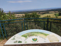
A challenging hike with elevation gain, ideal for preparing for mountain races.
La Cude - Le Leuzeu - Mont Afrique
10.69 mi
+2,142 ft
-2,146 ft
6h 45
Difficult
Departure from Velars-sur-Ouche (Côte-d'Or)
This hike, which includes a steep climb (called the Montée du Ouf by hikers from Dijon), allows you to discover the historic Leuzeu farm, which is very well equipped for hikers, and Mont Afrique, one of the highest points in the Côte d'Or.
The Rentes route starting from Flavignerot
 14.14 mi
+1,824 ft
-1,847 ft
8h 05
Difficult
Departure from Flavignerot (Côte-d'Or)
14.14 mi
+1,824 ft
-1,847 ft
8h 05
Difficult
Departure from Flavignerot (Côte-d'Or)
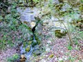
This route starts from Flavignerot and links the various ‘rentes’ (isolated farmsteads) in the western Dijon region
It thus links Mont Afrique, the ‘Rente Neuve’, the ‘Rente de Chamerey’, the ‘Rente de la Reppe’, the village of Clémencey, the ‘Rente des Écotois’ and the ‘Rente du Leuzeu’.
It offers the chance to explore the beautiful, unspoilt landscapes of the western Dijon region, a vast limestone plateau dominated by Mont Afrique at an altitude of 600 metres, deeply carved by numerous wild valleys.
Through the woods and vineyards from Flavignerot to Marsannay-La-Côte
13.67 mi
+2,067 ft
-2,051 ft
8h 05
Difficult
Departure from Flavignerot (Côte-d'Or)
A walk through wooded hills and vineyards, passing through four renowned wine-growing villages.
The three shelters from Flavignerot
 7.42 mi
+1,401 ft
-1,401 ft
4h 40
Moderate
Departure from Flavignerot (Côte-d'Or)
7.42 mi
+1,401 ft
-1,401 ft
4h 40
Moderate
Departure from Flavignerot (Côte-d'Or)
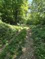
Discover the Rentes de Chamerey, Écotois and Leuzeu farms starting from Flavignerot. A short and different variation on the Rentes route. A completely shaded route with smooth trails and relatively gentle slopes will allow for easy progress that is accessible to most people.
Baulme-la-Roche site
 3.99 mi
+509 ft
-358 ft
2h 15
Easy
Departure from Baulme-la-Roche (Côte-d'Or)
3.99 mi
+509 ft
-358 ft
2h 15
Easy
Departure from Baulme-la-Roche (Côte-d'Or)
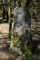
A route mainly through woodland on the hills above Baulme-la-Roche, leading to La Roche Aiguë and past an old boundary marker. In spring, you can see martagon lilies, pick daffodils and admire the villages of Baulme and Malain. A remarkable natural site featuring limestone grasslands, this area has been listed as a natural heritage site since 1942. The cliffs are part of an Area of Special Interest.
Roche Aigüe and Baulme-la-Roche Cliffs Viewpoints
 4.46 mi
+604 ft
-574 ft
2h 35
Easy
Departure from Baulme-la-Roche (Côte-d'Or)
4.46 mi
+604 ft
-574 ft
2h 35
Easy
Departure from Baulme-la-Roche (Côte-d'Or)
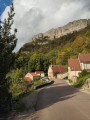
A lovely walk along the hills between Baulme-la-Roche and La Roche Aigüe, overlooking Malain and the Ouche valley. You can admire the springs of the Douix at the entrance to the village of Baulme-la-Roche, with a small cave, a restored wash house and a water reservoir nearby. You’ll pass through this picturesque village and, from above, can admire the lush green countryside stretching between Baulme-la-Roche and Malain.
More walks in Fleurey-sur-Ouche
Select a point of interest below: