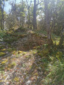
Baulme-la-Roche site

A route mainly through woodland on the hills above Baulme-la-Roche, leading to La Roche Aiguë and past an old boundary marker. In spring, you can see martagon lilies, pick daffodils and admire the villages of Baulme and Malain. A remarkable natural site featuring limestone grasslands, this area has been listed as a natural heritage site since 1942. The cliffs are part of an Area of Special Interest.

Details

107658416
Creation:
Last update:
Last review:
  • Walking
    Activity: Walking
  • ↔
    Distance: 3.99 mi
  • ◔
    Average duration: 2h 15 
  • ▲
    Difficulty: Easy

  • ⚐
    Back to start: Yes
  • ↗
    Ascent: + 509 ft
  • ↘
    Descent: - 358 ft

  • ▲
    Highest point: 2,149 ft
  • ▼
    Lowest point: 1,854 ft

Photos

Description of the walk

Car park at a place called Les Roches on the D104c.

(S/E) With your back to the car park, head south-east until you reach a Fork in the road.

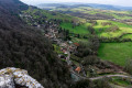
(1) Ignore the left-hand fork, which will be the return route, and continue along the right-hand path until you reach the viewpoint overlooking the village.

(2) Carry on along the path through the woodland, ignoring the paths on the left, until you reach a junction.

(3) Carry on straight ahead, passing a path on your left.

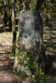
(4) At the next junction, turn left towards the south-east and walk past the boundary stone bearing the coat of arms.

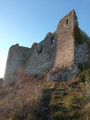
(5) Climb up to the left along a steep, root-covered slope. At the top, turn right to join a tarmac road leading to La Roche Aiguë. Follow it to the right to make a round trip to the viewpoint overlooking Malain: the communications masts.

(6) Retrace your steps and continue right along the road for 200 metres.

(7) Leave the road, turn left heading north-west and head for a crossroads of footpaths.

(8) Turn right, go straight on, heading due north; ignore all the paths to the right and left and carry on straight ahead until you reach a junction of several paths

(9) Turn left into a small passage (two red markings at the entrance) and head to the old shed, a hunters’ shelter.

(10) Take the second path on the right, which runs diagonally, and head back to the original fork you passed on the way out.

(1) Continue to the right to return to the car park (S/E).

Waypoints

  1. S/E : mi 0 - alt. 1,854 ft - Car park at a place called Les Roches on the D104c
  2. 1 : mi 0.26 - alt. 1,988 ft - Crossroads at the end of the circular loop
  3. 2 : mi 0.45 - alt. 2,005 ft - View of the village
  4. 3 : mi 1 - alt. 2,024 ft - Crossroads
  5. 4 : mi 1.31 - alt. 2,031 ft - Crossroads
  6. 5 : mi 1.52 - alt. 2,005 ft - Steep, root-covered slope
  7. 6 : mi 1.89 - alt. 2,149 ft - Antennae
  8. 7 : mi 2.11 - alt. 2,090 ft - Fork in the path
  9. 8 : mi 2.33 - alt. 2,083 ft - Crossroads of footpaths
  10. 9 : mi 3.29 - alt. 1,985 ft - Crossroads
  11. 10 : mi 3.49 - alt. 2,037 ft - Hunters’ shelter
  12. S/E : mi 3.99 - alt. 2,005 ft - Car park at a place called Les Roches on the D104c

Notes

Hunters’ shelter at point (10).

Municipal boundary marker between points (4) and (5).

Worth a visit

The boundary marker, bearing a coat of arms and engraved with a bishop’s (or abbot’s) crozier, is situated near La Roche-Aigüe, on the boundary between the municipalities of Ancey and Baulme-la-Roche in Côte-d’Or (Burgundy).

In spring, martagon lilies.

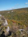
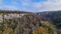
View over Baulme-la-Roche and the surrounding hills.

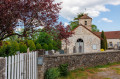
View of Malain.

Other walks in the area

For more walks, use our search engine .

The GPS track and description are the property of this route's author. Please do not copy them without permission.