Roche Aigüe and Baulme-la-Roche Cliffs Viewpoints

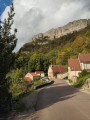
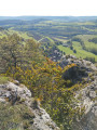
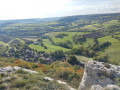
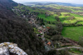
A lovely walk along the hills between Baulme-la-Roche and La Roche Aigüe, overlooking Malain and the Ouche valley. You can admire the springs of the Douix at the entrance to the village of Baulme-la-Roche, with a small cave, a restored wash house and a water reservoir nearby. You’ll pass through this picturesque village and, from above, can admire the lush green countryside stretching between Baulme-la-Roche and Malain.

Details

n°69380957
Creation:
Last update:
Last review:
  • Walking
    Activity: Walking
  • ↔
    Distance: 4.46 mi
  • ◔
    Average duration: 2h 35 
  • ▲
    Difficulty: Easy

  • ⚐
    Back to start: Yes
  • ↗
    Ascent: + 604 ft
  • ↘
    Descent: - 574 ft

  • ▲
    Highest point: 1,978 ft
  • ▼
    Lowest point: 1,421 ft

Photos

Description of the walk

Park in the car park at the Baulme-la-Roche cliffs.

(S/E) Head right onto the road towards Baulme-la-Roche for a few dozen metres, then take the signposted path that descends towards the village. At the bottom of the path, you’ll come to a road. Follow it to the left for a few metres, then turn left to reach the Baulme-la-Roche wash house at the entrance to the village.

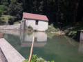
(1) Take the small path leading uphill to the right, then cut through the woods to the source of the Douix. Walk round the spring and head back towards the village, admiring the reservoir and the washhouse on your right. Continue left along Rue Georges Clémenceau until you reach Baulme-la-Roche Town Hall.

(2) Turn left onto Rue du Maréchal Foch; at the end of the houses, you’ll reach a Y-junction marked by a cross.

(3) Turn right onto the track through the hedgerow, follow a power line, then enter the woodland. At the end of the track, carry on straight ahead along the path that follows it. You’ll reach a Y-junction.

(4) Carry on straight ahead for about a hundred metres, then keep to the right at the next junction. Walk gently uphill to a junction at the foot of Roche Aigüe.

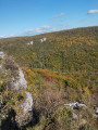
(5) Take care here: this is a tricky section. Do not stray from the GPS track; head diagonally to the right and, via a steep climb, reach the transmission masts and Roche-Aigüe, with the viewpoint below.

(6) Head up towards the mast, then follow the tarmac road for about 100 metres, passing the first path on your left. Further along the road, you’ll come to a junction of paths.

(7) Take the signposted path on the left; a few metres further on, leave the signposted path and turn left, then return to the Y-junction you passed earlier.

(4) Turn right and, following a very gentle climb through the forest, you’ll emerge at a rest area in a clearing.

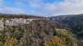
(8) Take the signposted path opposite and continue uphill towards the cliffs. Pass the paragliding launch site and finish the climb at the Baulme-la-Roche Cliffs Viewpoint with its orientation table.

(9) Carry on, following the signposts, to easily return to the Baulme-la-Roche cliffs car park (S/E).

Waypoints

  1. S/E : mi 0 - alt. 1,854 ft - Car park at the Baulme-la-Roche cliffs
  2. 1 : mi 0.56 - alt. 1,476 ft - Washing place, cave and resurgences of the Douix
  3. 2 : mi 0.74 - alt. 1,427 ft - Baulme-la-Roche Town Hall
  4. 3 : mi 0.96 - alt. 1,539 ft - Crossroads
  5. 4 : mi 1.88 - alt. 1,831 ft - Crossroads at the end of the circular loop
  6. 5 : mi 2.1 - alt. 1,962 ft - Foot of Roche Aigüe
  7. 6 : mi 2.19 - alt. 1,959 ft - Roche Aigüe viewpoint
  8. 7 : mi 2.48 - alt. 1,903 ft - Y-junction
  9. 8 : mi 3.42 - alt. 1,857 ft - Clearing, designated rest area
  10. 9 : mi 4.01 - alt. 1,854 ft - Baulme-la-Roche Cliffs Viewpoint
  11. S/E : mi 4.46 - alt. 1,854 ft - Car park at the Baulme-la-Roche cliffs

Worth a visit

(1) Source de la Douix: its waters are swelled by the resurgence of the Ruisseau de Pâques, which flows through a siphon at the bottom of the enclosed Combe Pélerin valley (below the car park where you are parked).
(1) Above the spring is a small cave, guaranteed to be cool in summer.
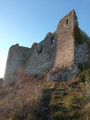
Between (2) and (3) enjoy this picturesque village and the view of the castle below.
Between (3) and (4), you’ll see a tunnel and the remains of an old gypsum quarry on the right-hand side of the valley.
(6) Roche Aigüe viewpoint: enjoy the sweeping view and take a break, perhaps sitting on the small seats cut out of tree trunks with a chainsaw.

Reviews and comments

4.2 / 5
Based on 2 reviews

Reliability of the description
4 / 5
Ease of following the route
4 / 5
Route interest
4.5 / 5
Oudot
Oudot

Overall rating : 3.3 / 5

Date of your route : Jun 24, 2025
Reliability of the description : ★★★☆☆ Average
Ease of following the route : ★★★☆☆ Average
Route interest : ★★★★☆ Good
Very busy route : No

The directions provided are sometimes vague, and the signposting on the ground is not always easy to spot.
Beautiful views.
No particular difficulties.
It might be worth noting that the car park is at the village exit, on the right (and not the first car park on the left)

Machine-translated

Lauram70
Lauram70

Overall rating : 5 / 5

Date of your route : Apr 10, 2025
Reliability of the description : ★★★★★ Very good
Ease of following the route : ★★★★★ Very good
Route interest : ★★★★★ Very good
Very busy route : No

A walk that isn’t particularly difficult, apart from the long descent at the start. You cover the entire descent in one go, and then climb it back up at a leisurely pace for the rest of the walk!
The spring and the wash house are the route’s little highlights

Machine-translated

Other walks in the area

For more walks, use our search engine .

The GPS track and description are the property of this route's author. Please do not copy them without permission.