Refine your search for walks in Druelle
Druelle walks


 Between Brienne and Aveyron
 Visorando Member
 7.34 mi
 +1,276 ft
 -1,276 ft
 4h 30
4h 30
 Moderate
 Departure from Druelle (Aveyron)
A lovely walk through the woods between the Brienne Valley and the Aveyron Valley.
Route of discovery of the historic centre of Rodez
2.58 mi
+144 ft
-144 ft
1h 20
 Easy
Departure from Rodez (Aveyron)
Easy
Departure from Rodez (Aveyron)
The city of Rodez, former capital of Rouergue, perched on its "piton" (peak), is undoubtedly worth a more in-depth visit. However, during a stopover, this walk allows you to discover some of the historic centre's most iconic buildings. You can also add on a visit to the Soulages Museum.
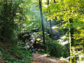
The Cross of Nances and the Bois d'Enfer
 6.83 mi
+1,273 ft
-1,270 ft
4h 15
Moderate
Departure from Moyrazès (Aveyron)
6.83 mi
+1,273 ft
-1,270 ft
4h 15
Moderate
Departure from Moyrazès (Aveyron)
A lovely walk from the charming village of Moyrazes, which overlooks the Aveyron valley and its magnificent panoramic views.
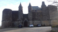
Three castles route in Onet-le-Château
 5.99 mi
+387 ft
-374 ft
3h 05
Moderate
Departure from Onet-le-Château (Aveyron)
5.99 mi
+387 ft
-374 ft
3h 05
Moderate
Departure from Onet-le-Château (Aveyron)
A route in nature, yet very close to Rodez. You can admire three castles and old houses along the route.
Circular route around Combelle via Istournet
 5.82 mi
+453 ft
-443 ft
3h 05
Easy
Departure from Le Monastère (Aveyron)
5.82 mi
+453 ft
-443 ft
3h 05
Easy
Departure from Le Monastère (Aveyron)
Short, shaded walk along the Monastery section of the Briane and heath. Then, walk through Combelles Park with its horses and activities. On leaving, a path will take you to a limestone plateau and finally, the last part towards Istournet and its small lake will guide you to the Banocres plateau, which offers superb views of Rodez and the Aubrac.
Around Salles-la-Source
 3.71 mi
+610 ft
-604 ft
2h 15
Easy
Departure from Salles-la-Source (Aveyron)
3.71 mi
+610 ft
-604 ft
2h 15
Easy
Departure from Salles-la-Source (Aveyron)
A short hike suitable for everyone, ideal for children, with a few gentle slopes but no particular difficulties.
Loop of the four estates in Sébazac
 5.77 mi
+351 ft
-351 ft
2h 55
Easy
Departure from Sébazac-Concourès (Aveyron)
5.77 mi
+351 ft
-351 ft
2h 55
Easy
Departure from Sébazac-Concourès (Aveyron)
An easy hike on the outskirts of Rodez, allowing you to discover four mansions with remarkable architecture typical of the Causse Comtal, the limestone plateau of the Counts of Rodez. This region, with its strong agricultural tradition, is full of estates, including those visible here, which bear witness to a rich past.
From the basilica to the oratory at Ceignac
 2.50 mi
+344 ft
-367 ft
1h 25
Easy
Departure from Calmont (Aveyron)
2.50 mi
+344 ft
-367 ft
1h 25
Easy
Departure from Calmont (Aveyron)
A walk to enjoy on your own or with the family. Lots of tree-lined paths, some of which are narrow. Starting from the Basilica of Notre-Dame de Ceignac, the route follows small streams before becoming circular and returning to the start, passing in front of the oratory.
The Causse de Salles-la-Source starting from Pont-les-Bains
 7.19 mi
+1,004 ft
-971 ft
4h 10
Moderate
Departure from Salles-la-Source (Aveyron)
7.19 mi
+1,004 ft
-971 ft
4h 10
Moderate
Departure from Salles-la-Source (Aveyron)
Discover the Rougier de Marcillac and the Causse de Salles-la-Source.
Exploring the Ségala on foot: The Lakes Trail
 Tourist office
 6.29 mi
+614 ft
-614 ft
3h 25
Moderate
Departure from Baraqueville (Aveyron)
6.29 mi
+614 ft
-614 ft
3h 25
Moderate
Departure from Baraqueville (Aveyron)
This is the land of white water and a thousand springs that feed numerous streams and small lakes further downstream. A short detour at the town’s main crossroads allows you to see three spires: since 1997, they have stood at the centre of the crossroads where Baraqueville was founded, clearly marking the place the town intends to retain at the heart of the Ségala, that of the main hub for events and interaction. The three spikes symbolise the Ségala’s past and give way between them to the three roads of the crossroads, which, when viewed from above, form the spokes of a turning wheel.
The Buenne via Le Teil
 7.43 mi
+738 ft
-735 ft
4h 05
Moderate
Departure from Mayran (Aveyron)
7.43 mi
+738 ft
-735 ft
4h 05
Moderate
Departure from Mayran (Aveyron)
A bit of history
The area overlooked by the Buenne is bordered to the south by the Aveyron valley. On its northern flank, the 11th-century Soulié Chapel is a fine example of Romanesque architecture with its remarkable altar. Higher up on the plateau, the Cistercian Abbey of Bonnecombe had established in Ruffepeyre, at the foot of the ‘draye’ – a track used for the transhumance of herds – both a manorial centre to manage all the rights and tenures it held in this area, and a seat of justice; the tower (14th century) was the main feature of this fortified house.
Dolmen and La Roque spring, starting from Salles-la-Source
 2.82 mi
+525 ft
-551 ft
1h 45
Easy
Departure from Salles-la-Source (Aveyron)
2.82 mi
+525 ft
-551 ft
1h 45
Easy
Departure from Salles-la-Source (Aveyron)
Highlights of this walk include:
- exploring a dolmen,
- a panoramic view of the limestone plateaus grazed by cows,
- a short detour to the source of the Roque (optional),
- a walk down to La Roque waterfall,
- views over the Roque and Créneau valleys.
Around Magrin – views of the Viaur valley and the wind turbines
3.52 mi
+184 ft
-197 ft
1h 45
Easy
Departure from Calmont (Aveyron)
A circular walk passing through the village of Magrin. The final section of the walk offers a lovely view of the Viaur valley and the wind turbines.
The Combes walk from Puech de Cassagne-Comtaux
3.44 mi
+141 ft
-144 ft
1h 40
Easy
Departure from Goutrens (Aveyron)
Amidst fields and meadows, shaded paths and tracks wind through a gently rolling agricultural landscape. An easy walk suitable for families.
The Créneau balcony
 10.31 mi
+1,325 ft
-1,306 ft
5h 55
Moderate
Departure from Marcillac-Vallon (Aveyron)
10.31 mi
+1,325 ft
-1,306 ft
5h 55
Moderate
Departure from Marcillac-Vallon (Aveyron)
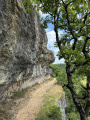
From Marcillac-Vallon, climb up to admire the Créneau valley on the right bank, with its waterfall gushing out in the middle of the village of Salles-la-Source. Then cross to the other bank to return first along a balcony path and then along a small road and shaded paths, inviting you to enjoy a bucolic walk that ends with a view of the valley from the famous Pont Rouge bridge in Marcillac-Vallon.
The chapels of Marcillac-Vallon
 8.05 mi
+1,532 ft
-1,526 ft
5h 00
Moderate
Departure from Marcillac-Vallon (Aveyron)
8.05 mi
+1,532 ft
-1,526 ft
5h 00
Moderate
Departure from Marcillac-Vallon (Aveyron)
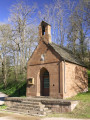
This circular route combines tarmac sections with an original route to discover four chapels located around the village of Marcillac-Vallon. Two marked sections (GR® 62 andPR®) make it easier to follow thesecond part of the route, from Saint-Jean-le-Froid, the highest point of this itinerary focused on small religious heritage sites.
Please note: a return variant has just been published following the deterioration of the path in the Bruéjouls ravine.
The Three Panoramas Walk via Cassagne-Comtaux
3.69 mi
+108 ft
-105 ft
1h 50
Easy
Departure from Goutrens (Aveyron)
With its beautiful views and architectural heritage, this easy walk is ideal for a pleasant family outing.
The Belcastel Ridge Route
 1.72 mi
+440 ft
-440 ft
1h 10
Easy
Departure from Belcastel (Aveyron)
1.72 mi
+440 ft
-440 ft
1h 10
Easy
Departure from Belcastel (Aveyron)
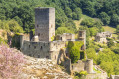
This route overlooks one of the “Most Beautiful Villages in France”: Belcastel and its castle, transporting you back 1,000 years.
The Roc d’Anglars and the Lourdou
 4.37 mi
+840 ft
-837 ft
2h 45
Easy
Departure from Belcastel (Aveyron)
4.37 mi
+840 ft
-837 ft
2h 45
Easy
Departure from Belcastel (Aveyron)
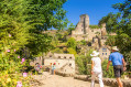
Walk this trail in one of the “Most Beautiful Villages of France”: Belcastel, selected in 2023 to represent Occitanie on the television programme *Le Village Préféré des Français*. Explore over 1,000 years of history as you make your way to the Roc d’Anglars. This is a largely shaded walk throughout.
The Tour de Belcastel via the footbridge
 0.77 mi
+33 ft
-33 ft
0h 25
Easy
Departure from Belcastel (Aveyron)
0.77 mi
+33 ft
-33 ft
0h 25
Easy
Departure from Belcastel (Aveyron)
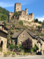
This very short walk is suitable for everyone and can be done with a pushchair. You’ll walk alongside Belcastel as far as the footbridge and return to the village via a shaded path.
Le Lourdou: Way of the Cross in Belcastel
 1.66 mi
+187 ft
-164 ft
0h 55
Easy
Departure from Belcastel (Aveyron)
1.66 mi
+187 ft
-164 ft
0h 55
Easy
Departure from Belcastel (Aveyron)
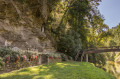
This walk is suitable for everyone (although there are some difficulties accessing the Roc d’Anglars fort) and is partly shaded.
The Ségala: the Marsende Stream
3.37 mi
+548 ft
-535 ft
2h 00
Easy
Departure from Boussac (Aveyron)
A walk through the ‘Land of 100 Valleys’, following a secret and unspoilt valley,
In the heart of the village of Boussac, with its traditional houses, stands a remarkable church, originally built in the 13th century and subsequently fortified by its inhabitants during the 14th and 15th centuries to protect the local population from the English invasion. Battlements, arrow slits and machicolations still bear witness today to the building’s defensive purpose.
Loop around Belcastel
 4.11 mi
+889 ft
-866 ft
2h 40
Easy
Departure from Belcastel (Aveyron)
4.11 mi
+889 ft
-866 ft
2h 40
Easy
Departure from Belcastel (Aveyron)
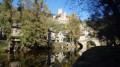
A tour around the valley of one of the most beautiful villages in France, Belcastel, with several viewpoints over its castle, its old bridge and the village below. You will also pass by the Fort du Roc d'Anglars, and on the way down via the Way of the Cross, you will discover the Lourdou cave with its Virgin Mary.
Exploring the Ségala on foot: Towards Belcastel
 6.62 mi
+1,283 ft
-1,306 ft
4h 10
Moderate
Departure from Colombiès (Aveyron)
6.62 mi
+1,283 ft
-1,306 ft
4h 10
Moderate
Departure from Colombiès (Aveyron)
Set in the heart of the Ségala’s rich agricultural landscape, the village of Colombies still boasts beautiful medieval houses, some dating back to the 15th century. This village has retained a certain harmony even in its official buildings, such as the town hall and its porch. Its Romanesque-style church, built in 1880, stands in the centre of a small square near a landscaped fountain.
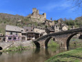
This walk, marked with yellow signposts, will take you to one of the Most Beautiful Villages in France, Belcastel.
Farrebique and Biquefarre Trail
4.76 mi
+223 ft
-223 ft
2h 25
Easy
Departure from Goutrens (Aveyron)
This walking route takes you to the locations chosen by Georges Rouquier for the filming of the films *Farrebique* and *Biquefarre*, released in 1946 and 1983 respectively. Made thirty-eight years apart, these two films were shot in the same location and featured the same non-professional actors playing themselves.
*Farrebique*, filmed from November 1943 to November 1945, and *Biquefarre*, from autumn 1982 to May 1983, depict the daily life of Georges Rouquier’s family, who lived in the village of Goutrens.
As you move from one filming location to another, you’ll have the chance to observe the surroundings and the framing of the scenes for yourself… This will give you a better understanding of how this great filmmaker worked and, above all, when you watch his films for the first or second time, you’ll see each scene in a different light.
In the Land of Georges Rouquier in Goutrens
8.27 mi
+968 ft
-961 ft
4h 40
Moderate
Departure from Goutrens (Aveyron)
Facing south, the vines of the ‘fer servadou’ variety – known locally as ‘mansois’ and elsewhere as ‘braucol’ – are producing the next vintage of Marcillac. The vineyard was awarded AOC status in 1990.
The Cruou Valley
 7.10 mi
+932 ft
-932 ft
4h 05
Moderate
Departure from Salles-la-Source (Aveyron)
7.10 mi
+932 ft
-932 ft
4h 05
Moderate
Departure from Salles-la-Source (Aveyron)
At the gateway to the Marcillac vineyards, on the Causse Comtal plateau, a notch in the Vallée du Cruou splits this hub of civilisation where châteaux and manor houses dot the landscape among the devèzes, woods and streams.
Causse de Lanhac cazelles route (northern circular)
4.63 mi
+43 ft
-43 ft
2h 10
Easy
Departure from Rodelle (Aveyron)
This hike is partly the same as the hike (Causse de Lanhac cazelles route, southern circular). The route is the same for both routes up to point (4).
A land of pastoralism, the Causse de Lanhac has preserved not only its fauna and flora, but also an important heritage. No fewer than twenty cazelles are listed there.A volunteer association attached to the Rodelle rural community centre has been working for several years to restore these buildings, which have suffered the ravages of time. This hike will allow you to discover the northern part of the area
Circuit of the cazelles of the Causse de Lanhac, southern loop
4.96 mi
+1,053 ft
-1,040 ft
3h 10
Moderate
Departure from Rodelle (Aveyron)
This hike is partly the same as the "Circuit des cazelles du Causse de Lanhac boucle Nord" hike. The route is the same for both circuits until (8). Marked with "Espace Naturel Sensible (ENS)" signs. A pastoral land, the Causse de Lanhac has preserved not only its fauna and flora but also an important heritage. No fewer than twenty cazelles are listed there. A volunteer association, attached to the Rodelle rural community centre, has been working for several years to restore these buildings, which have suffered the ravages of time. This hike will allow you to discover the southern part of the site.