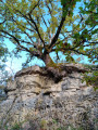
The Combes walk from Puech de Cassagne-Comtaux

Amidst fields and meadows, shaded paths and tracks wind through a gently rolling agricultural landscape. An easy walk suitable for families.

Details

71374899
Creation:
Last update:
Last review:
  • Walking
    Activity: Walking
  • ↔
    Distance: 3.44 mi
  • ◔
    Average duration: 1h 40 
  • ▲
    Difficulty: Easy

  • ⚐
    Back to start: Yes
  • ↗
    Ascent: + 141 ft
  • ↘
    Descent: - 144 ft

  • ▲
    Highest point: 1,886 ft
  • ▼
    Lowest point: 1,791 ft

Description of the walk

Starting point: Puech de Cassagnes-Comtaux.

(S/E) Head down the RD 651 and take the second track on the right: the Chemin de la Croix Saint-Laurent. Take the first right, then at the second junction go straight ahead and continue to a crossroads of footpaths.

(1) Turn left at the Fork in the road and then left onto the Route du Lac, then turn right onto the Chemin des Chênes. At the Fork in the road, turn right and continue straight on to La Palairie.

(2) At the junction, leave the hamlet of La Palairie on your right and carry on straight ahead along the Route de Clairvaux, then turn left onto the Route du Bois de l’Homs until you reach the crossroads at the end.

(3) Turn left onto a wide track, which you then leave to continue straight ahead along a sunken path. Follow the path to the end.

(4) Turn left onto a farm track which rejoins the Route de Clairvaux. Cross over and take the Chemin des Combes straight ahead, which leads to the hamlet of Le Lac.

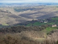
(5) At the crossroads, turn right onto the Route de la Borie de Cassagnes, and at the bend, between two buildings, take the Sentier du Point de Vue de Cassagnes straight ahead until you reach the viewpoint on the left at the end of the path(magnificent panoramic view over the Clairvaux valley and the vineyards).

(6) With your back to the viewpoint, rejoin the RD 651 to the right, heading towards the Puech de Cassagnes-Comtaux (S/E).


Waypoints

  1. S/E : mi 0 - alt. 1,877 ft - Puech de Cassagnes-Comtaux
  2. 1 : mi 0.48 - alt. 1,850 ft - Junction with footpath
  3. 2 : mi 1.2 - alt. 1,831 ft - La Palairie
  4. 3 : mi 1.74 - alt. 1,870 ft - Junction
  5. 4 : mi 2 - alt. 1,870 ft - End of the trail
  6. 5 : mi 2.97 - alt. 1,886 ft - La Borie and Le Lac
  7. 6 : mi 3.09 - alt. 1,870 ft - La Borie drystone shelter viewpoint
  8. S/E : mi 3.44 - alt. 1,877 ft - Puech de Cassagnes-Comtaux

Notes

Practical information

·Toilets and drinking fountains near the village hall at Puech de Cassagnes-Comtaux

·Picnic tables: Puech de Cassagnes and the Borie de Cassagnes drystone shelter

·Outdoor defibrillators at the Cassagnes-Comtaux village hall

Worth a visit

Nearby

In Cassagnes-Comtaux:

-Former 15th-century fortified town, church, historic houses, ruins

-Marcillac vineyards; Domaine du Cros (sales and tastings)

-Panoramic views over the Marcillac vineyards, the Clairvaux valley and Bruéjouls

-The Serre dolmen, listed as a historic monument

-In La Palairie: the ‘Nos Campagnes d’Autrefois’ museum, showcasing rural life before 1950

-At the Bois de l’Homs: the source of the Alzou, a tributary of the Aveyron

Reviews and comments

4 / 5
Based on 3 reviews

Reliability of the description
4 / 5
Ease of following the route
3.7 / 5
Route interest
4.3 / 5
auriat
auriat

Well-maintained paths… A lovely little walk… not particularly interesting… apart from two viewpoints.

Machine-translated

Office de tourisme du Pays Rignacois

Thank you for your feedback, and enjoy your walks in the Rignac region!

Machine-translated

auriat
auriat

Overall rating : 4 / 5

Date of your route : Sep 07, 2026
Reliability of the description : ★★★★☆ Good
Ease of following the route : ★★★★☆ Good
Route interest : ★★★★☆ Good
Very busy route : No

An interesting walk with lovely views both on the way there and back…
An easy walk through the countryside… a well-maintained path through open countryside… fairly shaded.

Machine-translated

User 25644638

Overall rating : 4.3 / 5

Date of your route : May 31, 2025
Reliability of the description : ★★★★☆ Good
Ease of following the route : ★★★★☆ Good
Route interest : ★★★★★ Very good
Very busy route : No

Contrary to the previous review, the path had been cleared. It really is an easy walk, with lovely shaded paths and scenic viewpoints. The signposting isn’t in place yet.

Machine-translated

User 15942582

Overall rating : 3.7 / 5

Date of your route : May 18, 2025
Reliability of the description : ★★★★☆ Good
Ease of following the route : ★★★☆☆ Average
Route interest : ★★★★☆ Good
Very busy route : No

Some of the paths were barely visible and difficult to walk on, so we had a lot of trouble finding our way.
It’s a shame, as the circular walk is interesting, with some lovely discoveries and views.
App performance: Very good

Machine-translated

Other walks in the area

For more walks, use our search engine .

The GPS track and description are the property of this route's author. Please do not copy them without permission.