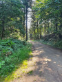
Starting point: the Croix de Bel viewpoint on the D43.
(S/E) Cross the D43 with care and take the Chemin du Dolmen de la Serre (you can make a return trip to the dolmen via a gate on the left after the farm). Arrive at Cassagnes-Comtaux.
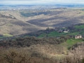
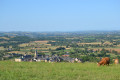
(1) Once in Cassagnes-Comtaux, cross the D651 with care and walk across the grassy esplanade at Puech de Cassagnes (panoramic view of the Clairvaux valley and Bruéjouls). Head right towards the war memorial and the TV relay station, then follow the D651 to the viewpoint:panoramic views of Vieux Cassagnes and the Clairvaux and Bruéjouls valleys.
(2) Cross the D651 with care to join the Cassagnes Viewpoint Trail, which leads to La Borie. Continue straight on. At the junction, go straight on along the Route du Lac until you reach a Fork in the road opposite.
(3) Turn right onto a path. Cross the D43, taking care as always, to join the Route de la Cassou de Poux.
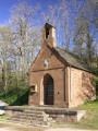
(4) After the bend to the left, turn right onto the Passage de Poux. At the junction, turn left, then immediately right to reach the Croix de Bel (panoramic view of the Glassac valley, the Aubrac and the Cantal mountains) (S/E).
Waypoints
S/E : mi 0 - alt. 1,827 ft - Croix de Bel viewpoint on the D43
2 : mi 1.48 - alt. 1,870 ft - La Borie drystone shelter viewpoint
3 : mi 2.42 - alt. 1,821 ft - Intersection
4 : mi 3.11 - alt. 1,834 ft - Lice
S/E : mi 3.69 - alt. 1,827 ft - Croix de Bel viewpoint on the D43
Notes
·Toilets and water points near the village hall at Puech de Cassagnes-Comtaux
·Picnic tables: Puech de Cassagnes, the Croix de Bel viewpoint and the Borie de Cassagnes drystone shelter
·Outdoor defibrillators at the Cassagnes-Comtaux village hall
Recommendations:
- Wear suitable footwear. - Take some food and drink with you. - Walkers follow the route at their own risk. They remain responsible for any accidents they may suffer and for any damage they may cause to others (forest fires, vandalism, pollution, etc.). - Stick to the marked paths and do not take shortcuts. If the route has been altered, follow the new signposting. - Be considerate. We are not the only ones using the paths; be mindful of others. - Take your rubbish away with you. Leave no trace of your visit; do not throw anything on the ground; carry a rubbish bag with you. - Keep your dog on a lead, particularly near homes or livestock. - Close gates and fences behind you, and walk around crops. We should respect the work of those who shape and preserve our environment. - Observe the rules in certain areas. - Do not light fires. Areas with dense vegetation (forests) or those that are too exposed (scrubland, dry heathland, etc.) can catch fire very quickly. - Do not drink water from streams. Clear water does not necessarily mean it is safe to drink. - Check hunting seasons; some routes may be dangerous.
Worth a visit
In the village of Goutrens:
The Espace Georges Rouquier, a museum dedicated to the filmmaker who specialised in rural life, director of *Farrebique* and *Biquefarre*, and a cinema.
E15th-century processional cross, listed as a historic monument, on display in Goutrens church.
Playground.
Café/restaurant.
In Cassagnes-Comtaux:
A former15th-century fortified town, church, old houses and ruins.
Marcillac vineyards; the Cros wine estate (sales and tastings).
Panoramic views over the Marcillac vineyards, the Clairvaux valley and Bruéjouls.
At the Bois de l’Homs: the source of the Alzou, a tributary of the Aveyron
Reviews and comments
5 / 5
Based on 1 review
Reliability of the description 5 / 5
Ease of following the route 5 / 5
Route interest 5 / 5
Office de tourisme du Pays Rignacois
Thank you for your comment, and we hope you enjoy your walks!
Machine-translated
lacombe bernadette
Overall rating :
5 / 5
Date of your route : Oct 19, 2026 Reliability of the description : ★★★★★ Very good Ease of following the route : ★★★★★ Very good Route interest : ★★★★★ Very good Very busy route : Yes
A short walk to share with friends and family, offering panoramic views of almost the entire route. It’s not at all difficult – just a lovely spot to take in the views. Thank you!
To open this route on your smartphone, you must have the Visorando app installed. If not, got to the Apple Store (iPhone) or Google Play Store (Android) to download the app.



 Country:

 City:




 Tourist office
 Moderate

 Visorando Member