Between Brienne and Aveyron

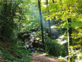
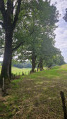
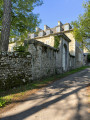
A lovely walk through the woods between the Brienne Valley and the Aveyron Valley.

Details

6182166
Creation:
Last update:
Last review:
  • Walking
    Activity: Walking
  • ↔
    Distance: 7.34 mi
  • ◔
    Average duration: 4h 30 
  • ▲
    Difficulty: Moderate

  • ⚐
    Back to start: Yes
  • ↗
    Ascent: + 1,276 ft
  • ↘
    Descent: - 1,276 ft

  • ▲
    Highest point: 2,083 ft
  • ▼
    Lowest point: 1,617 ft

Description of the walk

Park at the bend in the road between the hamlets of Sanhes and Le Rival (take care not to block access to the adjacent meadows). If this is full, try to park at the hamlet of Le Rival a little further down.

(S/E) Start the walk by continuing straight ahead along the path you are on.

(1) Ignore a path branching off to the left (this will be your return route) and follow the red and white markings ofthe GR®62Bsouth-eastwards.

(2) At the junction, take the road on your left. At the next junction, carry on straight ahead and, 100 metres further on, take the path that goes straight down. At the hamlet known as La Brienne, take the path on your left and carry on straight ahead (south-west). Keep following theGR® markings.

(3) At the crossroads, carry straight on along the main track, leaving the GR®. Near the barn, carry straight on where the climb is gentler.

(4) At the junction, carry on straight ahead (east-north-east). Several paths do not appear on the IGN map; however, I suggest carrying on straight ahead to enjoy the view over the valley. If you take a wrong turn and go right, it’s no problem as the path leads to the same place. At the top of the climb, turn right to join a road.

(5) Once you reach the road, turn left and carry on straight ahead until you reach the start of a descent through the woods.

(6) The path splits into two. Take the path on the right, which runs along the slope you’re on.
Once again, if you take a wrong turn, it’s no problem, as the other path can serve as a shortcut.
Cross the stream then head up the slope. Go round the first field and you’ll reach a junction at the corner of another field (elevation 607). Follow the small mountain bike sign to the left (north-east) and enjoy a lovely descent.

(7) Cross the Brienne via the small bridge provided for this purpose. Head back up and reach the hamlet of La Heath.

(8) At the crossroads, head north-west along the road opposite and to your left. Continue towards Linars / Les Ballades. At the next three crossroads, keep heading due west, i.e. straight on.

(9) Turn right (north) onto the Linars path (GR®62B®), continue straight on, then turn left and descend the series of hairpin bends through the Linars woods. At the bottom of the descent, turn left and follow the River Aveyron on your right.

(10) This section is a little steep; use the rope on your right for support. Once you reach the end, you’ll come out onto the road. Turn right and follow it. Before you reach the hamlet known as Les Ballades, take the hairpin bend on your left and head up the hill.

(11) Shortly after the house, head off to the right towards the west, onto the path that descends towards the forest. From there, there is only one possible path; it is not signposted nor marked on IGN maps, though it is clearly visible on the ground and on some maps.
Important: See Practical Information regarding this section.

(12) At the end of this lovely path along the Aveyron, turn left and head uphill. Once at the top, you’ll rejoin the original path; turn right to return to the start (S/E).


Waypoints

  1. S/E : mi 0 - alt. 1,709 ft - Start at the bend
  2. 1 : mi 0.1 - alt. 1,752 ft - Junction of the circular loop
  3. 2 : mi 0.62 - alt. 2,018 ft - Road to the left
  4. 3 : mi 1.38 - alt. 1,716 ft - Crossroads
  5. 4 : mi 1.78 - alt. 1,841 ft - Junction, go straight on
  6. 5 : mi 2.12 - alt. 1,988 ft - Road, on the left
  7. 6 : mi 2.39 - alt. 1,870 ft - Path on the right
  8. 7 : mi 3.07 - alt. 1,831 ft - Bridge over the - Brienne (ruisseau)
  9. 8 : mi 3.6 - alt. 2,073 ft - Heath
  10. 9 : mi 4.53 - alt. 2,064 ft - GR62B. Turn right
  11. 10 : mi 5.92 - alt. 1,654 ft - Road - Aveyron (rivière)
  12. 11 : mi 6.33 - alt. 1,791 ft - Turn-off towards the forest
  13. 12 : mi 7.21 - alt. 1,709 ft - Climb to the left
  14. S/E : mi 7.34 - alt. 1,709 ft - Return to the start

Notes

This walk is ideal in hot weather.
In the middle of a rainy winter, the section between (11) and (12) may be submerged if the River Aveyron floods. If this appears to be the case, simply finish the walk by continuing along the road at (11) and rejoin the outbound route towards (2).
The same applies during the summer months, when the area is overgrown with dense, rather unpleasant vegetation.

It is possible to start the walk from the hamlet of La Heath (8), where there is a car park.

Worth a visit

Hello, botany enthusiasts – here you can admire a wealth of flowers in spring.
You’ll also find lovely spots for picnicking, fishing (check for permits) and even swimming.

Always be cautious and plan ahead when you're outdoors. Visorando and the author of this route cannot be held responsible for any accidents occurring on this route.

The GR® and PR® markings are the intellectual property of the Fédération Française de Randonnée Pédestre.

Reviews and comments

4.1 / 5
Based on 3 reviews

Reliability of the description
4.7 / 5
Ease of following the route
3.7 / 5
Route interest
4 / 5
Anne12
Anne12

Overall rating : 4.7 / 5

Date of your route : Sep 01, 2023
Reliability of the description : ★★★★★ Very good
Ease of following the route : ★★★★☆ Good
Route interest : ★★★★★ Very good
Very busy route : No

Well shaded, pleasant in hot weather. Walking along the riverbank is always a pleasure.
At point 11, the signposted path is completely blocked by branches and brambles. You have to step over them all to get back on track.

Machine-translated

Christian REY
Christian REY

Overall rating : 3.7 / 5

Date of your route : Jul 10, 2022
Reliability of the description : ★★★★☆ Good
Ease of following the route : ★★★☆☆ Average
Route interest : ★★★★☆ Good
Very busy route : Yes

The route is interesting, but in places it is overgrown with stinging nettles and brambles between markers 11 and 12.

Machine-translated

Neutenq
Neutenq

Hello,
Thank you for your feedback.
I did indeed have some doubts about whether it was private property given the gate, although this does happen on some public footpaths too. I will therefore suggest a detour, which will unfortunately extend the section on the road.
I must admit that the path after the walks is a bit overgrown. I walked it in early spring and didn’t have too much trouble following the trail through the low vegetation. At that time of year, it’s best to follow the GPS track.
I’ve mentioned the need for caution in the Aveyron area before tackling this section in the ‘Practical Information’ section.
Have a good evening!

Machine-translated

randovolant
randovolant

Overall rating : 4 / 5

Date of your route : May 25, 2021
Reliability of the description : ★★★★★ Very good
Ease of following the route : ★★★★☆ Good
Route interest : ★★★☆☆ Average
Very busy route : No

Good evening
At Linar, take the path to the right of a shed; after that, the path is barely recognisable as it’s overgrown with scrub… you’ll have to cross private property, which ends at a barbed-wire fence. As for the final stretch after the walks, it’s now nothing more than a haphazard track, bordering on dangerous when the Aveyron is in flood, and overrun with stinging nettles.
A few lovely paths

Machine-translated

Other walks in the area

For more walks, use our search engine .

The GPS track and description are the property of this route's author. Please do not copy them without permission.