Country:

 City:
City:


Car park: Goutrens church square.
(1) From the church, take the Chemin de la Borde to the left of the school. At the junction, turn right onto the Chemin des Barthes. Continue straight on along the farm track for 1.5 km.
(2) Before Cancerles, take the path on the left. At the next junction, turn right and head uphill through the woods until you reach the road leading to Bois Besc. Turn right to join the D595. Follow it to the left for 100 m, then take a sharp left-hand bend onto a ridge path.
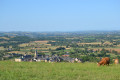
(3) At the first junction (on the right, there’s a 45-minute round trip option to climb up to Le Buenne: chapel, panoramic view), turn left onto the path. Walk down through the woods to the D651. Head straight on towards Cassagnes–Comtaux for 20 metres, then turn left onto a narrow path between two fields. Follow the ‘Chemin des Combes’ track to the right as far as the hamlet of Le Lac. At the crossroads, turn right onto the Route de La Borie de Cassagnes as far as the bend, then take the Chemin du Point de Vue de Cassagnes between two buildings to the viewpoint on the left at the end of the path (panoramic view of the Vallon de Clairvaux and the vineyards).
(4) Leaving the viewpoint, follow the D 651 to the left. 50 metres after the La Borie junction, turn left onto a path which, running along the hillside, descends to the Cros estate. Go round the estate on the right and follow the access road down towards Clairvaux for 400 metres. At a bend, turn left onto an old vineyard track which leads onto a dirt track climbing left towards Cassagnes-Comtaux.
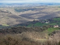
(5) At the bottom of the village, turn right onto the Impasse du Vieux Cassagnes. Climb the steps to Saint Vincent’s Church. Walk up the main street to the junction with the road coming from Plagnol. Turn left, then right above the car park, to take the Chemin du Treillou, which bends left and climbs up to the Puech de Cassagnes (panoramic view over the Clairvaux valley). At the TV relay station, walk down the D 651 for 100 metres and turn right onto the Chemin du Colombier. At the junction of the farm tracks, turn left onto the Chemin du Dolmen de la Serre (gate on the right for a return trip to the dolmen) and join the D 43.
(6) You’ll emerge onto the road at the Croix de Bel viewpoint (view over the Glassac valley). Head straight on along the Route de la Croix de Bel as far as Poux. On leaving the hamlet, after the wayside cross, turn left onto the Chemin de Cauffour. At the road, continue left until you reach the D43. Follow it to reach the square in front of Saint Amans Church and the Espace Georges Rouquier.


 Tourist office
 Easy
Easy