The Buenne via Le Teil

A bit of history
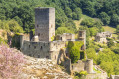
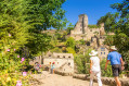
The area overlooked by the Buenne is bordered to the south by the Aveyron valley. On its northern flank, the 11th-century Soulié Chapel is a fine example of Romanesque architecture with its remarkable altar. Higher up on the plateau, the Cistercian Abbey of Bonnecombe had established in Ruffepeyre, at the foot of the ‘draye’ – a track used for the transhumance of herds – both a manorial centre to manage all the rights and tenures it held in this area, and a seat of justice; the tower (14th century) was the main feature of this fortified house.

Details

63931203
Creation:
Last update:
Last review:
  • Walking
    Activity: Walking
  • ↔
    Distance: 7.43 mi
  • ◔
    Average duration: 4h 05 
  • ▲
    Difficulty: Moderate

  • ⚐
    Back to start: Yes
  • ↗
    Ascent: + 738 ft
  • ↘
    Descent: - 735 ft

  • ▲
    Highest point: 2,415 ft
  • ▼
    Lowest point: 1,801 ft

Photos

Description of the walk

Park in the car park at Mayran Stadium.

(S/E) From the stadium car park, walk alongside the sports ground and turn left onto a farm track, then right onto the road towards Les Farguettes.

(1) Turn left onto the D994. After the cheese dairy, turn right and head towards Ruffepeyre.

(2) Keep to the right, then pass two junctions and take the track that climbs to the left towards Les Ausselats, on leaving the village. At the hamlet, turn left until you reach the bend just above the farm.

(3) Keep to the right and turn left towards Celzet. Follow the ravine, then at the bend, keep to the right and take a stony track on the left up to the 658-metre mark (next junction).

(4) Turn left. At the next junction, veer right past an iron cross. Continue climbing until you reach Route de Bessarède and the Croix de la Vidalie, keeping straight on the whole time.

(5) Follow the D595 to the right, then turn left after the cross until you reach the rest stop.

(6) Take a detour to the right to the chapel and back. Return to the D595 on the right, then carry on straight ahead along the forest road from the first bend until you reach a fork.

(7) Turn left. After Pioux and Bellevue, cross the D994 with care.

(8) Head towards the Bez crossroads via the disused section of the old Rodez road. Before the crossroads, turn left onto a track leading to a first set of hairpin bends to reach a second crossroads.

(9) Head down to the left. Caution: you will be crossing pastureland; dogs must be kept on a lead. Head back up to Le Teil and join the D285.

(10) Turn right towards Mayran on the D285, then take the footpath. Pass the town hall, turning left, and the village hall to reach the stadium (S/E).


Waypoints

  1. S/E : mi 0 - alt. 1,969 ft - Mayran Stadium
  2. 1 : mi 0.68 - alt. 1,903 ft - Les Farguettes
  3. 2 : mi 1.1 - alt. 1,883 ft - Ruffepeyre
  4. 3 : mi 1.64 - alt. 1,834 ft - Les Ausselats
  5. 4 : mi 2.5 - alt. 2,159 ft - Côte 658
  6. 5 : mi 3.41 - alt. 2,356 ft - Road
  7. 6 : mi 3.89 - alt. 2,411 ft - Rest stop, access to the chapel
  8. 7 : mi 4.52 - alt. 2,326 ft - Fork in the path
  9. 8 : mi 5.41 - alt. 2,051 ft - D994
  10. 9 : mi 6 - alt. 2,005 ft - Crossroads before Le Bez
  11. 10 : mi 6.51 - alt. 2,031 ft - Le Teil
  12. S/E : mi 7.43 - alt. 1,969 ft - Mayran Stadium

Notes

Hikers follow the route at their own risk. They remain solely responsible, not only for any accidents they may suffer, but also for any damage they may cause to others, such as forest fires, pollution or vandalism…
Recommendations: stay on the marked paths. Never throw anything on the ground; take a bin bag with you. Respect private property and crops. Keep dogs on a lead near farms or herds. Wear suitable footwear and bring some food and drink.

Worth a visit

Along the way:
• Mayran: 15th-century church.
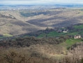
• Le Buenne: 19th-century chapel, pilgrimage site, 15th–18th-century cross, panoramic views, picnic area.
• Ruffepeyre: 14th-century square tower.

Nearby:
• Belcastel: village (worth a visit), castle (worth a visit), bridge (15th century) and its cross, church (14th century), recumbent effigy of Alzias de Saunhac. Roc d’Anglars. Lourdou Cave. The Lord’s Chairs. House of the Forge and Traditional Crafts.
• Bournazel: castle and garden (open to visitors), village (open to visitors).
• Goutrens: the village of Cassagnes-Comtaux. Wine estate. Espace Georges Rouquier Museum. ‘Nos Campagnes Autrefois’ Museum.

Reviews and comments

4.3 / 5
Based on 2 reviews

Reliability of the description
4.5 / 5
Ease of following the route
4.5 / 5
Route interest
4 / 5
Office de tourisme du Pays Rignacois

Thank you for your review! We hope you enjoy your walks in the Rignac region!

Machine-translated

Faf12
Faf12

Overall rating : 4.7 / 5

Date of your route : Mar 19, 2025
Reliability of the description : ★★★★★ Very good
Ease of following the route : ★★★★★ Very good
Route interest : ★★★★☆ Good
Very busy route : No

An easy walk with some lovely views. A bit too much tarmac before and after Notre-Dame de Buenne, but there’s no alternative!
A lovely walk back through the woods.

Machine-translated

Augusto vincent
Augusto vincent

Overall rating : 4 / 5

Date of your route : Jan 20, 2025
Reliability of the description : ★★★★☆ Good
Ease of following the route : ★★★★☆ Good
Route interest : ★★★★☆ Good
Very busy route : No

Hello, a lovely walk with some beautiful views; the chapel is halfway along the route and there are tables for a picnic – we even got to hear the carillon.
The signposting has faded on a short section of the route, but otherwise it’s well signposted.
The stretch through the pastures is really lovely.
It’s a shame there’s so much tarmac on the route, even though it’s not very busy,
All in all, a lovely walk.
We had a lovely time.

Machine-translated

Other walks in the area

For more walks, use our search engine .

The GPS track and description are the property of this route's author. Please do not copy them without permission.