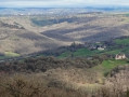
Farrebique and Biquefarre Trail

This walking route takes you to the locations chosen by Georges Rouquier for the filming of the films *Farrebique* and *Biquefarre*, released in 1946 and 1983 respectively. Made thirty-eight years apart, these two films were shot in the same location and featured the same non-professional actors playing themselves.
*Farrebique*, filmed from November 1943 to November 1945, and *Biquefarre*, from autumn 1982 to May 1983, depict the daily life of Georges Rouquier’s family, who lived in the village of Goutrens.
As you move from one filming location to another, you’ll have the chance to observe the surroundings and the framing of the scenes for yourself… This will give you a better understanding of how this great filmmaker worked and, above all, when you watch his films for the first or second time, you’ll see each scene in a different light.

Details

43686915
Creation:
Last update:
Last review:
  • Walking
    Activity: Walking
  • ↔
    Distance: 4.76 mi
  • ◔
    Average duration: 2h 25 
  • ▲
    Difficulty: Easy

  • ⚐
    Back to start: Yes
  • ↗
    Ascent: + 223 ft
  • ↘
    Descent: - 223 ft

  • ▲
    Highest point: 1,969 ft
  • ▼
    Lowest point: 1,719 ft

Description of the walk

Park at Place de l’Église.

(S/E) Walk opposite the church towards the town hall, turn right and head out onto the D43. Turn left, leaving the Bar Restaurant on your right. Walk past Maison de Tante Marie until you reach the cross and the well.

(1) Turn right onto a narrow path between two low walls. At the end of the path, turn left onto the lane that ends at a Stop sign.

(2) Pass the return route on your right, turn left onto the D595, ignore the road towards Bournazel (D595) and head back towards the D43, near the house of Henri and Maria (cross on your right).

(3) Walk alongside the D43 on the right for about a hundred metres; at the wooden cross, turn right onto a pleasant grassy path. At the tarmac road, turn left and walk for about 150 metres until you reach the Ferme de Bourrel.

(4) Continue along the road and, at the sports ground, turn right and head (straight ahead) along a path. At the next junction, turn left for a return trip to the Croix du Burel, near the D43.

(5) Return to the junction and turn left, until you reach a bend in the Route de Farrebique.

(6) Carry on along the road until you reach the D43. Cross over, almost directly opposite, by taking a left then a right. Head up the wide farm track towards the high-voltage power line for a round trip to the metal electricity pylon and its viewpoint, which you’ll reach after a right-hand bend in the forest.

(7) Head back down and, just before the D43, turn right. Continue straight ahead, passing under the high-voltage line twice, and carry on to the next road and the view over Goutrens.

(8) At the D595, turn left, then right. Follow the path to the first fork. Take the left-hand fork to head back towards the village. At the first junction, go straight ahead, passing to the left of the cross, then at the D43, cross over, heading towards La Capelle Del Vern. Pass behind the village hall. Keep the roads on your left until you reach the cemetery.

(9) Carry on uphill and, at the junction, turn left and head back down towards the village centre and the
car park (S/E).


Waypoints

  1. S/E : mi 0 - alt. 1,745 ft - Car park: Place de l’Eglise
  2. 1 : mi 0.09 - alt. 1,742 ft - Aunt Marie’s House – Well
  3. 2 : mi 0.2 - alt. 1,772 ft - Stop – Junction of the circular loop
  4. 3 : mi 0.31 - alt. 1,762 ft - Henri and Maria’s house
  5. 4 : mi 0.77 - alt. 1,719 ft - Bourrel Farm. Towards the - Alzou (rivière) - Affluent de l'Aveyron
  6. 5 : mi 1.34 - alt. 1,778 ft - The Croix du Bruel
  7. 6 : mi 1.6 - alt. 1,781 ft - Farrebique Road
  8. 7 : mi 2.12 - alt. 1,969 ft - Viewpoint
  9. 8 : mi 3 - alt. 1,834 ft - View of Goutrens
  10. 9 : mi 4.44 - alt. 1,762 ft - Cemetery
  11. S/E : mi 4.76 - alt. 1,745 ft - Car park: Place de l’Eglise

Notes

Practical information
- Wear suitable footwear.
- Take some food and drink with you.
- Hikers follow the route at their own risk. They remain liable for any accidents they may suffer and for any damage they may cause to others (forest fires, damage to property, pollution, etc.).
- Check that your vehicle is parked in an authorised area: parking in the village is regulated (by municipal by-law).
- Stick to the marked trails and do not take shortcuts. If the route has been altered, follow the new signposting.
- Keep a low profile. We are not the only ones using the paths; please be considerate of others.
- Take your rubbish away with you. Leave no trace of your visit; do not throw anything on the ground; carry a rubbish bag with you.
- Keep your dog on a lead, particularly near houses or livestock.
- Close gates and fences behind you; walk around crops. We should respect the work of those who shape and preserve our environment.
- Observe the rules in certain areas.
- Do not light fires. Areas that are overgrown (such as forests) or too exposed (such as scrubland and dry heathland) can catch fire very quickly.
- Do not drink water from streams. Clear water does not necessarily mean it is safe to drink.
- Check hunting seasons; some routes may be dangerous.

Worth a visit

To find out more, visit the Georges Rouquier area.

Reviews and comments

4.7 / 5
Based on 2 reviews

Reliability of the description
5 / 5
Ease of following the route
4.5 / 5
Route interest
4.5 / 5
Office de tourisme du Pays Rignacois

We appreciate your feedback and will inform the individuals responsible for signage.

Machine-translated

User 343174

Overall rating : 4.3 / 5

Date of your route : Sep 15, 2025
Reliability of the description : ★★★★★ Very good
Ease of following the route : ★★★★☆ Good
Route interest : ★★★★☆ Good
Very busy route : No

The description of the hike is extremely accurate! It's perfect!
However, the signposting needs to be improved as it is not very visible at certain points along the route, and there is often no indication of whether to turn left or right.
An interesting hike, well illustrated by the information boards about Georges Rouquier.

Machine-translated

jipe12
jipe12

Overall rating : 5 / 5

Date of your route : Feb 21, 2024
Reliability of the description : ★★★★★ Very good
Ease of following the route : ★★★★★ Very good
Route interest : ★★★★★ Very good
Very busy route : Yes

Impeccable route
A very enjoyable walk with plenty of historical interest
Lots of people were doing the route in the opposite direction; in my opinion, it’s better to follow VISORANDO’s advice

Machine-translated

Other walks in the area

For more walks, use our search engine .

The GPS track and description are the property of this route's author. Please do not copy them without permission.