The Roc d’Anglars and the Lourdou

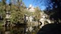
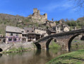
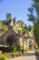
Walk this trail in one of the “Most Beautiful Villages of France”: Belcastel, selected in 2023 to represent Occitanie on the television programme *Le Village Préféré des Français*. Explore over 1,000 years of history as you make your way to the Roc d’Anglars. This is a largely shaded walk throughout.

Details

43009347
Creation:
Last update:
Last review:
  • Walking
    Activity: Walking
  • ↔
    Distance: 4.37 mi
  • ◔
    Average duration: 2h 45 
  • ▲
    Difficulty: Easy

  • ⚐
    Back to start: Yes
  • ↗
    Ascent: + 840 ft
  • ↘
    Descent: - 837 ft

  • ▲
    Highest point: 1,814 ft
  • ▼
    Lowest point: 1,329 ft

Photos

Description of the walk

The route starts in the village of Belcastel, opposite the bridge over the Aveyron.

(S/E) Cross the15th-century bridge, admiring as you pass the stone cross standing on a plinth which is a former12th-century altar, on which five small crosses represent the five wounds of Christ. You will arrive at the church.

(1) Cross the 15th-century bridge (stone cross standing on a plinth which is a former 12th-century altar,on which five small crosses represent the five wounds of Christ). (Off the route: continue on to the Church of Sainte-Madeleine. Inside: a remarkable recumbent effigy and Stations of the Cross).  After the bridge, follow the small road to the right, skirting the river for 150 m. Turn right onto a dirt track which leads onto a path. Leave this path to the right and walk to the Roc d’Anglars and back (visit the fort with caution. To reach the Lourdou cave (Little Lourdes), on the western side of the fort, below the rock, follow the Stations of the Cross path leading there.

(2) Continue along the track to the right, following the River Aveyron, until you reach the D 285. Follow it to the right to reach the D 997. Turn right and cross the Pont Neuf.

(3) After the bridge, continue to the right towards Belcastel for 100 m (GR®©62B, from Rodez to Villefranche-de-Rouergue via the Aveyron valley). Turn left onto a dirt track leading to the Magabiès farm. Continue uphill to the left. At the first crossroads, take a “forest path” on the right, keeping level, to the Mazens-le-Bas farm.

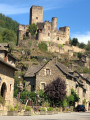
(4) After the farm, leave the GR® and head uphill to the left towards Rignac. Afterthe third hairpin bend, turn right onto the forest track, continue straight on, and admire the panoramic view of Belcastel along the way. Turn right to descend to the castle road. Continue straight on to reach the village directly, where you turn left to go round the castle. (S/E)


Waypoints

  1. S/E : mi 0 - alt. 1,345 ft - Vieux Pont
  2. 1 : mi 0.03 - alt. 1,342 ft - Vieux Pont
  3. 2 : mi 0.95 - alt. 1,539 ft - Le Lourdou
  4. 3 : mi 1.99 - alt. 1,329 ft - The Pont Neuf
  5. 4 : mi 3.17 - alt. 1,650 ft - Mazens Bas
  6. S/E : mi 4.37 - alt. 1,345 ft - Vieux Pont

Notes

- Wear suitable footwear
- Take some food and drink with you
- Hikers follow the route at their own risk. They remain responsible for any accidents they may suffer and for any damage they may cause to others (forest fires, damage to property, pollution, etc.).
- Check that your vehicle is parked in an authorised area; parking in the village is regulated (by municipal by-law).
- Stick to the marked trails and do not take shortcuts. If the route has been altered, follow the new signposting.
- Keep a low profile. We are not the only ones using the paths; be considerate of others.
- Take your rubbish away with you. Leave no trace of your visit; do not throw anything on the ground; carry a rubbish bag with you.
- Keep your dog on a lead, particularly near homes or livestock.
- Close gates and fences behind you, and walk around crops. We should respect the work of those who shape and preserve our environment.
- Observe the rules in certain areas.
- Do not light fires. Areas with dense vegetation (forests) or those that are too exposed (scrubland, dry heathland, etc.) can catch fire very quickly.
- Do not drink water from streams. Clear water does not necessarily mean it is safe to drink.
- Check hunting seasons; some routes may be dangerous.

Worth a visit

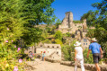
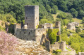
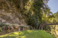
Visit Belcastel, one of the “Most Beautiful Villages in France”, and discover the Roc d’Anglars fort, a listed archaeological site which was an inhabited motte-and-bailey castle fromthe 5th tothe 10th centuries, where you can see notched huts and herringbone-patterned structures. This outpost, perched on a rock 50 metres above the River Aveyron, was used to keep watch over the ancient Carolingian road that wound its way through the valley. The Lourdou sanctuary, meanwhile, is a cave in which an altar has been set up. A statue of Our Lady of Lourdes overlooks the religious site, hence the name ‘Petit Lourdes’ (Lourdou in Occitan).

Always be cautious and plan ahead when you're outdoors. Visorando and the author of this route cannot be held responsible for any accidents occurring on this route.

The GR® and PR® markings are the intellectual property of the Fédération Française de Randonnée Pédestre.

Reviews and comments

4.6 / 5
Based on 3 reviews

Reliability of the description
4.7 / 5
Ease of following the route
5 / 5
Route interest
4 / 5
vttaveyron
vttaveyron

Overall rating : 4.7 / 5

Date of your route : Nov 17, 2025
Reliability of the description : ★★★★★ Very good
Ease of following the route : ★★★★★ Very good
Route interest : ★★★★☆ Good
Very busy route : Yes

Pleasant hike with a bit of road at the start.

Machine-translated

Office de tourisme du Pays Rignacois

Thank you for your feedback, which helps us to improve. I’m delighted that you enjoyed your time on our trails.
See you soon in the Rignac area!

Machine-translated

Nadou63
Nadou63

Overall rating : 4.7 / 5

Date of your route : Apr 21, 2025
Reliability of the description : ★★★★★ Very good
Ease of following the route : ★★★★★ Very good
Route interest : ★★★★☆ Good
Very busy route : No

We did this route and then carried on along the Belcastel Ridge Trail. It was magnificent – we were all on our own.

Machine-translated

Office de tourisme du Pays Rignacois

Hello,
Thank you for your feedback on our walking route. You are correct: you should follow the yellow markings on the way out and the GR markings (white and red) on the way back.
Have a lovely day.

Machine-translated

asker
asker

Overall rating : 4.3 / 5

Date of your route : Sep 16, 2024
Reliability of the description : ★★★★☆ Good
Ease of following the route : ★★★★★ Very good
Route interest : ★★★★☆ Good
Very busy route : No

A lovely walk through lush green countryside, featuring historic ruins and a beautifully restored village.
The colours of the road book markings are sometimes different on the ground, but it’s impossible to get lost.

Machine-translated

Other walks in the area

For more walks, use our search engine .

The GPS track and description are the property of this route's author. Please do not copy them without permission.