Dolmen and La Roque spring, starting from Salles-la-Source

Highlights of this walk include:
- exploring a dolmen,
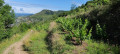
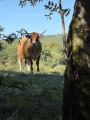
- a panoramic view of the limestone plateaus grazed by cows,
- a short detour to the source of the Roque (optional),
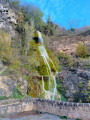
- a walk down to La Roque waterfall,
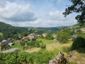
- views over the Roque and Créneau valleys.

Details

16989145
Creation:
Last update:
Last review:
  • Walking
    Activity: Walking
  • ↔
    Distance: 2.82 mi
  • ◔
    Average duration: 1h 45 
  • ▲
    Difficulty: Easy

  • ⚐
    Back to start: Yes
  • ↗
    Ascent: + 525 ft
  • ↘
    Descent: - 551 ft

  • ▲
    Highest point: 1,883 ft
  • ▼
    Lowest point: 1,460 ft

Photos

Description of the walk

Park in the car park at the Dolmen des Genévriers (signposted by tourist road signs).

(S/E) Take the path running south across the causse. This path is lined with cattle fences on both sides. Very soon, you’ll reach the Dolmen des Genévriers, signposted on the right.
Climb up onto the mound and enjoy the 360° view over the causse, then descend from the mound to rejoin the main path and continue to the right, heading south.
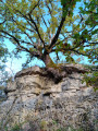
You’ll come to a three-way junction; carry on straight ahead along the main path and you’ll soon reach another crossroads with an old oak tree.

(1) Follow the main path, leaving the tree on your left, then turn left onto the Terra Trail 1/3, which is the same as the mountain bike trail. Be careful here: do not go straight on onto Terra Trail 1.
You will then reach the Fontcoussergue road.

(2) Cross it and take the track opposite, which forms part of theGR®62. Continue for a few hundred metres along theGR® to the viewpoint at the picnic area.

(3) Take the path below the picnic area. After a right-hand hairpin bend, you’ll emerge at the ford above La Roque.

(4) From here, you can continue straight ahead to reach the Source de La Roque. To do this, take the unmarked path that you can just make out on the right; follow it for about fifty metres to discover the entrance to a cave and the Source de La Roque (below the cave).
Head back to the ford and continue to the left along theGR®62. You will then reach the hamlet of La Roque; walk through it and carry on to reach the foot of the La Roque waterfall.

(5) Turn round and head back to the previous junction.

(4) Keep left on theGR® to quickly reach the junction with the road you took on the way out.

(2) Turn left and follow the route back in the opposite direction to return to the car park at the Dolmen des Genévriers (S/E).

Waypoints

  1. S/E : mi 0 - alt. 1,883 ft - Car park at the Genévriers dolmen
  2. 1 : mi 0.65 - alt. 1,683 ft - After the oak tree
  3. 2 : mi 0.97 - alt. 1,696 ft - Crossroads of the circular loop
  4. 3 : mi 1.2 - alt. 1,781 ft - Picnic area
  5. 4 : mi 1.48 - alt. 1,581 ft - Ford
  6. 5 : mi 1.57 - alt. 1,460 ft - Cascade de Laroque
  7. S/E : mi 2.82 - alt. 1,883 ft - Car park at the Genévriers dolmen

Notes

The path is generally not shaded, so make sure you bring water and a hat.
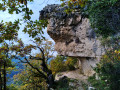
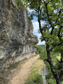
Between (4) and (5), the path runs along a cliff for about 200 metres.
Although the path remains wide, keep a close eye on young children and dogs. Avoid this route if you have a severe fear of heights; otherwise, it’s fine – the path is wide (> 2 m).
In wet weather, some sections may be slippery; please take appropriate precautions.
(3) There is a picnic area with a viewpoint along the path.
You can shorten the walk by not going down to La Roque waterfall (which would be a shame) and by not visiting the source of the Roque (which isn’t spectacular).

Worth a visit

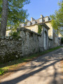
(4) La Roque hamlet
(5) La Roque Waterfall

Always be cautious and plan ahead when you're outdoors. Visorando and the author of this route cannot be held responsible for any accidents occurring on this route.

The GR® and PR® markings are the intellectual property of the Fédération Française de Randonnée Pédestre.

Reviews and comments

4.4 / 5
Based on 3 reviews

Reliability of the description
4.3 / 5
Ease of following the route
4.3 / 5
Route interest
4.7 / 5
Gigi12850
Gigi12850

Overall rating : 4.7 / 5

Date of your route : Feb 23, 2025
Reliability of the description : ★★★★★ Very good
Ease of following the route : ★★★★★ Very good
Route interest : ★★★★☆ Good
Very busy route : No

A short walk, but with a fair bit of elevation gain and some lovely views.

Machine-translated

ESMS
ESMS

Overall rating : 3.7 / 5

Date of your route : Aug 22, 2022
Reliability of the description : ★★★☆☆ Average
Ease of following the route : ★★★☆☆ Average
Route interest : ★★★★★ Very good
Very busy route : No

Lack of yellow markings. Confusion with the mountain bike and trail markings

Machine-translated

beauvillage
beauvillage

Overall rating : 5 / 5

Date of your route : Feb 12, 2022
Reliability of the description : ★★★★★ Very good
Ease of following the route : ★★★★★ Very good
Route interest : ★★★★★ Very good
Very busy route : Yes

A very pleasant walk to do in winter. It takes just an hour and a half, but you can take your time to admire the scenery and the cliffs. Even in winter, the Causse is very pretty. Some parts are very windy, whilst others are well sheltered from the wind. It’s a dream location for trail runners.

Machine-translated

Other walks in the area

For more walks, use our search engine .

The GPS track and description are the property of this route's author. Please do not copy them without permission.