


Refine your search for walks in Créquy
Créquy walks


 Les coteaux de la Créquoise
 Visorando Member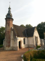
 10.53 mi
 +709 ft
 -719 ft
 5h 30
5h 30
 Moderate
 Departure from Créquy (Pas-de-Calais)
Another option, slightly shorter but still quite challenging, offers views of the Créquoise valley.
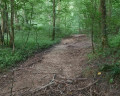
The route through the Bois de Créquy is the same as on the other walk: ‘The Bois de Créquy’, but the return journey takes you down the other side, offering a lovely view of the valley.
The Créquy Woods
 13.09 mi
+745 ft
-732 ft
6h 40
13.09 mi
+745 ft
-732 ft
6h 40
 Difficult
Departure from Créquy (Pas-de-Calais)
Difficult
Departure from Créquy (Pas-de-Calais)
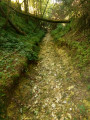
A long route with virtually no roads, making use of three short-distance hiking trails: the Maury, the Têtards and the Fréniaux.It’s best to go during a dry spell, as the paths can be quite poor in wet weather.Three-quarters of the walk takes place on the edge of or within the woods.
From La Planquette to Bois de Fressin
 13.20 mi
+958 ft
-942 ft
6h 55
Difficult
Departure from Fressin (Pas-de-Calais)
13.20 mi
+958 ft
-942 ft
6h 55
Difficult
Departure from Fressin (Pas-de-Calais)
A succession of small roads and paths for a day in the great outdoors.The icing on the cake: a good elevation gain with a superb climb in the Bois de Fressin.
For very experienced hikers, I highly recommend the alternative route described in the practical information section.
The Chevrette Trail in Fressin
6.31 mi
+443 ft
-430 ft
3h 15
Moderate
Departure from Fressin (Pas-de-Calais)
A short walk around Fressin with a few climbs through lovely scenery. Head up through the Fressin woods, cross the Planquette, and walk across the plateau where you can take some lovely photos of Fressin Castle, which you’ll get a closer look at on the way back.
Well-marked yellow trail. Some might say there’s no point in describing marked trails, but for me it’s important to share them with the community.
Henry V Trail in Azincourt
 7.48 mi
+167 ft
-177 ft
3h 35
Moderate
Departure from Azincourt (Pas-de-Calais)
7.48 mi
+167 ft
-177 ft
3h 35
Moderate
Departure from Azincourt (Pas-de-Calais)
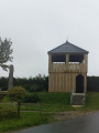
A beautiful hike along the Henry V trail around the plain where the Battle of Agincourt took place in 1415.
From Turkey to Fond Breton (in less than 10 km!)
5.80 mi
+358 ft
-354 ft
3h 00
Moderate
Departure from Renty (Pas-de-Calais)
A short but fairly strenuous route with a steep hill and some very grassy paths.
On 12/08/2025: the start of the trail is once again very overgrown (brambles and nettles). It's passable but it's best to wear trousers or good gaiters and, of course, bring a walking stick or even a pair of secateurs.
5 woods and some steep slopes
 9.42 mi
+1,004 ft
-1,017 ft
5h 10
Difficult
Departure from Saint-Michel-sous-Bois (Pas-de-Calais)
9.42 mi
+1,004 ft
-1,017 ft
5h 10
Difficult
Departure from Saint-Michel-sous-Bois (Pas-de-Calais)
A very hilly route over the Artois heights.
A great sporting outing with beautiful scenery.
From Bras de Bronne to L’Embrienne
15.06 mi
+1,555 ft
-1,532 ft
8h 15
Difficult
Departure from Saint-Michel-sous-Bois (Pas-de-Calais)
Same starting point as for the “5-bois-et-quelques-raidillons” hike, but this route is a bit longer, with a decent climb, and avoids walking along the D129.
I think the app is essential, especially as the GR® markings are very faint (you might even wonder if this legendary GR® still exists?).
The slopes of the Ternoise near Auchy
 10.43 mi
+669 ft
-650 ft
5h 25
Moderate
Departure from Rollancourt (Pas-de-Calais)
10.43 mi
+669 ft
-650 ft
5h 25
Moderate
Departure from Rollancourt (Pas-de-Calais)
A fairly long but not overly difficult hike offering beautiful views over the Ternoise valley.
May 2025: The Montigny trail (3) has been thoroughly cleared, something that hasn’t happened for ages! It is currently perfectly passable.
On the plateau between the Lys and the Aa
 15.76 mi
+912 ft
-922 ft
8h 00
Difficult
Departure from Dennebrœucq (Pas-de-Calais)
15.76 mi
+912 ft
-922 ft
8h 00
Difficult
Departure from Dennebrœucq (Pas-de-Calais)
A long route with a significant elevation gain on paths that are generally in very good condition.
The Ternoise hills, from Blangy-sur-Ternoise to Rollancourt
7.64 mi
+548 ft
-551 ft
4h 00
Moderate
Departure from Blangy-sur-Ternoise (Pas-de-Calais)
A circular loop on the good paths surrounding Blangy-sur-Ternoise.
The upper Lys valley
 13.55 mi
+673 ft
-666 ft
6h 50
Difficult
Departure from Lisbourg (Pas-de-Calais)
13.55 mi
+673 ft
-666 ft
6h 50
Difficult
Departure from Lisbourg (Pas-de-Calais)
The source of the Lys, the Lugy Mill and a lovely route across the plateau (beautiful views).This walk can be more difficult in wet weather as some paths are regularly churned up.Some tarmac, but on minor roads.
Please note: the path leading up through the Lugy woods after the (5) can be very difficult in wet weather.
An uphill battle
 15.98 mi
+1,371 ft
-1,365 ft
8h 35
Difficult
Departure from Fauquembergues (Pas-de-Calais)
15.98 mi
+1,371 ft
-1,365 ft
8h 35
Difficult
Departure from Fauquembergues (Pas-de-Calais)
It's a route that will delight altitude enthusiasts (Carto exploreur and the Visorando app suggest it's as high as 500m). What's more, the views are stunning.
Route slightly modified in November 2019.
All trails are very good as of May 14, 2020 (even if some are very grassy).
From Reclinghem to Mont d'Erny
11.08 mi
+814 ft
-797 ft
5h 50
Difficult
Departure from Reclinghem (Pas-de-Calais)
Three lovely climbs and a long stroll across the plateau make for a walk surrounded by nature. A very hilly first section, followed by a long stretch along the heights before descending to Reclinghem with magnificent views. The icing on the cake is an optional circular loop I suggest, which brings the total elevation gain to over 300 m.
The Belrem in Beaurainville
 Association / Club / Walk leader6.50 mi
+246 ft
-246 ft
3h 10
Moderate
Departure from Beaurainville (Pas-de-Calais)
Association / Club / Walk leader6.50 mi
+246 ft
-246 ft
3h 10
Moderate
Departure from Beaurainville (Pas-de-Calais)
A lovely walk along the banks of the Canche, through marshes and with a view over Beaurainville
The hedgerows
10.90 mi
+374 ft
-354 ft
5h 20
Moderate
Departure from Teneur (Pas-de-Calais)
The old marked trail around Ambricourt is unfortunately poorly maintained or not maintained at all. We have been walking it for 25 years and have encountered difficulties every time (poor signage, paths buried under nettles or difficult to walk on).The start at Teneur allows you to pass (twice) in front of the superb limestone hillside of Teneur. Deer are often visible in or around the Bois de Crépy
The path is in very poor condition between points (2) and (6).
If possible, avoid the period between mid-June and mid-August. The passage after point (3) will be easier if the field is not too far into the growing season or has already been harvested.
Hills and valleys in Coyecques
9.64 mi
+991 ft
-991 ft
5h 20
Moderate
Departure from Coyecques (Pas-de-Calais)
From the Lys Valley to Noir Mont and discovery of the hidden valley of Maisnil.
The route is almost entirely off-road, either on good grassy paths or vaguely paved paths.
Do not look for markings, as there are none.
The Maronnes Hills
7.35 mi
+361 ft
-348 ft
3h 40
Moderate
Departure from Humières (Pas-de-Calais)
A lovely hike in the Ternois region starting from the charming village of Humières with its castle and cave.
You’ll be walking mainly on paths and trails that can get muddy in wet weather, but the scenery quickly makes you forget that.
Bois Robert in Œuf-en-Ternois
 5.06 mi
+246 ft
-276 ft
2h 30
5.06 mi
+246 ft
-276 ft
2h 30
 Easy
Departure from Œuf-en-Ternois (Pas-de-Calais)
Easy
Departure from Œuf-en-Ternois (Pas-de-Calais)
A short walk around and through a village in the Ternois region called Oeuf-en-Ternois. The walk through the village is interesting and the paths are very pleasant. At the Bois Robert crossroads, you may, like me, encounter a few deer.