


Refine your search for walks in Corquilleroy
Corquilleroy walks

 Between rivers and canals in the heart of the Montargis conurbation.
 Visorando Member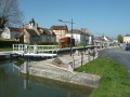
 12.14 mi
 +92 ft
 -92 ft
 5h 40
5h 40
 Difficult
 Departure from Montargis (Loiret)
Circular starting from the lakeside town of Montargis, known as the Venice of Gatinais. The junctions of the Briare, Orléans and Loing canals made it a veritable river crossroads between the Loire and Seine basins until the Orléans canal was decommissioned in 1954. Follow the waterways through the Loing valley, passing rivers, canals and lakes.
Montargis, the Venice of Gâtinais
 4.79 mi
+89 ft
-89 ft
2h 15
4.79 mi
+89 ft
-89 ft
2h 15
 Easy
Departure from Montargis (Loiret)
Easy
Departure from Montargis (Loiret)
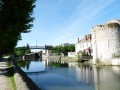
Ranked among the most beautiful sites in France, explore Montargis through its streets on the water with 131 bridges and footbridges. A gastronomic and lakeside town nicknamed the Venice of Gâtinais.
The Briare Canal between Montargis and the Moulin Bardin
 4.79 mi
+30 ft
-30 ft
2h 15
Easy
Departure from Montargis (Loiret)
4.79 mi
+30 ft
-30 ft
2h 15
Easy
Departure from Montargis (Loiret)
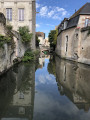
A stroll along the Briare Canal, passing through the lakes area of the Savoies and Népruns Nature Reserve, ending at Lac des Closiers and a circular route through the beautifully restored Pêcherie district.
Peace and quiet, nature, barges, birds and a few beautiful old houses – this is what awaits you.
Suburban walking route from Villemandeur to Saint-Maurice-sur-Fessard
 6.48 mi
+20 ft
-26 ft
3h 00
6.48 mi
+20 ft
-26 ft
3h 00
 Moderate
Departure from Villemandeur (Loiret)
Moderate
Departure from Villemandeur (Loiret)
Starting from Saint-Didier Church in the welcoming village of Villemandeur, with its many shops, this route will take you due west towards the peaceful village of Saint-Maurice-sur-Fessard, following the old towpath of the Canal d’Orléans, which has been converted into a cycle route. The route passes Machot Lock and follows various paths through the countryside, offering magnificent scenery that alternates between farmland and wooded areas.
Discover the mills starting from Montargis
6.99 mi
+82 ft
-82 ft
3h 15
Moderate
Departure from Montargis (Loiret)
A route taking you along the Loing, past ponds, castles, mills and the old village of Amilly, then on to Lac des Closiers, the perfect spot for a picnic. The two locks: the Passerelle de la Marolles lock, followed by the Écluse de la Tuilerie lock.
Passing through the locks and mills via Lac des Closiers
 6.57 mi
+125 ft
-69 ft
3h 10
Easy
Departure from Montargis (Loiret)
6.57 mi
+125 ft
-69 ft
3h 10
Easy
Departure from Montargis (Loiret)
A walk to explore the Loing, along the Briare Canal via the GR®13, starting from the Marolle Footbridge, passing through the Lac des Closiers peninsula – an ideal spot for a picnic. Discover the mills, ponds and locks at La Tuilerie and La Marolle, then pass through the old village of Amilly.
A tour around Paucourt
 7.89 mi
+131 ft
-121 ft
3h 45
Moderate
Departure from Paucourt (Loiret)
7.89 mi
+131 ft
-121 ft
3h 45
Moderate
Departure from Paucourt (Loiret)
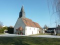
Discover the village of Paucourt and its forest, a veritable green lung in the heart of the Montargis national forest.
The Fusain Trail in Sceaux-du-Gâtinais
 1.94 mi
+20 ft
-20 ft
0h 55
Easy
Departure from Sceaux-du-Gâtinais (Loiret)
1.94 mi
+20 ft
-20 ft
0h 55
Easy
Departure from Sceaux-du-Gâtinais (Loiret)
A superb, easily accessible walk along the Fusain. The path is lined with trees, with a long stretch through a field. You then arrive in the village at the church square, which has a picnic area, a football pitch and basketball hoops. The walk has recently been made accessible and the path is maintained by the local council.
The Canal d’Orléans, starting from Chevillon-sur-Huillard
 10.32 mi
+66 ft
-66 ft
4h 50
Moderate
Departure from Chevillon-sur-Huillard (Loiret)
10.32 mi
+66 ft
-66 ft
4h 50
Moderate
Departure from Chevillon-sur-Huillard (Loiret)
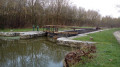
A walk that follows the Canal d’Orléans towpath for a third of its length. The remaining two-thirds follow quiet country lanes and paths through fields or woods, in peaceful countryside.
Château-Landon, the Loing Canal and the Étangs de Dordives
10.77 mi
+292 ft
-279 ft
5h 10
Moderate
Departure from Château-Landon (Seine-et-Marne)
This walk follows the city's monument trail and adds the canal, ponds and promenade along the Fusain to combine a cultural approach with the discovery of bucolic landscapes.
From the Dordives Bridge to Nemours via Souppes-sur-Loing.
12.21 mi
+184 ft
-220 ft
5h 45
Difficult
Departure from Château-Landon (Seine-et-Marne)
A lovely route along the banks of the Loing, exploring the ponds surrounding Souppes-sur-Loing. Visit Nemours with its Chaintreauville Fountain, bridges covered in flowers in spring, beautiful church with its bell on the ground and the bridge over the Loing blessed by Pius VII.
Arrange for transport for the return journey.
The Canal du Loing and the medieval past of Château Landon
 11.82 mi
+384 ft
-371 ft
5h 45
Moderate
Departure from Dordives (Loiret)
11.82 mi
+384 ft
-371 ft
5h 45
Moderate
Departure from Dordives (Loiret)
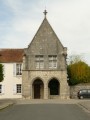
A circular route passing by the lakes of Dordives, taking the "Chemin de César" (Caesar's path), then the Gâtinais countryside to end up in Château-Landon, where you can explore its medieval past. The return journey follows the Canal du Loing with the Néronville canal bridge.
The 4 mills, between the valley and the plateau around the Betz via the Chemin du Roy
 5.20 mi
+131 ft
-138 ft
2h 30
Easy
Departure from Bransles (Seine-et-Marne)
5.20 mi
+131 ft
-138 ft
2h 30
Easy
Departure from Bransles (Seine-et-Marne)
A lovely little walk through light and shade, centred on the Betz Valley, which you cross four times near the Moulin de Brandard, the Moulin de Madame, the Moulin de Cusset (more visible) and the Moulin de Gros Lot.
The wild hyacinth trail and the Betz Valley at Branles
 5.71 mi
+200 ft
-190 ft
2h 50
Easy
Departure from Bransles (Seine-et-Marne)
5.71 mi
+200 ft
-190 ft
2h 50
Easy
Departure from Bransles (Seine-et-Marne)
This route explores the bottom of the Betz valley, with two lovely sections crossing fords or small bridges at Moulin de Madame and Barbigny, and above all a remarkable stretch through the forest in spring when the hyacinths are in bloom. Some sections are shared with other walks starting from the garden in the valley.
On the Bransles stagecoach route
4.11 mi
+112 ft
-112 ft
2h 00
Easy
Departure from Bransles (Seine-et-Marne)
A lovely little walk between the Betz Valley and the plateau, along the edge of the woods and through the undergrowth, with two mills along the way.
Around Bransles via the Betz and Ardouzes valleys
 8.88 mi
+223 ft
-240 ft
4h 15
Moderate
Departure from Bransles (Seine-et-Marne)
8.88 mi
+223 ft
-240 ft
4h 15
Moderate
Departure from Bransles (Seine-et-Marne)
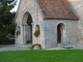
This route is the only one marked in green in the communeYou can start it from the village or from the garden in the valley; it takes in two superb valleys, that of the Betz via the Chemin du Roi and that of the Ardouzes, passing in front of the village’s listed church and the 13th-century Château du Mez le Maréchal (in the commune of Dordives).
The Fusain Valley
8.01 mi
+151 ft
-161 ft
3h 50
Moderate
Departure from Souppes-sur-Loing (Seine-et-Marne)
A walk from station to station starting in Souppes-sur-Loing, which follows the Canal du Loing past the leisure centre. A short detour to the former Abbey of Cercanceaux, passing through several locks, and arriving at Château-Landon, a charming medieval town perched high above the valley. Finally, head back towards the Ordives bridge and its ponds to return to Ordives station.
From Souppes-sur-Loing to Nemours via the Beauregards rocks
 11.00 mi
+397 ft
-420 ft
5h 25
Difficult
Departure from Souppes-sur-Loing (Seine-et-Marne)
11.00 mi
+397 ft
-420 ft
5h 25
Difficult
Departure from Souppes-sur-Loing (Seine-et-Marne)
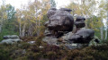
A hike from station to station, mainly through woodland. After climbing up a wooded valley and crossing a cultivated plateau, you follow a very winding route through rocky chaos that is every bit as impressive as that of the neighbouring Forest of Fontainebleau. Passing through the village of Poligny and the town centre of Nemours adds a lovely touch of heritage.
Château Landon circular loop
13.50 mi
+295 ft
-305 ft
6h 30
Difficult
Departure from Souppes-sur-Loing (Seine-et-Marne)
Discover a variety of landscapes, including the Fusain Valley and Château-Landon on a limestone plateau overlooking Fusain. See Saint-Séverin Abbey, the little brother of Mont Saint-Michel, the Romanesque tower, the Templar Chapel, and the Grand Étang de Dordives lake with its water sports centre. A beautiful day ahead without too much elevation gain.
The Canal d’Orléans and a few ponds starting from Chailly
 9.04 mi
+72 ft
-72 ft
4h 15
Moderate
Departure from Chailly-en-Gâtinais (Loiret)
9.04 mi
+72 ft
-72 ft
4h 15
Moderate
Departure from Chailly-en-Gâtinais (Loiret)
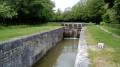
A walk that follows the towpath of the Canal d’Orléans for a third of its route. The remaining two-thirds alternate between stretches through fields or meadows and through woodland, passing a few ponds hidden in the shade.