Country:
 City:
City:


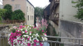
Start from the car park on Rue Cyrille Robert, opposite the entrance to the Lycée Jeannette Verdier. Please arrange for a vehicle to be waiting for you on arrival at the Amilly Industrial Estate.
(S) Return to Avenue Gaillardin and follow it to the right. At the end, turn left and, at the end of Rue Jean Jaurès, turn right then continue straight on until you reach the Canal de Briare.
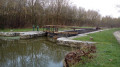
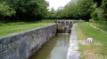
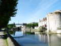
(1) Cross the footbridge over the canal and turn right onto the path that runs alongside the canal and the boulevard. Take the footbridge at the Écluse de la Marolle lock, then follow the Briare Canal on your right. Walk past the water treatment plant and go under the D2007 bridge.
(2) Ignore the return path on the left, carry on straight ahead and you’ll reach the Moulin de Bardin. Continue to follow the Briare Canal.
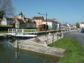
(3) Ignore the return path on the right. Continue along the canal, pass under the railway bridge and arrive at the Tuilerie Lock, by the bridge.
(4) Leave the canal bank, turn left and follow the road along the footpath. Pass the Tanneries (visits possible by appointment, 3 euros in 2026), cross the bridge over the Loing and enter Amilly. At the right-hand bend, continue straight ahead and arrive at a side street, opposite No. 169.
(5) Turn left, then at the three-way junction ahead, keep right onto Rue Raymond Tellier.
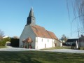
(6) Pass in front of Amilly Town Hall, carry on along Rue de la Mairie, go past Saint-Martin’s Church and carry on straight ahead. Pass the small chapel, situated below on your left, then keep left and reach the D943.
(7) Cross it carefully and continue straight ahead onto Rue de l’Union. Cross the bridge over the Loing and, at the sewage treatment works, turn right onto the path which is closed to all vehicles except authorised users; pass through the barrier.
(8) Go under the railway bridge and arrive at the edge of a pond. Turn right. At the corner of the second pond, turn left, ignore a turn-off on the left and, at the next junction, continue left to quickly reach a small car park.
(9) Continue to the left, crossing the footbridge over the Loing.
(2) At the Briare Canal, turn left, following the same route as on the way there: pass the Moulin de Bardin and arrive at a bridge on the right.
(3) Turn right and cross this bridge to quickly reach a fork in the road.
(10) Turn left, then, at No. 198, turn right and reach the end of Rue du Moulin Bardin. Turn right onto the D93, go through the roundabout, and follow the D93 towards Montargis. Pass under the D2007 road bridge, then go round the roundabout on the left to reach the shopping area with its numerous car parks (E).
 Visorando Member
 Moderate
 Difficult