The Canal d’Orléans, starting from Chevillon-sur-Huillard

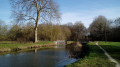
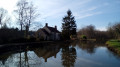
A walk that follows the Canal d’Orléans towpath for a third of its length. The remaining two-thirds follow quiet country lanes and paths through fields or woods, in peaceful countryside.

Details

2879224
Creation:
Last update:
Last review:
  • Walking
    Activity: Walking
  • ↔
    Distance: 10.32 mi
  • ◔
    Average duration: 4h 50 
  • ▲
    Difficulty: Moderate

  • ⚐
    Back to start: Yes
  • ↗
    Ascent: + 66 ft
  • ↘
    Descent: - 66 ft

  • ▲
    Highest point: 338 ft
  • ▼
    Lowest point: 289 ft

Photos

Description of the walk

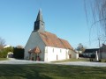
Starts from the church in Chevillon-sur-Huillard (large car park).

Yellow markings (sparse and faded)

(S/E) From the car park, head back towards the main street (Grande Rue) and the mini-market, then take the road leading towards Saint-Maurice-sur-Fessard. Continue straight on, past the ‘Village Exit’ sign and then the water tower, until you reach a bridge over the Canal d’Orléans.

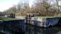
(1) Then turn right (ignore a yellow arrow pointing left; thePR® path runs in both directions). Follow the canal on your left along a compacted path. Pass the May lock. About 500 m further on, cross a stream (stone guardrails at ground level).

(2) Leave the canal bank immediately and take a grassy path on the right (not shown on the IGN map; take care to spot this turn-off as there are no signposts here). You’ll come out onto a small tarmac road; follow it to the left.

(3) At thefirst junction, turn right towards La Gionnerie. Pass a detached house on your right; the tarmac then gives way to a gravel track. At the end (elevation 91), take a path on the right between the fields. Further on, enter a woodland.

(4) At the T-junction, follow a track to the left. At a three-way junction, turn right onto a small road.

(5) At the Stop sign, first turn left then right to cross the road and join a path leading into a woodland. Continue straight on (south then south-southeast).

(6) Cross a stream (the Limetin) and leave the woodland. Follow a grassy track, passing an abandoned house on your right. Continue along the track lined with hedges.

(7) At the crossroads, turn right onto a wide, compacted track. Carry straight on (south-west) and ignore all side tracks.

(8) At the end, turn right onto a small road ( with narrow verges). Cross the Limetin again. Note two isolated trees on the right-hand side.

(9) About a hundred metres further on, turn left onto a track which soon gives way to a grassy path running parallel to a power line.

(10) Back on the tarmac, turn right onto the Route de la Dauvernerie. At the three-way junction (elevation 96), turn left onto thePR® de Marchais Clair. After a few houses, the tarmac gives way to a grassy track.

(11) You’ll come out onto a small road; follow it to the left. After about a hundred metres, at a Fork in the road, turn left onto the Route des Quatre Croix. Pass through a residential area.

(12) At the corner of No. 46, turn right onto a wide grassy track (not shown on the IGN map), lined with garden fences on the right-hand side.

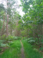
(13) At the end, follow a small road to the left. At the junction, go straight on towards the Clos de l’Alisier. After the last house, the tarmac gives way to a gravel track. Walk through a woodland, alternating between paths along the edge.

(14) At the junction (sign for “Impasse des Barres” on the right), turn left. At the T-junction, follow the road to the right ( narrow verges).

(15) About 300 m further on, turn right onto the Chemin des Rains. Pass a few derelict buildings. Ignore a dead-end on the right and continue along the small road which bends first to the left and then to the right.

(16) At the end of the tarmac, ignore a turn-off to the right and continue along a compacted track that winds through the fields. After a stretch along the edge of the fields, enter a wood. At the ‘give way’ sign, cross the D963 road and continue for about fifty metres along the path opposite until you reach a bridge over the canal.

(17) Then follow the towpath to the right, whichis the alternative routefor thePR® trail. Walk alongside the canal on your left. After about 400 metres, pass the Marchais Clair lock. Continue along a path beside the canal. Pass the old Courbouin buildings and a small swing bridge over the canal.

(1) At the bridge you passed on the way out, turn right onto the road leading to the village of Chevillon. At the end of the road, first turn left then right to return to the car park where you started (S/E).

Waypoints

  1. S/E : mi 0 - alt. 331 ft - Église Saint-Martin (Chevillon-sur-Huillard)
  2. 1 : mi 0.34 - alt. 312 ft - Junction of the circular loop - Canal d'Orléans
  3. 2 : mi 1.43 - alt. 292 ft - Start of the path - Canal d'Orléans
  4. 3 : mi 1.61 - alt. 292 ft - Junction
  5. 4 : mi 2.29 - alt. 302 ft - T-junction
  6. 5 : mi 2.64 - alt. 305 ft - D963 road
  7. 6 : mi 3.02 - alt. 292 ft - Limetin (ruisseau) - Affluent de la Bezonde
  8. 7 : mi 3.24 - alt. 308 ft - Crossroads
  9. 8 : mi 4.01 - alt. 325 ft - Le Marais
  10. 9 : mi 4.49 - alt. 312 ft - Start of the trail
  11. 10 : mi 4.84 - alt. 318 ft - Route de la Dauvernerie
  12. 11 : mi 5.37 - alt. 331 ft - Small road
  13. 12 : mi 5.74 - alt. 328 ft - La Férandière
  14. 13 : mi 5.91 - alt. 335 ft - Small road
  15. 14 : mi 6.84 - alt. 338 ft - Junction
  16. 15 : mi 7.11 - alt. 335 ft - Junction
  17. 16 : mi 7.53 - alt. 322 ft - Les Caillats
  18. 17 : mi 8.12 - alt. 318 ft - Lonleuvre Bridge - Canal d'Orléans
  19. S/E : mi 10.32 - alt. 331 ft - Église Saint-Martin (Chevillon-sur-Huillard)

Notes

Hiking boots are recommended.

Facilities at the starting point (S/E):
- In the church car park: drinking water and public toilets.
- Near the car park: a bar and tobacconist, a bar-restaurant, a bakery and a mini-market.

This walk follows aPR® trail designed, marked and signposted by the Loiret departmental committee of the FFRP. The markings are weathered; they are generally sparse and completely absent on some long stretches. A 1:25,000 map is required (at the very least, the one accompanying this description).

Warnings:
- On several occasions, the route crosses private property via private paths where access is permitted. Several signs and gates regularly remind walkers of this. Do not stray from the paths and please respect the local area.
- Walkers should be aware that, apart from the section along the canal, the route includes a significant proportion of tarmac roads (generally with little traffic).

Walk completed by the author on 11 January 2020.

Worth a visit

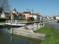
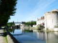
The walk along the canal, between (1) and (2) and between (17) and (1), is very pleasant, featuring two locks and a swing bridge.

The town of Chevillon-sur-Huillard provides interesting information on the local heritage and the history of the canal.

Always be cautious and plan ahead when you're outdoors. Visorando and the author of this route cannot be held responsible for any accidents occurring on this route.

The GR® and PR® markings are the intellectual property of the Fédération Française de Randonnée Pédestre.

Reviews and comments

4.3 / 5
Based on 3 reviews

Reliability of the description
4.7 / 5
Ease of following the route
4.7 / 5
Route interest
3.7 / 5
philouviso
philouviso

Overall rating : 4.7 / 5

Date of your route : Sep 08, 2024
Reliability of the description : ★★★★★ Very good
Ease of following the route : ★★★★★ Very good
Route interest : ★★★★☆ Good
Very busy route : No

The section running alongside the canal is magnificent

Machine-translated

Petit Christian
Petit Christian

Overall rating : 3.7 / 5

Date of your route : Feb 22, 2021
Reliability of the description : ★★★★☆ Good
Ease of following the route : ★★★★☆ Good
Route interest : ★★★☆☆ Average
Very busy route : No

Hello, I was looking for a route with a few picnic tables along the way for a day out. See you soon on other trails...

Machine-translated

efao45
efao45

Overall rating : 4.7 / 5

Date of your route : Aug 23, 2020
Reliability of the description : ★★★★★ Very good
Ease of following the route : ★★★★★ Very good
Route interest : ★★★★☆ Good
Very busy route : No

A lovely, pleasant walk, with no difficulty.

Machine-translated

Other walks in the area

For more walks, use our search engine .

The GPS track and description are the property of this route's author. Please do not copy them without permission.