


Refine your search for walks in Chiddes (Saône-et-Loire)
Chiddes (Saône-et-Loire) walks

 Butte de Suin, starting from Buffières
 Visorando Member
 11.21 mi
 +1,457 ft
 -1,457 ft
 6h 25
 Moderate
 Departure from Buffières (Saône-et-Loire)
Setting off from Buffières, we head for Suin and its famous “butte” via theGR®76Cand then theGR®7. The Butte de Suin rises to around 600 m. From the orientation table, there is a 360° view. You can see the Charolais region to the west, Mont Saint-Vincent and Montceau-les-Mines to the north-west, the Chalon region to the north-east, the Cluny region to the east, and Mont Saint-Cyr and the foothills of the Beaujolais to the south. The return journey is via Sivignon.
A trip to the valley from the Butte de Suin
 Tourist office
 9.13 mi
+1,020 ft
-1,001 ft
5h 05
Moderate
Departure from Suin (Saône-et-Loire)
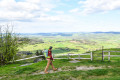
An unmissable viewpoint offering a magnificent panorama of the Charolais and Beaujolais hills. This route invites you to discover an unspoilt landscape, alternating between meadows and forests.
Saint-André-le-Désert circular
 5.88 mi
+581 ft
-581 ft
3h 15
 Easy
Departure from Saint-André-le-Désert (Saône-et-Loire)
The village of Saint-André-le-Désert is located between Clunisois and Charolais. I suggest this short walk in the heart of the Charolais cattle breeding region. The paths run through a landscape of rolling hills and hedgerows. You will pass through small hamlets with stone houses and places steeped in history. Suitable for families.
From Verosvres to Chevagny-sur-Guye via the GR®7
 15.14 mi
+1,322 ft
-1,841 ft
10h 10
 Difficult
Departure from Verosvres (Saône-et-Loire)
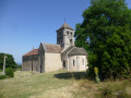
On the GR®7 trail between the Col des Vaux, in the commune of Verosvres, and Chevagny-sur-Guye, passing by the Butte de Suin
This is a very quiet section of the GR®7. There are no signposts at some junctions and no footprints in the tall grass to mark the route, so you must take an IGN map with you, although a GPS device is preferable.
This section of the GR® needs to be more popular, as it is not difficult and offers beautiful scenery. The view from the Butte de Suin is magnificent.
From Verosvres to Mont Rigaud via the GR®7
 17.52 mi
+3,451 ft
-1,529 ft
11h 05
 Very difficult
Departure from Verosvres (Saône-et-Loire)
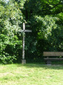
On the GR®7 trail, between the Col des Vaux in the commune of Verosvres and Mont Rigaud, passing through the village of Saint-Bonnet-des-Bruyères.
There are many shaded sections in the forest and beautiful landscapes.
The trail is sometimes unmarked, so bring an IGN map, but it is preferable to have a GPS device.
The hillside walk from Beaubery
 8.97 mi
+1,017 ft
-1,010 ft
5h 00
Moderate
Departure from Beaubery (Saône-et-Loire)
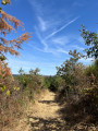
Starting from the village of Beaubery, this walk offers a wonderful immersion in the heart of the Charolais bocage. The route winds its way through hills and along small country lanes, revealing sweeping views.
Circular Cluny route via the Carmel de la Paix
9.86 mi
+1,329 ft
-1,329 ft
5h 40
Moderate
Departure from Cluny (Saône-et-Loire)
This walk will take you in the footsteps of the Cluniac monks, through deaneries and the ‘sacred ban’, across wide plateaus and past breathtaking viewpoints that invite contemplation. It requires a bit of effort, certainly, but with plenty of rewards in store.
A short walk around Marizy, taking in the Pierre d’Orgeval and the Étang Neuf
8.32 mi
+446 ft
-453 ft
4h 15
Moderate
Departure from Marizy (Saône-et-Loire)
A short walk around Marizy will take you into the countryside to discover the Pierre d’Orgeval hidden in the forest, the ancient Roman road and the Étang Neuf, tucked away in the middle of the Bois de Montchappa.
Around Marizy through the hills
7.55 mi
+538 ft
-538 ft
3h 55
Moderate
Departure from Marizy (Saône-et-Loire)
This easy circular route, which largely avoids muddy paths, follows quiet country lanes offering lovely views of the countryside. It passes near the Pierre d’Orgeval, a local landmark, then heads towards Fontaine Chaude, a spring that maintains a constant temperature all year round.
Saint-Point, Col des Enceints via Corcelle Castle
11.80 mi
+1,988 ft
-1,969 ft
7h 10
Moderate
Departure from Saint-Point (Saône-et-Loire)
A circular walk offering numerous beautiful views over the Charolais valleys and wooded countryside in the spirit of Alphonse de Lamartine, notably the Grosne valley, and, before the Col des Enceints, views of Berzé-la-Ville.
Circular route from village to village west of Cormatin
9.28 mi
+472 ft
-486 ft
4h 40
Moderate
Departure from Cormatin (Saône-et-Loire)
To the west of Cormatin, in the heart of the Ban Sacré, this walk may occasionally involve getting your feet wet during heavy rain, but above all it offers the chance to discover some of the most beautiful Cluniac sites.
Circular route starting from Cormantin
8.30 mi
+305 ft
-331 ft
4h 05
Moderate
Departure from Cormatin (Saône-et-Loire)
This circular route passes through pretty hamlets and winds its way through vineyards and woodland. The route follows paths and small roads with almost no traffic.
A short tour of the village of Sologny
1.11 mi
+164 ft
-164 ft
0h 40
Easy
Departure from Sologny (Saône-et-Loire)
A short circular walk through the vineyards near the village of Sologny.
Introductory course starting from Colombier-en-Brionnais
1.99 mi
+203 ft
-210 ft
1h 05
Easy
Departure from Colombier-en-Brionnais (Saône-et-Loire)
A discovery walk, specially designed for children.
The mills of Brionnais-Pays Clayettois
 9.22 mi
+850 ft
-879 ft
5h 00
Moderate
Departure from Gibles (Saône-et-Loire)
A beautiful, easy walk in the Brionnais-Pays Clayettois region, surrounded by peace and greenery. The route allows you to discover some of the ponds and old grain mills.
Col des Enceints via Les Provenchères and Les Fougères from Pierreclos
12.31 mi
+2,464 ft
-2,461 ft
7h 50
Difficult
Departure from Pierreclos (Saône-et-Loire)
A hike largely through woodland with few roads and numerous viewpoints.
The summit of Signal de la Mère Boitier from Serrières
 10.18 mi
+1,988 ft
-1,991 ft
6h 25
Moderate
Departure from Serrières (Saône-et-Loire) (Saône-et-Loire)
Hike from Serrières to the summit of Signal de la Mère Boitier
This hike largely follows the yellow-marked Mâcon Tourisme route (14 km | 4 hours 40 minutes on foot), which can be downloaded here, and another part of the Crêtes route, marked in blue from Mère Boitier to the hamlet of Les Guérins.