Country:

 City:
City:


Park in the designated spaces on Rue Sainte-Odile, near Notre-Dame Church.
(S/E) Head towards the tourist information centre by turning left at the corner by the chemist’s and following Rue Mercière alongside the church. Walk past the 1939–1945 war memorial and take the passage on the left to reach Place Notre-Dame. Exit to the right via Rue de la Barre to rejoin Rue Mercière. Walk up this street to the left.
(1) Walk past the Fontaine aux Serpents (1789) and the Maison des Vendanges, then continue straight on along Rue du Merle.
(2) At No. 22, note the Maison de l’Apothicaire. Continue to the end of the street to reach Place du Champ de Foire.
(3) Turn left onto Rue Jacques Guéritaine (D152), which forms part of the GR®76C route, heading towards the castle.
(4) At the junction marked ‘La Framboise’, follow the GR® to the left onto the Chemin de Montillet and rejoin the D152.
(5) Cross it carefully (poor visibility) and take the path opposite, which climbs towards a wooded area.
(6) At the junction (small ruin on the left), carry on straight ahead. As you approach a sharp bend, leave the GR®, pass a well, a large house, then the ‘Les Granges’ signpost before rejoining the D152 once more.
(7) Cross it with the same caution to take the path opposite towards La Brosse and reach the hamlet at a crossroads marked by a tree in the centre.
(8) Turn right onto a dirt track running parallel to the high-voltage power lines. Stay on this path , which leads to the ‘ban sacré’ – the zone of peace and immunity established around Cluny Abbey in the Middle Ages: marked with yellow signposts. Continue straight on. Before passing under the high-voltage power line, you’ll find an information board on the Roche plateau in the commune of Château.
(9) At the “En Roche” signpost, continue towards Mazille. On the plateau, there is no longer a marked path. Follow the hedge on the right: you will see a ruin on the left.
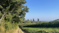
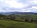
(10) At the end of the straight stretch, enter the woodland. Pass, on the left and slightly to one side of the path, a new information board entitled “Au-dessus du Plateau de Borde”: there’s a lovely view of Mont Gremois and the church at Grange as you emerge from the woods. Walk through Borde, passing close to the castle and the chapel: the access path on the left is marked by a wayside cross. Join the D165 (Route de Jalogny).
(11) Walk carefully along this road, keeping to the left. At the “Les Gorlières” signpost, stay on the road, leaving the yellow markings behind, and negotiate the bend to the left.
(12) Turn right onto the road towards Chaumont and the Carmel. At the “Les Crays” signpost, carry on straight ahead.
(13) Continue along the road, which turns 90° to the right, to reach the Carmel de la Paix.
(14) Retrace your steps back to the bend.
(13) Take the dirt track on the right downhill and reach the junction marked “Chemin du Carmel”.
(15) Head left towards Vaux. Ignore the path on the left and continue downhill; there may be a muddy section for 200 m. Join the GR®76 – GR®765 North at the “Chapelle de Vaux” signpost and follow them to the left towards Jalogny. Stay on the main road until you reach the last houses.
(16) At the fork in the road, take the path leading down to the left. Leave this almost immediately to take the path on the right which follows the high-voltage power line and then passes underneath it. You’ll come out onto the D165.
(17) First turn left then right as you cross the road to join a track; follow this for about a hundred metres before turning right at a 90° angle towards Jalogny. Cross the gravel path (grey) known as the Cras and continue straight ahead. Join the Chemin des Vergers, then take the Rue du Carge on the right and head towards the “Jalogny Bourg” signpost.
(18) Turn left towards Château, then turn right onto the path towards Cluny, which runs through the woodland at the foot of Mont Saint-Pierre.
(19) On emerging from the woods, at the “La Fosse” signpost, continue to the right, passing a mobile phone mast.
(20) A few metres before reaching the Route de Saunat and before the broken wayside cross, turn left onto the path. At the wash house, carry on straight ahead; you’ll come out onto the Route de Saunat and continue left until you reach the junction marked by a detached building.
(21) Follow Route de Brizolles to the right until it ends. Cross the junction of Rue Salvador Allende and Rue Léo Lagrange and take Rue du 19 Mars 1962 opposite, which joins Promenade du Fouettin.
(22) Cross at the pedestrian crossing and head down Rue Sainte-Odile opposite. Walk past Les Récollets at No. 7, then past the primary school, to return to the car park (S/E).
 Visorando Member
 Easy
Easy