Introductory course starting from Colombier-en-Brionnais

A discovery walk, specially designed for children.

Details

9759300
Creation:
Last update:
Last review:
  • Walking
    Activity: Walking
  • ↔
    Distance: 1.99 mi
  • ◔
    Average duration: 1h 05 
  • ▲
    Difficulty: Easy

  • ⚐
    Back to start: Yes
  • ↗
    Ascent: + 203 ft
  • ↘
    Descent: - 210 ft

  • ▲
    Highest point: 1,627 ft
  • ▼
    Lowest point: 1,378 ft

Description of the walk

Park at the edge of the Colombier-en-Brionnais quad bike track.

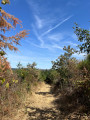
(S/E) Set off uphill, heading east, along a stony path. At a four-way junction, turn left, towards the forest. Pass a cross on your right, ignore the path leading to it, and carry on straight ahead. You will soon see a small path leading uphill on your right.

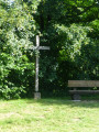
(1) Take the path on the right and head uphill. At the first junction, carry on straight ahead. You’ll come to a second junction with a cross in front of you; this is the ‘Homme Mort’ cross.

(2) Take the path to the right (south). Immediately ignore a path branching off to the right and continue south. At a Fork in the road, take the path on the right, the one that climbs. A little further on, head back down through an area of deciduous trees.

(3) At the junction at the bottom of the descent, turn left onto a wider path. This path curves to the right, and you’ll then reach another junction. Keep to the right on the wide path and exit the woods. Ignore a path on the right and you’ll come to a junction with houses opposite and a shed on your right.

(4) Turn 90° to the right, immediately ignore a dead end on the left and follow the houses on your left. At the next junction (after about 350 m), turn right, heading east, to reach the quad bike track (S/E).

Waypoints

  1. S/E : mi 0 - alt. 1,430 ft - Car park at the quad bike track
  2. 1 : mi 0.43 - alt. 1,568 ft - Path on the right
  3. 2 : mi 0.69 - alt. 1,608 ft - Croix de l’Homme Mort
  4. 3 : mi 1.18 - alt. 1,522 ft - T-junction
  5. 4 : mi 1.65 - alt. 1,378 ft - Crossroads by the hangar
  6. S/E : mi 1.99 - alt. 1,427 ft - Car park at the quad bike track

Reviews and comments

4.7 / 5
Based on 2 reviews

Reliability of the description
4.5 / 5
Ease of following the route
5 / 5
Route interest
4.5 / 5
Azimut71
Azimut71

Overall rating : 4.3 / 5

Date of your route : Apr 20, 2023
Reliability of the description : ★★★★☆ Good
Ease of following the route : ★★★★★ Very good
Route interest : ★★★★☆ Good
Very busy route : No

There’s no parking at the start, but there is some 350 metres to the west, if you turn south along the mini-stadium.
Otherwise, the description is accurate.

Machine-translated

randokick
randokick

Overall rating : 5 / 5

Date of your route : Oct 02, 2021
Reliability of the description : ★★★★★ Very good
Ease of following the route : ★★★★★ Very good
Route interest : ★★★★★ Very good
Very busy route : No

A walk we went on on a lovely sunny day. We didn’t see a soul! It’s a lovely area; we’ll be back to go walking there.

Machine-translated

Other walks in the area

For more walks, use our search engine .

The GPS track and description are the property of this route's author. Please do not copy them without permission.