Country:

 City:
City:


Park at the lakeside car park in Saint-Point.
(S/E) Join the district road, Route du Lac (D22), and turn left to walk along the hard shoulder towards the village.
(1) Turn left at the first street, Rue du Valouzin. Continue straight on until you reach Rue de l’Église, a dead-end street with no entry except for GIC vehicles, which climbs steeply towards the Romanesque Church of Saint-Donat and Lamartine’s tomb.
(2) Set off again along the narrow, grassy path leading downhill, and join the road to the château. Turn right and follow the boundary wall of the Château de Lamartine.
(3) At the castle entrance, turn left onto the Route de Chagny. Then take the second dirt track on the right, which climbs up to rejoin the Route de Chagny. Continue to the right along the dirt track, which rejoins the Route de Chagny once more. Cross over and take the Impasse de la Louve straight ahead. At the bend, leave the cul-de-sac and follow the track to the right to reach the Impasse de la Source. At the last house on the left, take the path on the left which climbs up to rejoin the Route de Chagny one last time.
(4) Cross the road and take the dirt track opposite, which, after about 200 m, leads into the woods. Continue up the steep climb along the track, which merges with the tarmac road to Champ de Brand, until you reach the Route de la Montagne, where the route joins the GR® 76 and the Way of St James. It’s well worth stopping to admire the view over the Grosne valley, its hedgerows and villages.
(5) Continue to the right along the road until you reach the first houses.
(6) Leave the road and the GR® and take the path on the right which leads into the forest. Stay on the main path which, after a fairly flat section, begins to descend: from here on, take care as there are many fallen trees across the path. On the descent, take the first path branching off to the left, then, after about 200 m, at the junction, turn left again. Continue for a further 200 m or so and turn right onto the path that descends to join the tarmac road to Le Rousset. Continue downhill, cross Valouzin and head back up to join the RD22, Route Lamartine.
(7) Follow the departmental road to the left for 50 m, then turn right onto the Chemin de Praye, which climbs alongside the wall of the farm building. Continue uphill, go straight on at the first junction, and turn left at the second to reach the hamlet of Montangerand. Walk through the hamlet keeping to the right and, once at the end, turn right onto the path that climbs until it reaches the road called Rue de Bourgogne.
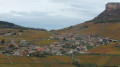
(8) Head down this road to the left. Admire Château de Corcelle in the distance, then reach the hamlet and the D212. Cross the roadcarefully, keeping the château on your left, and continue along the path opposite, continuing the descent.
(9) Just after crossing a small leat, turn immediately right onto the path that runs alongside it, rising gently.
(10) At a very old ruin, turn left onto the path which climbs steeply. Join a forest track, turn right and continue the climb until you reach a major junction: take a moment toadmire the view!
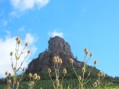
(11) Head right towards the Col des Enceints. At the next junction, turn left towards the Tour de Vayon, where there is a picnic area. Return to the previous junction and continue towards the Col des Enceints. Cross the county road at the pass and take the forest track opposite.
(12) After about 100 m, keep to the right and stay on the track until the next crossroads marked by a cross.
(13) Continue along the main track on level ground, turning neither right nor left.
(14) At the next fork, turn right onto the track which descends steeply. Stay on this main track as it continues down to the hamlet of Les Verchères, where you’ll rejoin a tarmac road: take in the breathtaking view of Lamartine Castle.
(15) Continue along the road, pass through the hamlet of Blanchizet and, after about 500 m, turn right onto the dirt track which takes you to the hamlet of Bourgogne without having to walk along the road.
(16) At the junction at the entrance to the hamlet, turn right, then, after about a hundred metres, turn left at the corner of a house. Continue along the dirt track as it descends. Join the road, go straight on at the next junction and carry on.
(17) When you reach the first houses, turn immediately right onto the road leading to the house below. A dirt track takes you to the main road. Cross it and turn left to reach the lakeside. Continue to the left, cross a small bridge over the Valouzin, then turn right, following the lake’s edge to reach the car park (S/E).

 Visorando Member
 Easy
Easy