


Refine your search for walks in Chausseterre
Chausseterre walks


 Bois de Dôle
 Local authority
 2.34 mi
 +276 ft
 -276 ft
 1h 20
 Easy
 Departure from Chausseterre (Loire)
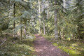
A family-friendly route for a breath of fresh air in the Dole forest at Chausseterre. A shaded route, very pleasant on hot days. It has its charms in other seasons, too. This is a route marked by Urfé Random and the Pays d’Urfé Community of Communes with the number 28.
Arconsat – Cherier
 Association / Club / Walk leader
 13.12 mi
+2,336 ft
-2,041 ft
8h 05
 Difficult
Departure from Arconsat (Puy-de-Dôme)
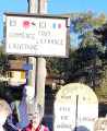
The fifth stage of the Boucle du Rez de Sol route, where you leave the Auvergne to return to the Loire region by crossing the Col Saint-Thomas, famous for its sign reading “Here ends France, here begins the Auvergne”. You leave the Bois Noirs to pass through the pretty hamlets of Chausseterre and then Saint-Just-en-Chevalet. A long climb leads up to the Pras plateau at an altitude of 1,000 metres (in the commune of Cherier), involving a 400-metre ascent in the second half of the day, along lovely little shaded paths well maintained by the Urfé Community of Communes. Discover numerous isolated houses, beautifully restored by those who love solitude.
Saint-Just-en-Saltire – Laprugne
 11.35 mi
+1,594 ft
-1,296 ft
6h 35
 Moderate
Departure from Saint-Just-en-Chevalet (Loire)
Second stage of a 5-day horse-riding route across the Monts de la Madeleine, the Bois Noirs and the northern Livradois. A typical mid-mountain route, featuring open countryside used for livestock farming, deciduous forests, lively villages, and quiet, well-maintained paths. The start involves little elevation gain (La Tuilière plateau), but most of the climb comes towards the end, after crossing into the Allier.
The Vernières oak tree via the Chemin de la Pierre aux deux Yeux
 Visorando Member7.80 mi
+1,220 ft
-1,234 ft
4h 40
Moderate
Departure from Chabreloche (Puy-de-Dôme)
Hidden in the heart of the Bois Noirs, the Pierre aux Deux Yeux (Two-Eyed Stone) watches over the unwary hiker. If you escape it, the majestic old oak tree will grant you some of its serenity. Then take a break at the foot of the Roc du Guet rock formation, a place conducive to meditation.
Between agriculture and heritage in Saint-Marcel-d'Urfé
 11.77 mi
+1,969 ft
-1,978 ft
7h 10
Moderate
Departure from Saint-Marcel-d'Urfé (Loire)
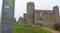
A hike to an altitude of nearly 1,000 metres, through a farming landscape where you will encounter ancient heritage.
Circular Cornes d'Urfé starting from Saint-Marcel d'Urfé
 9.92 mi
+1,883 ft
-1,893 ft
6h 10
Moderate
Departure from Saint-Marcel-d'Urfé (Loire)
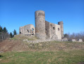
Circular through the countryside and forest to discover Les Cornes d'Urfé.
The Puy de Montoncel from La Lizolle
 4.45 mi
+1,385 ft
-1,401 ft
3h 15
Moderate
Departure from Palladuc (Puy-de-Dôme)
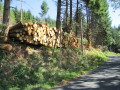
The Giant of the Bois Noirs, whose summit is often shrouded in clouds or mist, can be approached from Lavoine or Saint-Priest-la-Prugne. For this walk, we chose to approach it via Palladuc. It is a fairly strenuous walk, but one that guarantees peace and quiet, wide open spaces and sweeping views over this part of the beautiful Auvergne region.
Le Puy de Montoncel
 7.50 mi
+1,516 ft
-1,493 ft
4h 45
Moderate
Departure from Palladuc (Puy-de-Dôme)
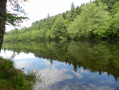
For much of this route, it is clear why we are walking through the Bois Noirs, as the light sometimes struggles to penetrate the foliage. In other places, however, tree felling has opened up the view, and the number of logs stacked along the paths is impressive.
The chestnut tree of La Bitortie
6.50 mi
+801 ft
-778 ft
3h 40
Moderate
Departure from Noirétable (Loire)
A walk in the Netrablaise countryside, across fields, from hamlet to hamlet, to discover an old and majestic chestnut tree.
The Altar of the Barony and the Gilbernie Oak Tree
5.79 mi
+597 ft
-571 ft
3h 10
Easy
Departure from Noirétable (Loire)
An easy walk through fields and woods to discover a beautiful rock formation, the Autel de la Baronnie, with its wobbly stone, armchairs and potholes, followed by a large majestic oak tree at the Ferme de la Gilbernie.
Noirétable Lake and Puy de Rot
 4.64 mi
+472 ft
-476 ft
2h 35
Easy
Departure from Noirétable (Loire)
A gentle hike to start your holiday in the Forez mountains.
Laprugne – Saint-Victor-Montvianeix
 12.93 mi
+2,195 ft
-2,169 ft
7h 50
Difficult
Departure from Laprugne (Allier)
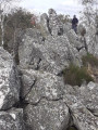
Third stage of the Rez de Sol circular route, straddling the Monts de la Madeleine, the Bois Noirs and the northern Livradois. There is a stark contrast as you cross from the Allier into the Puy-de-Dôme: from pretty mid-mountain hamlets as far as Lavoine, then a landscape dominated by forests cascading down deep gorges from which a few hilltop villages emerge, seeming timeless, towards St-Victor-Montvianeix (a very extensive commune covering 4,500 ha). An optional detour takes you to the Rez de Sol (1.6 km). Omitting this route reduces the length of the stage by the same distance.
The Saint-Vincent Rock
 5.10 mi
+738 ft
-738 ft
3h 00
Easy
Departure from Lavoine (Allier)
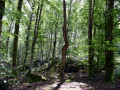
Winding its way between forests and pastures, this walk leads to the foot of Rocher Saint-Vincent, the protective power of Lavoine and the Sichon valley.
Rez de Sol walking route
 62.40 mi
+10,089 ft
-10,089 ft
5 days
Difficult
Departure from Cherier (Loire)
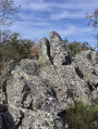
A five-day itinerary linking the Monts de la Madeleine, the Bois Noirs and the northern Livradois, taking in the Rez de Sol and the Pierre du Sang. There is a lodge where you can stay overnight and have dinner each evening. The landscape is that of the mid-mountain range, predominantly wooded on the Auvergne side and predominantly agricultural on the Forez side, always following small paths that allow you to truly discover this little-known region.
From Cherier (Le Point du Jour) to the campsite at Saint-Just-en-Chevalet
 13.04 mi
+1,788 ft
-2,667 ft
7h 35
Difficult
Departure from Cherier (Loire)
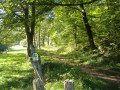
First stage of a 5-day route through the Monts de la Madeleine, the Bois Noirs and the northern Livradois. Most of the day is spent on the lovely paths of the commune of Cherier, offering a range of views from the tops of its hills, amidst unspoilt countryside. At the end of the route, the path descends to Saint-Just-en-Chevalet, after passing through the charming hamlet of Fonthieur.
Roannaise coast and mountains
 50.15 mi
+7,923 ft
-7,907 ft
4 days
Difficult
Departure from Cherier (Loire)
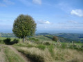
A 4-day hiking tour from lodge to lodge in the Monts de la Madeleine (low mountain range) west of the town of Roanne. Immerse yourself in nature, often still wild, by taking as many small paths as possible.
From Point du Jour to Saint-Haon-le-Châtel
 14.49 mi
+1,686 ft
-3,130 ft
8h 10
Difficult
Departure from Cherier (Loire)
Departure from a high point in the Monts de la Madeleine, in Cherier, at a place called Le Point du Jour (870 m, 14-bed stopover lodge with meals) to descend to the Côte Roannaise, cross its vine-covered hillsides and arrive at the medieval village of Saint-Haon-le-Châtel (14-bed stopover lodge with meals). This route gives priority to small paths with no motor vehicle traffic and beautiful views of the Roanne plain.