


Refine your search for walks in Aix (rivière) - Affluent de la Loire
Aix (rivière) - Affluent de la Loire walks


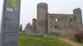
 Between agriculture and heritage in Saint-Marcel-d'Urfé
 Visorando Member
 11.77 mi
 +1,969 ft
 -1,978 ft
 7h 10
 Moderate
 Departure from Saint-Marcel-d'Urfé (Loire)
A hike to an altitude of nearly 1,000 metres, through a farming landscape where you will encounter ancient heritage.
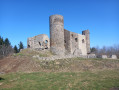
Circular Cornes d'Urfé starting from Saint-Marcel d'Urfé
 9.92 mi
+1,883 ft
-1,893 ft
6h 10
Moderate
Departure from Saint-Marcel-d'Urfé (Loire)
Circular through the countryside and forest to discover Les Cornes d'Urfé.
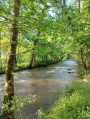
Along the Aix to Grézolles
 5.23 mi
+495 ft
-469 ft
2h 50
 Easy
Departure from Grézolles (Loire)
Walk in Grézolles, along the Aix, to the Moulin du Gué, then back to the village after a visit to the Sainte-Barbe Chapel.
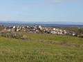
Route of the huts from the Saint-Germain-Laval Architects’ Festival
 3.74 mi
+564 ft
-541 ft
2h 15
Easy
Departure from Saint-Germain-Laval (Loire)
This summer 2021, Saint-Germain-Laval is hosting the Festival des Cabanes d’Architectes, organised in partnership with the Festival des Cabanes and La Soierie associations, both based in Faverges. This route will allow you to discover the three huts, the historic village and the banks of the River Aix...
Le circuit de l'Aix par la campagne de Saint-Julien-d'Oddes
 7.53 mi
+4,652 ft
-4,836 ft
7h 30
Moderate
Departure from Saint-Julien-d'Oddes (Loire)
Ce circuit parcours la campagne de Saint-Julien-d'Oddes au milieu d'une végétation luxuriante. La Rivière l'Aix nous accompagne jusqu'à la centrale hydroélectrique de Chizonnet.
Walks near Aix (rivière) - Affluent de la Loire
Arconsat – Cherier
 Association / Club / Walk leader
 13.12 mi
+2,336 ft
-2,041 ft
8h 05
 Difficult
Departure from Arconsat (Puy-de-Dôme)
The fifth stage of the Boucle du Rez de Sol route, where you leave the Auvergne to return to the Loire region by crossing the Col Saint-Thomas, famous for its sign reading “Here ends France, here begins the Auvergne”. You leave the Bois Noirs to pass through the pretty hamlets of Chausseterre and then Saint-Just-en-Chevalet. A long climb leads up to the Pras plateau at an altitude of 1,000 metres (in the commune of Cherier), involving a 400-metre ascent in the second half of the day, along lovely little shaded paths well maintained by the Urfé Community of Communes. Discover numerous isolated houses, beautifully restored by those who love solitude.
Saint-Just-en-Saltire – Laprugne
 11.35 mi
+1,594 ft
-1,296 ft
6h 35
Moderate
Departure from Saint-Just-en-Chevalet (Loire)
Second stage of a 5-day horse-riding route across the Monts de la Madeleine, the Bois Noirs and the northern Livradois. A typical mid-mountain route, featuring open countryside used for livestock farming, deciduous forests, lively villages, and quiet, well-maintained paths. The start involves little elevation gain (La Tuilière plateau), but most of the climb comes towards the end, after crossing into the Allier.
Laprugne – Saint-Victor-Montvianeix
 12.93 mi
+2,195 ft
-2,169 ft
7h 50
Difficult
Departure from Laprugne (Allier)
Third stage of the Rez de Sol circular route, straddling the Monts de la Madeleine, the Bois Noirs and the northern Livradois. There is a stark contrast as you cross from the Allier into the Puy-de-Dôme: from pretty mid-mountain hamlets as far as Lavoine, then a landscape dominated by forests cascading down deep gorges from which a few hilltop villages emerge, seeming timeless, towards St-Victor-Montvianeix (a very extensive commune covering 4,500 ha). An optional detour takes you to the Rez de Sol (1.6 km). Omitting this route reduces the length of the stage by the same distance.
Saint-Victor-Montvianeix – Arconsat
 11.87 mi
+2,172 ft
-1,909 ft
7h 20
Moderate
Departure from Saint-Victor-Montvianeix (Puy-de-Dôme)
Stage4 of the circular mid-mountain loop linking the Monts de la Madeleine, Bois Noirs and the northern Livradois – picturesque hilltop villages nestled in deep gorges carved out by rivers, from the beautiful Muratte Dam to the village of Arconsat: explore the wooded and unspoilt countryside on the Auvergne side of the Puy de Montoncel. This stage very often follows the routes of the Espace VTT Bois Noirs, guaranteeing that you’ll find open, signposted trails.
From the Loge des Gardes to Point du Jour
 11.96 mi
+1,368 ft
-2,044 ft
6h 40
Moderate
Departure from Laprugne (Allier)
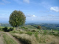
Departure from the Loge des Gardes sports centre. Start the day in the beautiful beech undergrowth of the Assise State Forest, above 1,000 metres altitude, before descending to the more open plateaus of La Tuilière and Cherier, with beautiful views. End at the Refuge du Point du Jour lodge (overnight stay and meals made with farm produce) (altitude 870 metres).
From Cherier (Le Point du Jour) to the campsite at Saint-Just-en-Chevalet
 13.04 mi
+1,788 ft
-2,667 ft
7h 35
Difficult
Departure from Cherier (Loire)
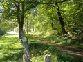
First stage of a 5-day route through the Monts de la Madeleine, the Bois Noirs and the northern Livradois. Most of the day is spent on the lovely paths of the commune of Cherier, offering a range of views from the tops of its hills, amidst unspoilt countryside. At the end of the route, the path descends to Saint-Just-en-Chevalet, after passing through the charming hamlet of Fonthieur.
From Point du Jour to Saint-Haon-le-Châtel
 14.49 mi
+1,686 ft
-3,130 ft
8h 10
Difficult
Departure from Cherier (Loire)
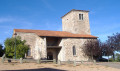
Departure from a high point in the Monts de la Madeleine, in Cherier, at a place called Le Point du Jour (870 m, 14-bed stopover lodge with meals) to descend to the Côte Roannaise, cross its vine-covered hillsides and arrive at the medieval village of Saint-Haon-le-Châtel (14-bed stopover lodge with meals). This route gives priority to small paths with no motor vehicle traffic and beautiful views of the Roanne plain.
Thiers - Les Quatre Vents
11.38 mi
+1,998 ft
-1,526 ft
7h 00
Difficult
Departure from Thiers (Puy-de-Dôme)
This first stage of the Chemin de Sainte-Agathe gives us the opportunity to take different PR®® trails. We pass through charming little hamlets: Lamouroux, Sardier, Grand Cognet, Laurençon and cross a few streams. Beautiful trees line the route, as well as numerous views of the Chaîne des Puys.From the village of Vollore-Ville, passing close to the castle, we descend towards the plain and reach the Gîte des Quatre Vents via the hamlet of Sauvetat.
La Renaudie – Sainte-Agathe
12.96 mi
+1,673 ft
-2,661 ft
7h 25
Difficult
Departure from La Renaudie (Puy-de-Dôme)
This fourth stage of the route is the longest and most challenging. We will often be walking at high altitudes (highest point: 1,153 m). We will follow the River Couzon before descending along good paths through the woodland towards Vollore-Montagne. The walk through the Ayguebonne Forest, near the Grun de Chignore, will take us to Sainte-Agathe.