Refine your search for walks in Chapelle
Chapelle walks
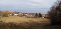
 A walk through the Bois du Jorat forest
 Visorando Member
 8.86 mi
 +886 ft
 -856 ft
 5 hrs
5 hrs
 Easy
Easy
 Departure from Froideville (Canton de Vaud) (Vaud)
When it’s hot, the route is perfect – and you’re away from the insects!
Plenty of forest paths, lovely mountain huts, drinking fountains – though not many opportunities for galloping.
There’s one slightly tricky section on this route: a descent along a narrow path towards the river followed by a steep climb, but you can easily go round it.
 Les Paccots - Vevey
 13.66 mi
+1,657 ft
-4,098 ft
7h 45
13.66 mi
+1,657 ft
-4,098 ft
7h 45
 Difficult
Departure from Châtel-Saint-Denis (Canton of Fribourg)
Difficult
Departure from Châtel-Saint-Denis (Canton of Fribourg)
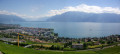
This last stage will take you to the shores of Lake Geneva in Vevey. From Les Paccots, a forest trail will lead you to the Fégire footbridge, where the Veveyse de Fégire marks the border between the cantons of Fribourg and Vaud. When you arrive at Laly and from the Pléiades trail, you can admire Lake Geneva and the surrounding Alpine peaks. You will pass through a few vineyards before arriving in Vevey.
The Terraces of Lavaux, the Three Suns
6.83 mi
+899 ft
-787 ft
3h 55
 Moderate
Departure from Vaud
Moderate
Departure from Vaud
A beautiful walk through the vineyards of Lavaux, discovering the different appellations. Lovely views of the lake and the Alps.
Local wines can be tasted throughout the hike.
N.B. Contrary to what is automatically indicated on the hike information sheet, the Lavaux terraces are located in the canton of Vaud and not in Valais.
Crossing the Pléiades from Blonay
 6.58 mi
+1,762 ft
-2,480 ft
4h 35
Moderate
Departure from Blonay (Vaud)
6.58 mi
+1,762 ft
-2,480 ft
4h 35
Moderate
Departure from Blonay (Vaud)
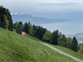
A classic destination in the region offering magnificent views of Lake Geneva and the surrounding mountains. The route is particularly recommended in spring and autumn. In summer, this largely shaded route limits excessive exposure to the sun. The hike is ideal for family activities, including a visit to the AstroPléiades educational site.
Around Teysachaux
8.30 mi
+2,677 ft
-2,654 ft
6h 10
Difficult
Departure from Châtel-Saint-Denis (Canton of Fribourg)
A beautiful circular to do in the Teysachaux area, with varied landscapes. If you're lucky, you might spot some marmots. You can park at the starting point of the route, where there are 5 or 6 spaces.
Teysachaux and Le Moléson from Belle Chaux
 6.71 mi
+2,398 ft
-2,398 ft
5h 10
Difficult
Departure from Châtel-Saint-Denis (Canton of Fribourg)
6.71 mi
+2,398 ft
-2,398 ft
5h 10
Difficult
Departure from Châtel-Saint-Denis (Canton of Fribourg)
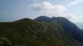
Moléson is a popular peak in the Fribourg Pre-Alps because it offers superb views of Lake Geneva and the surrounding mountains. This hike takes you up the mountain, first passing the steep summit of Teysachaux and then following a pleasant ridge trail.
Bottens – Froideville – Montheron – Bottens
10.70 mi
+2,375 ft
-2,375 ft
4 hrs
Easy
Departure from Bottens (Vaud)
Some lovely gallops, beautiful woodland (Bois du Jorat), more tarmac roads at the start but a magnificent route with a lovely shelter by the river halfway along for a picnic.
Be careful to adjust your route and avoid riding along the edges of forests or fields if they haven’t been mowed!
Dent de Lys
 3.68 mi
+2,018 ft
-1,988 ft
3h 25
Difficult
Departure from Châtel-Saint-Denis (Canton of Fribourg)
3.68 mi
+2,018 ft
-1,988 ft
3h 25
Difficult
Departure from Châtel-Saint-Denis (Canton of Fribourg)
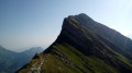
The Dent de Lys is a summit that lives up to the elegance of its name and offers superb panoramic views! Its ascent includes steep and exposed sections that make it suitable only for experienced hikers.
The Moléson circular walk from Plans-Francey
4.35 mi
+1,985 ft
-1,982 ft
3h 45
Difficult
Departure from Gruyères (Canton de Fribourg) (Canton of Fribourg)
Moléson is a must-see peak in the Gruyères region of Switzerland. Easily accessible by cable car and funicular, you can walk all the way round it to enjoy a 360° view of the French and Swiss Alps. Although challenging, the ascent is fairly short but technical, as is the descent. It is possible to start much lower down in the valley from Moléson-sur-Gruyères.
Cape au Moine circular via Soladier and Jaman
9.25 mi
+3,022 ft
-3,022 ft
6h 55
Difficult
Departure from Montreux (Canton de Vaud) (Vaud)
Starting from La Cergniaulaz towards Le Molard, this is a beautiful route that runs along the peaks of Cape au Moine. It can be extended via La Pierra Perchia (to be avoided in bad weather) and descends via the Col de Jaman and La Planiaz.
La Cergniaulaz, Le Molard and Le Folly
6.10 mi
+1,883 ft
-1,883 ft
4h 25
Moderate
Departure from Montreux (Canton de Vaud) (Vaud)
A magnificent hike starting from the Auberge de la Cergniaulaz restaurant with free parking. Accessible in summer with the chance to see fields full of daffodils in early May, and in winter on snowshoes or touring skis. It's quite a climb at the start, but the surrounding mountain scenery and the beauty of the forests and wildlife make you forget the effort. The view of the lake on the descent from the summit of Folly is breathtaking, and if you're there around August, you can refuel with thousands of wild blueberries on the way down from Molard. The Cergniaulaz restaurant offers semi-gourmet dishes but is very hiker-friendly, and you can also enjoy some typical dishes such as planchette, fondue or rösti. Their tart of the day was to die for.
Beautiful views and forest above Surpierre.
2.36 mi
+400 ft
-394 ft
1h 25
Easy
Departure from Surpierre (Canton of Fribourg)
Views of Moléson, the Alps and Mont Blanc on a clear day. Mostly shaded hike, sheltered from the wind. If you look closely, you may spot wildlife along the path, which is closed to vehicles. The hike is ideal for walking with your dog, but watch out for horse riders on the path.
Cape au Moine from Col de Jaman
3.60 mi
+1,512 ft
-1,496 ft
3h 00
Moderate
Departure from Montreux (Canton de Vaud) (Vaud)
A short hike, mostly along the mountainside, ending with a ridge that requires caution. From the summit, superb panorama, especially of Lake Geneva, which is only five kilometres away and which you overlook from a height of nearly 1,600 metres.
Circular walk around the Rochers de Naye starting from Caux
 9.73 mi
+4,334 ft
-4,314 ft
8h 15
9.73 mi
+4,334 ft
-4,314 ft
8h 15
 Very difficult
Departure from Montreux (Canton de Vaud) (Vaud)
Very difficult
Departure from Montreux (Canton de Vaud) (Vaud)
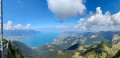
Les Rochers de Naye (2,042 m): A unique panoramic view of the Swiss and French Alps, from the Eiger to Mont Blanc and Lake Geneva. In particular, you can see the neighbouring peaks of the Dent de Jaman and Cape aux Moines, the French-speaking Jura, much of the Fribourg Pre-Alps and the Vaud Alps, including the Diablerets massif; the Bernese Oberland with the Eiger-Mönch-Jungfrau trio; as well as Mont Dolent and the Aiguille Verte in the Mont Blanc massif.
Rocher de Naye at Pertuis d'Aveneyre
8.60 mi
+3,661 ft
-3,642 ft
7h 10
Difficult
Departure from Villeneuve (Canton de Vaud) (Vaud)
Departure from Rochers de Naye by rack railway with overnight stay in a bivouac just above Pertuis d'Aveneyre. The route largely follows the Via Alpina trail. Some paths are narrow, so caution is advised for those prone to vertigo.
Saint Gingolph - La Chapelle d'Abondance
10.74 mi
+6,010 ft
-3,934 ft
10h 10
Difficult
Departure from Saint-Gingolph (Haute-Savoie)
Itinéraire de la traversée des Alpes. Etape des rives du lac Léman au Val d'Abondance. Franchir les montagnes du Chablais par une longue grimpette de 1850m en traversant les alpages pour passer le Col de Bise puis redescendre à la station de ski de la Chapelle d'Abondance. Cet itinéraire offre de très beaux panoramas sur le plus grand lac d'Europe et sur le sommet des Cornettes de Bise.
From Saint-Gingolph to the Chalets de Bise
 7.66 mi
+5,013 ft
-1,348 ft
7h 55
Difficult
Departure from Saint-Gingolph (Haute-Savoie)
7.66 mi
+5,013 ft
-1,348 ft
7h 55
Difficult
Departure from Saint-Gingolph (Haute-Savoie)
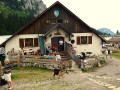
This first stage of the Grande Traversée des Alpes (GTA), from Lake Geneva to the Mediterranean, takes place in the Chablais massif. The path climbs up the Novel valley on the left bank of the Morge, below the hamlet of La Meurtaz, then follows the D30 road, which it overlooks after the hamlet of Jordy. On leaving Novel, the path winds its way above the hairpin bends of the D30 to La Planche. There, it leaves the main valley route to climb due south towards the chalets of Neuteu and on to the Col de Bise, before descending to the Chalets de Bise.
Along the shores of Lake Geneva from one Saint-Gingolph to the other
 1.61 mi
+102 ft
-102 ft
0h 50
Easy
Departure from Saint-Gingolph (Haute-Savoie)
1.61 mi
+102 ft
-102 ft
0h 50
Easy
Departure from Saint-Gingolph (Haute-Savoie)
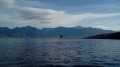
On the southern shore of Lake Geneva, two neighbouring municipalities are both called Saint-Gingolph; one is in Switzerland, the other in France. This short walk takes you from one to the other, first along the lake and then through the streets higher up. You’ll be treated to some stunning views and a rich heritage.
The quarries of Meillerie
 4.82 mi
+1,496 ft
-1,490 ft
3h 30
Moderate
Departure from Meillerie (Haute-Savoie)
4.82 mi
+1,496 ft
-1,490 ft
3h 30
Moderate
Departure from Meillerie (Haute-Savoie)
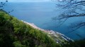
Exploited since the 18th century, the Meillerie quarries provided the stone used to construct many buildings in Geneva and Lausanne. Today, only one quarry is still in operation, but it is not open to the public. This hike, which requires sure-footedness, first takes you to two old quarries, La Balme and La Balle, and offers superb panoramic views of Lake Geneva. The return journey is along a lakeside path.
On the shores of Lake Geneva between Meillerie and Locum
 3.65 mi
+26 ft
-26 ft
1h 40
Easy
Departure from Meillerie (Haute-Savoie)
3.65 mi
+26 ft
-26 ft
1h 40
Easy
Departure from Meillerie (Haute-Savoie)
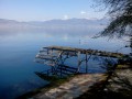
This short hike follows a path that runs continuously along Lake Geneva, which is an exception for this lake, whose shores are mostly located on private property. On one side, you can enjoy beautiful views of the opposite shore of the lake and the Vaud Alps, and on the other side, a view of the cliffs overlooking the lake.
Along the shores of Lake Geneva from Villeneuve to Montreux.
 3.27 mi
+177 ft
-167 ft
1h 40
Easy
Departure from Villeneuve (Canton de Vaud) (Vaud)
3.27 mi
+177 ft
-167 ft
1h 40
Easy
Departure from Villeneuve (Canton de Vaud) (Vaud)
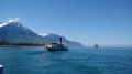
A pleasant walk along the "Riviera of Lake Geneva", with superb panoramic views of the lake and surrounding peaks, the grand residences of Montreux and the famous Château de Chillon. This walk is proposed as a one-way trip with the option of returning either by boat or on foot.
Rochers de Naye from the Col de Chaude
 4.01 mi
+1,814 ft
-1,808 ft
3h 25
Moderate
Departure from Villeneuve (Canton de Vaud) (Vaud)
4.01 mi
+1,814 ft
-1,808 ft
3h 25
Moderate
Departure from Villeneuve (Canton de Vaud) (Vaud)
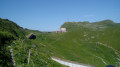
Les Rochers de Naye overlook Lake Geneva from a height of nearly 1,700m and offer a magnificent panorama of the lake and the neighbouring Alpine peaks. This hike offers a shorter and less exposed ascent than the more common route starting from the Col de Jaman.
Pointe d'Aveneyre
 3.41 mi
+1,617 ft
-1,614 ft
3h 00
Moderate
Departure from Villeneuve (Canton de Vaud) (Vaud)
3.41 mi
+1,617 ft
-1,614 ft
3h 00
Moderate
Departure from Villeneuve (Canton de Vaud) (Vaud)
Far less frequented than the neighbouring Rochers de Naye, the Pointe d'Aveneyre offers a magnificent panorama of Lake Geneva, the Vaud Alps and the Fribourg Alps, as well as the peaks of the Chablais.
Pic de Blanchard via the Chalets de Corniens
 8.07 mi
+2,267 ft
-2,241 ft
5h 40
Moderate
Departure from Thollon-les-Mémises (Haute-Savoie)
8.07 mi
+2,267 ft
-2,241 ft
5h 40
Moderate
Departure from Thollon-les-Mémises (Haute-Savoie)
A hike at medium altitude, on a route that is often shaded. A flower-covered summit offering superb views of Lake Geneva and the surrounding peaks. Beautiful views of the lake along the way.
Ascent and tour of Les Mémises from Thollon
 8.45 mi
+2,684 ft
-2,664 ft
6h 15
Difficult
Departure from Thollon-les-Mémises (Haute-Savoie)
8.45 mi
+2,684 ft
-2,664 ft
6h 15
Difficult
Departure from Thollon-les-Mémises (Haute-Savoie)
A circular that allows you to climb the Mémises via their northern slope. Splendid panoramic views of Lake Geneva and beautiful views of the northern faces of the Dent d'Oche and Pic de Borée await you.
The Belvédère du Hucel from Thollon
 2.73 mi
+390 ft
-361 ft
1h 35
Easy
Departure from Thollon-les-Mémises (Haute-Savoie)
2.73 mi
+390 ft
-361 ft
1h 35
Easy
Departure from Thollon-les-Mémises (Haute-Savoie)
At the foot of Montagne des Mémises, a short walk takes you up to a unique viewpoint offering breathtaking views of Lake Geneva.
Les Granges de Lain
 2.76 mi
+325 ft
-318 ft
1h 35
Easy
Departure from Thollon-les-Mémises (Haute-Savoie)
2.76 mi
+325 ft
-318 ft
1h 35
Easy
Departure from Thollon-les-Mémises (Haute-Savoie)
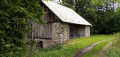
At the foot of the Montagne des Mémises, a short walk to discover a beautiful cluster of old barns in a vast clearing in the forest.
Balcony view over the heights of Lugrin
 6.25 mi
+794 ft
-810 ft
3h 35
Moderate
Departure from Lugrin (Haute-Savoie)
6.25 mi
+794 ft
-810 ft
3h 35
Moderate
Departure from Lugrin (Haute-Savoie)
The commune of Lugrin stretches from the shores of Lake Geneva (375 m) to the Plateau de Gavot (900 m) and the northern summit of Mont Bénand (1,240 m). This hike begins with a climb to the hilltop village of Les Combes (570 m) with its beautiful old houses, passing by the venerable chestnut tree of Troubois. Next, a balcony trail and a descent lead to the old church of Lugrin, before returning to the main village. A bucolic hike where heritage is very much in evidence.
The Hucel Viewpoint from Lugrin
 6.35 mi
+1,880 ft
-1,896 ft
4h 35
Moderate
Departure from Lugrin (Haute-Savoie)
6.35 mi
+1,880 ft
-1,896 ft
4h 35
Moderate
Departure from Lugrin (Haute-Savoie)
This hike involves a climb up steep paths to a unique viewpoint offering a breathtaking panorama of Lake Geneva.
 Coastal sailing on Lake Léman from Tourronde to Locum
 9.75 mi
+23 ft
-23 ft
3 hrs
Moderate
Departure from Lugrin (Haute-Savoie)
9.75 mi
+23 ft
-23 ft
3 hrs
Moderate
Departure from Lugrin (Haute-Savoie)
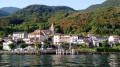
A boat trip along the shores of Lake Geneva, where the landscape is at its wildest and the mountains drop most steeply. Beautiful panoramic views and several lovely lakeside houses await.
From the shores of Lake Geneva to the Pic des Mémises
 12.83 mi
+4,524 ft
-4,514 ft
9h 50
Very difficult
Departure from Lugrin (Haute-Savoie)
12.83 mi
+4,524 ft
-4,514 ft
9h 50
Very difficult
Departure from Lugrin (Haute-Savoie)
From the "sea" to the mountains: a long hike with some steep sections, rewarded by superb panoramic views of Lake Geneva. The route takes you through a variety of environments: villages, cultivated countryside, forest, grassy plateaus, high-altitude pastures and ridges. You climb to the summit of Pic des Mémises, where you can enjoy extensive panoramic views of the lake.
From Lugrin to Meillerie via the hamlet of Les Combes
 4.50 mi
+1,115 ft
-1,112 ft
3h 00
Moderate
Departure from Lugrin (Haute-Savoie)
4.50 mi
+1,115 ft
-1,112 ft
3h 00
Moderate
Departure from Lugrin (Haute-Savoie)
A linear hike, which requires careful planning, connecting two landing stages on Lake Geneva at a higher altitude. An often shaded route that nevertheless offers beautiful views of the lake. Oratories, chapels and churches are also along the way.
Col de Creusaz and Bois de la Corne
 5.52 mi
+1,099 ft
-1,093 ft
3h 30
Moderate
Departure from Thollon-les-Mémises (Haute-Savoie)
5.52 mi
+1,099 ft
-1,093 ft
3h 30
Moderate
Departure from Thollon-les-Mémises (Haute-Savoie)
A mid-season hike, while waiting for the snow to melt from the peaks. Beautiful panoramic views of Lake Geneva. Beautiful views of the Mémises cliff.
Maxilly loop via Petite Rive and Presles
 4.40 mi
+479 ft
-459 ft
2h 25
Moderate
Departure from Maxilly-sur-Léman (Haute-Savoie)
4.40 mi
+479 ft
-459 ft
2h 25
Moderate
Departure from Maxilly-sur-Léman (Haute-Savoie)
Discover the countryside and woods that stretch along the slopes bordering Lake Geneva. Take small roads, good paths and trails, playing leapfrog with two streams rushing down from the Plateau de Gavot and the old disused railway line known as the Tonkin Line.
On the shores of Lake Geneva along the quays of Évian-les-Bains
 2.63 mi
+82 ft
-82 ft
1h 15
Easy
Departure from Évian-les-Bains (Haute-Savoie)
2.63 mi
+82 ft
-82 ft
1h 15
Easy
Departure from Évian-les-Bains (Haute-Savoie)
Famous for its mineral water and the agreements signed there in March 1962, Évian-les-Bains offers the charm of its shores on Lake Léman and the appeal of its architectural heritage, where Art Nouveau takes centre stage. This walk takes you along the quays and past the town’s various harbours, as well as on a detour to the famous Source Cachat and through the narrow streets of the historic centre.
Neuvecelle Park, Pierre Grosse and Bois du Pelloux
 3.12 mi
+738 ft
-738 ft
2h 05
Moderate
Departure from Neuvecelle (Haute-Savoie)
3.12 mi
+738 ft
-738 ft
2h 05
Moderate
Departure from Neuvecelle (Haute-Savoie)
A short hike but with some elevation! Starting from Parc de Neuvecelle, a natural area of ecological interest, you climb to the foot of Saint-Paul-en-Chablais for a route through the meadows. The return journey is mainly through pretty chestnut woods. There are several superb views of Lake Geneva along the way.
Circular walk between Neuvecelle and Saint-Paul
 3.37 mi
+912 ft
-899 ft
2h 20
Moderate
Departure from Neuvecelle (Haute-Savoie)
3.37 mi
+912 ft
-899 ft
2h 20
Moderate
Departure from Neuvecelle (Haute-Savoie)
A short walk with a moderate elevation gain, mainly through shaded terrain. The route through the meadows at the foot of the village of Saint-Paul-en-Chablais offers superb panoramic views of Lake Geneva and the surrounding peaks.