Country:

 City:
City:


Start from the marina car park, at the eastern entrance to Évian-les-Bains on the D1005 (formerly the N5), when approaching from Grande Rive. Park in the car park itself (pay-and-display) or, if available, along the road (blue zone).
(S/E) Head west towards the town centre of Évian-les-Bains. Walk past a restaurant and follow the large basin of the marina on your right. At the corner of the basin, turn right, walk along Square Henri Buet and head towards a series of small water jets by the lake (the Fontaine Musicale; a lovely view of the harbour and the jetty). Turn left between the lake and the square.
Continue westwards along the quay with the lake on your right. You’ll reach the traffic lights at the eastern entrance to the ferry terminal (the altitudes of the region’s peaks are engraved on its stone plinth). Continue westwards and pass the Compagnie Générale de Navigation (CGN) boarding terminal.
(1) When you reach the western entrance to the jetty, turn left and cross the road in two stages at the pedestrian crossings. Walk past the war memorial. Immediately turn right onto Rue du Port. At the first junction, turn left and head uphill along Rue Gustave et Pierre Girard. Pass Rue de la Touvière on your left and arrive at the Buvette Cachat (in Art Nouveau style).
First turn left then right to head up Ruelle de Griffon Cachat. At the top, turn right, leaving the rear of the Buvette Cachat and its clock on your right, and head slightly to the left towards the Source Cachat.
(2) Continue along Avenue des Sources, passing the funicular station on your left and ignoring the signposted “Chemin historique” on the left. At the “No Entry” sign, turn right and head downhill into Rue des Terreaux. After a few dozen metres, turn left into Impasse des Terreaux (labelled “Chemin” on the map). At the end, go round a pink-plastered building on the right, towards the exit onto Rue Nationale. After about twenty metres, go down a series of small steps on the right.
At the bottom, follow Rue Nationale to the left and immediately ignore Rue du Théâtre on the right. Then turn slightly left onto level ground, leaving a cobbled, sloping alleyway on your right which leads to Place Charles de Gaulle. Cross the Place de l’Ancienne Poste (sculpture commemorating the liberation of Évian on 16 August 1944) and continue along Rue Nationale (fresco depicting a scene on a CGN boat on the left-hand side).
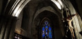
(3) After No. 70 on the right-hand side, turn right into the Gaffe des Francs (gaffe = alleyway, path). Walk between gardens of varying degrees of maintenance, then through a narrow covered passageway. At the bottom, cross a street and continue straight ahead into the narrow Passage de l’Église. At the end, turn left into Rue Bugnet and walk past the church on your right.
(4) At the corner, turn right and walk past the church entrance (open daily). Continue towards the lake and cross the Place des Anciens Combattants. Before the roundabout, cross Rue du Lac to the left at the pedestrian crossing. Pass the Tourist Office on your left and walk down a tarmac path to the public toilets. Then turn right and cross Avenue du Général Dupas in two stages at the pedestrian crossings.
(5) Turn left and walk along the lake on your right. You’ll come to a small harbour with an orientation board. Then retrace your steps.
(5) Continue straight on, passing under two weeping cedars. Carry on along the quay with the lake on your left. On your right, note some of Évian-les-Bains’s most iconic buildings: the Casino, the Hôtel Royal up on the hill, the Town Hall and the Palais Lumière.
(1) When you reach the west entrance to the jetty, carry straight on and pass the boarding point. Continue along the quay.
Carry on straight ahead (unless you fancy popping back to the Musical Fountain), walk along the marina on your left and you’ll come back to the car park where you started (S/E).

 Visorando Member

 Moderate