Country:

 City:
City:


Set off from the main town of Thollon-les-Mémises. Park in the large car park located beyond the D24 road, on the right-hand side when coming from Neuvecelle or Saint-Paul. This car park is flanked by the town hall, the church, the post office and a football ground; you’ll find recycling bins there.
Signposts are provided at major junctions.
No signposting
(S/E) Head towards the town hall (large fountain), then turn right to cross the D24 at the pedestrian crossing. First turn right then left to join the Route sur le Crêt. Pass two cul-de-sacs on the left, turn right and head uphill – the slope is quite steep at the start.
Dark blue signposting (rare)
At the ‘give way’ sign, veer right towards Le Nouy. At a drinking fountain, turn right. At the T-junction, head downhill to the right. At the ‘give way’ sign, cross the D24 (take care) and follow the Route sous la Tour opposite, towards Chez les Vesins.
(1) Cross the Route Saint-Roch on the right-hand side and follow the Route des Plagnes. Pass a car repair garage, enter Chez les Vesins and you’ll soon reach a junction (drinking fountain, wayside shrine).
(2) Turn left onto Route de l’Emmontagnée. At the next junction, turn left onto Chemin de Lain, towards Col de Creusaz. The tarmac soon gives way to a stony track. Climb up and enter a beech forest. Stay on the main track, ignoring all side paths (mountain bike tracks), and continue climbing steadily.
Snowshoe signposting (one-way, in the direction of travel)
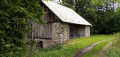
(3) At the signpost marked ‘Lain 1010m’, take the path furthest to the right. At the junction – not shown on the map – which you’ll come to straight away, carry on straight ahead along this main path. Pass two old barns on the left, then ignore a path branching off to the left. Shortly afterwards, you’ll reach a barn on the right (marker post).
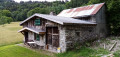
(4) Continue along the wide path to quickly reach a lovely group of three barns (see the recommendations in the practical information). Retrace your steps back to the barn with the signpost.
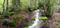
(4) Turn left onto a path that leads into the forest, leaving the barn on your right. Descend steadily. In wet weather, the path can turn into a stream, so it is advisable to take a parallel track further to the left. You’ll reach a torrent and follow it briefly on your right. Further down, cross the torrent and continue downwards, ignoring the occasional paths branching off to the left. Walk alongside meadows on your right and reach the hamlet of Le Fayet.
Unmarked
(5) Continue along a small road. Pass the Impasse du Sbolet on the left and reach a junction (with a fountain and drinking trough on the left). Then turn right onto the Route des Plagnes. Pass the Route de l’Emmontagnée on the right and, further on, come back to the junction you had previously taken with this road (which is semi-circular).
Dark blue signposting (rare)
(2) Continue straight on, passing the car garage once more.
(1) Take thefirst left onto Route Saint-Roch (signpost ‘Altitude 928m’). Pass the school on your right, turn right immediately, leave the church on your left and return to the starting car park (S/E).


 Visorando Member

 Moderate
 Difficult