


 Country:

 City:
City:


The walk starts at the end of the funicular line from Moléson-sur-Gruyères to Plans-Francey (see access details under ‘Practical information’).
(S/E) On exiting the funicular, turn left to reach a junction of paths.
(1) Turn right towards Moléson and enjoy the views over Lakes Gruyères and Neufchâtel. You’ll come to a Fork in the road.
(2) Take the path leading uphill opposite. At the next Fork in the road, continue left onto a stony, mountainous path. The climb, with a 600-metre elevation gain, is short but challenging. You’ll reach another junction.
(3) Carry on straight ahead, round two wide hairpin bends, and after a traverse, tackle the steepest part of the climb with two hairpin bends, which leads to a mountain pasture. Pass through a gate.
(4) Stay on the main path until the next junction, near the restaurant and the upper cable car station.
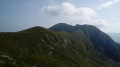
(5) Turn left towards the station, leave it on your right and veer left to climb to the summit of Moléson (360° panorama).
(6) Return to the previous junction.
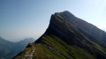
(5) Carry on straight ahead along the Crête du Moléson until you reach the first junction.
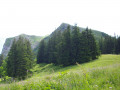
(7) Descend to the left along a winding path and enjoy the views of the Swiss Alps. The descent is very stony and can be slippery in places. When you reach a meadow at Tsuatsau Dessus, turn left towards the trees to reach the start of a traverse along the mountainside.
(8) Follow a zigzagging path to the left (generally descending). Take care, as it is narrow and runs along the mountainside. At the end, you’ll reach the Gros-Moléson mountain pasture.
(9) Head left (north) towards the botanical trail and the Plan-Francey funicular. You’ll then come back to a junction you passed at the start of the walk.
(1) Carry on straight ahead to reach the funicular station (S/E).


 Visorando Member
 Moderate
